Download
1 / 27
270 likes | 360 Views
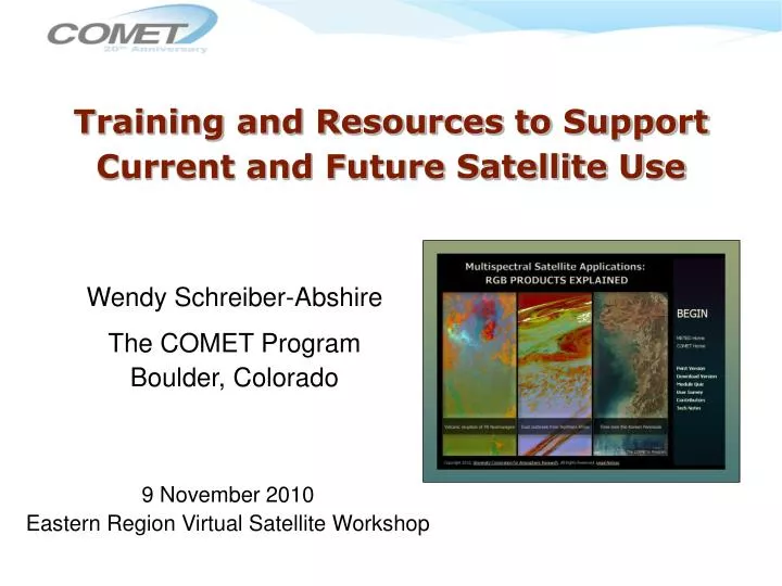
Training and Resources to Support Current and Future Satellite Use. Wendy Schreiber-Abshire The COMET Program Boulder, Colorado. 9 November 2010 Eastern Region Virtual Satellite Workshop. Outline. Recent history and new publications Ongoing activities

E N D
Training and Resources to Support Current and Future Satellite Use Wendy Schreiber-Abshire The COMET Program Boulder, Colorado 9 November 2010 Eastern Region Virtual Satellite Workshop
Outline Recent history and new publications Ongoing activities ESRC (Environmental Satellite Resource Center) Content updates and adaptations What’s next? Forthcoming Modules
Module Topic Areas Environmental Education Aviation CoastalWeather Fire Climate Hydrometeorology Mesoscale Meteorology International Activities Northern Latitudes Space Weather Tropical Meteorology Marine Met & Oceanography SatelliteMeteorology Numerical Weather Prediction Road Weather
COMET Modules on Satellite Topics Bold = published in last 5 yrs • Advanced Satellite Sounding: The Benefits of Hyperspectral Observation • Advances in Microwave Remote Sensing: Ocean Wind Speed and Direction • An Introduction to POES Data and Products • An Introduction to the EUMETSAT Polar System • Blowing Snow: Baker Lake, Nunavut, Canada 04-10 February 2003 • Creating Meteorological Products from Satellite Data • Deformation Zone Analysis • Deformation Zone Diagnosis • Deformation Zone Distribution • Determining Visibility • Dust Enhancement Techniques Using MODIS and SeaWiFS • Dynamic Feature Identification: The Satellite Palette • Feature Identification Exercises: Clouds, Snow, and Ice Using MODIS • Feature Identification Using Environmental Satellites • Forecasting Dust Storms • FORMOSAT-3/COSMIC • GOES-R: Benefits of Next-Generation Environmental Monitoring • Imaging with NPOESS VIIRS: A Convergence of Technologies and Experience • Introduction to Tropical Meteorology, Tropical Remote SensingApplications • Jason-2: Using Satellite Altimetry to Monitor the Ocean
COMET Modules on Satellite Topics • Microwave Remote Sensing: Overview • Microwave Remote Sensing: Clouds, Precipitation, and Water Vapor • Microwave Remote Sensing: Land and Ocean Surface Applications • Microwave Remote Sensing Resources • Multispectral Satellite Applications: Monitoring the Wildland Fire Cycle • Multispectral Satellite Applications: RGB Products Explained (Newest satellite publication!) • NexSat: Preparing Users for the NPOESS/VIIRS Era • Operational Satellite Derived Tropical Rainfall Potential (TRaP) • Polar Satellite Products for the Operational Forecaster (POES) Module 1: POES Introduction • Polar Satellite Products for the Operational Forecaster (POES) Module 2: Microwave Products and Applications • Polar Satellite Products for the Operational Forecaster (POES) Module 3: Case Studies • Polar Satellite Products for the Operational Forecaster (POES) Module 4: Soundings • Polar Satellite Products for the Operational Forecaster: Microwave Analysis of Tropical Cyclones • Recognition and Impact of Vorticity Maxima and Minima in Satellite Imagery • Remote Sensing of Land, Oceans, and Atmosphere with MODIS • Remote Sensing of Ocean Wind Speed and Direction:An Introduction to Scatterometry • Remote Sensing Using Satellites • Satellite Feature Identification: Blocking Patterns • Satellite Feature Identification: Ring of Fire • Satellite Meteorology: GOES Channel Selection • Satellite Meteorology: Introduction to Using the GOES Sounder
COMET Modules on Satellite Topics • The SPoRT Center – Infusing NASA Technology Into NWS WFO • Toward and Advanced Sounder on GOES? • Visible and Infrared Dust Detection Techniques • Vorticity Maxima and Comma Patterns • Vorticity Minima and Anticomma Patterns Translated Modules • 17 en Español , 9 en Francais
Multispectral Satellite Applications: Monitoring the Wildland Fire Cycle, 2007
Microwave Remote Sensing TopicsDistance Learning Course • Three core modules, supplemented by optional Overview and Resourcesmodules • Self paced • Provides a foundation in the science, products andapplications • Offers a certificate of completion
Introduction to Tropical Meteorology, Tropical Remote Sensing Applications Chapter
Dynamic Feature Identification:The Satellite Palette • Initial modules released as part of “The Satellite Palette” series • Based on work by Phil Chadwick of MSC
The Satellite Palette – New Releases • Coming soon: “Short Waves and Cyclogenesis”
GOES-R: Benefits of Next-Generation Environmental Monitoring • Includes 2 sections: Overview & Environmental Monitoring • GOES-R benefits and the ability to monitor 13 unique hazards and phenomenaEach topic includes: • Background and Needs(general public) • Capabilities and Benefits(decision makers) • Technical Improvements(forecasters)
Toward an Advanced Sounder on GOES? Approach: • Recorded interviews fromseveral meteorologists and respected satellite experts, to… • Speak directly to theuser community (forecasters)and decision makers • Reiterate the “current state ofaffairs”, impacts, and need for an advanced sounder in GEO orbit • State the potential for significant contributions • Understand the urgency for GEO HS observation
Most Recent Satellite Module, June 2010 • RGB compositing techniques are a powerful way to distill and highlight salient information • Module provides an introduction to basic methods and “best practices” • Also available Aplicaciones satelitales multiespectrales: explicación de los realces RGB
We’re in NOAA Learning Center & Training Portal • We do not announce publication of a module until it and quiz are live in LMS • Well over 150 modules in the system
Module Updates & Adaptations In Progress • Satellite Meteorology:GOES Channel Selection • Improvements to GOES-N/O/P (13/14/15) data and data availability • Forecasting Dust Storms • Update satellite detection techniques & more modeling information
The ESRC: COMET’s Role • Maintain the ESRC website • Populate it with our own materials, including smaller, focused learning-objects derived from our larger training modules (more on this on the next slide!) • Provide the necessary quality assurance and monitoring to ensure that all resources are appropriate and well described before being made available
Community’s Role in the ESRC • Use the site • Populate it with materials that you know and trust using the online submission form
Upcoming Activities • Satellite-specific training modules that will begin in 2011: • Climate Monitoring from Satellites • NPP on the Road to JPSS • Benefits of Satellite to the Transportation Industry • and other topics to be determined
Questions? URLs: • http://meted.ucar.edu • http://meted.ucar.edu/topics_satellite.php • http://meted.ucar.edu/esrc abshire@ucar.edu