Download
1 / 35
350 likes | 466 Views
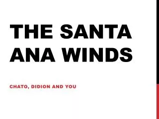
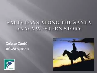
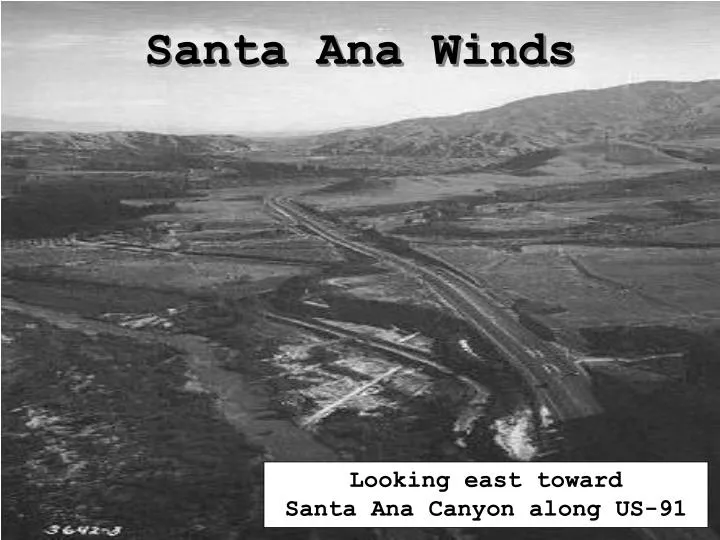
Santa Ana Winds. Looking east toward Santa Ana Canyon along US-91. WHAT IS A SANTA ANA WIND?.

E N D
Santa Ana Winds Looking east toward Santa Ana Canyon along US-91
WHAT IS A SANTA ANA WIND? “Santa Ana” wind is a local name given to a weather condition in which a migratory high pressure system moving over the Great Basin (Nevada & Utah) forces a hot dry foehn-type wind southward. These winds flow from the Desert Southwest, funnel through the passes and canyons of SOCAL and out over the SOCAL OPAREAS. As the air is forced down through these passes and canyons it heats due to atmospheric compression, at the dry adiabatic lapse rate, at approx. 5°F per 1000 FT. Weather conditions during a Santa Ana event are characterized by an increase in temperature (well above the seasonal average), a decrease in the dew point (relative humidity, commonly < 10%) and strong gusting winds during early AM hours (0400-1000L). Gusts exceeding 60-70 KTS (70-80 mph) are common in the inland valleys of SOCAL (aft sunset thru mid-morning).
SOCAL 4000 to 5000 FT 3000 to 4000 FT WHAT IS A FOEHN-TYPE WIND? Definition: A warm, dry wind which flows down the lee side of mountain ranges, adiabaticcompression warms and dries the air as it descends in the atmosphere. Santa Ana winds are already relatively dry before they descend the MTS. WHY? Note: As discussed, the air will heat at approx. 5°F per 1000 FT. The MTS ranges of SOCAL average about 3-5 KFT. Using this “rule-of-thumb”, air descending these MTS will warm 15-25°F by the time they reach the mesa and coastal regions.
WHERE IS THE GREAT BASIN? AND WHY ARE LOOKING FOR A HIGH IN THIS REGION? The Great Basin is the high plateau east of the Sierra Nevada MTS and west of the Rocky MTS including most of Nevada and Utah. H From the NPMOC-SD FCSTRS Handbook: The primary synoptic feature associated with Santa Ana conditions is the Great Basin High. BOTTOM LINE: WITHOUT THE OUTFLOW FROM A HIGH LOCATED SOMEWHERE OVER THE GREAT BASIN, SANTA Ana CONDITIONS CAN NOT EXIST.
WHERE IS SANTA Ana CANYON?
WHAT EFFECTS DO SANTA Ana WINDS HAVE ON DAILY OPERATIONS? AIRCRAFT OPERATIONS: Santa Ana wind speeds usually increase rapidly with height, creating STRONG LOW LEVEL WIND SHEAR and TURBULENCE. Slant Range VSBY is effected when haze/dust is lift aloft. LOCALIZED HIGH WIND/SEAS: Over the Northern SOCAL OPAREAS it is common to experience areas of High Wind/Seas from 0400-1000L. Highest probability, VCNTY KNTD. HEAT STRESS: Due to the increase in temps and decrease in relative humidity (dew point), the perceived heat stress on the body will increase. FIRE HAZARDS: Again, due to the decrease in the relative humidity and an increase in wind speed, the chance for wild fires increase. During the October 2003 San Diego Wild Fires, Santa Ana’s were the initial cause for the rapid loss of containment.
October 2003 San Diego Wild Fires
WHAT TIME OF YEAR SHOULD WE BE MOST CONCERNED ABOUT THESE CONDITIONS? Santa Ana conditions can occur at anytime during the year BUT are most frequent from early Fall to late Spring, with a peak frequency during the Winter months. NWS: Santa Ana winds commonly occur between October and February with December having the highest frequency of events. From the NPMOC-SD FCSTRS Handbook: Winter is the time of year when air masses move into the Great Basin most frequently. CLIMO: During the Summer, Santa Ana’s are most often caused by the EASTPAC High (mT) ridging in over the Great Basin. During the Winter, migratory highs (mP and cP) generate these conditions. During the early/late Summer there is still a chance that a migratory high could move over the Great Basin if the conditions are right (i.e. a weak EASTPAC High well off the coast and a strong push of cold air over the Gulf of Alaska).
THE UPPER-LEVEL RIDGE 1. Nearly every Great Basin High has the vertical support of a pronounced upper-level ridge situated over or just off the West Coast (upstream) which feeds subsiding air into the low level outflow. 2. The stronger the ridge, the stronger the SFC high will be. This will enhance the out-flow from the high and increase the winds along the coast. 3. When/if the long wave ridge becomes stationary over the West Coast, short wave troughs moving through the upper level flow may temporarily flatten it. These short wave troughs ”sometime” support surface fronts. 4. The ridge and high usually rebuild sharply after frontal passage resulting in the establishment of Santa Ana conditions. 5. In addition to a strong ridge over the West Coast a deep trough over Central USA (downstream), is favorable for Santa Ana conditions.
500 mb Chart ANAL Location of SFC High 564 H 570 1028 576 Look for a pronounced upper-level ridge located just off/over the West Coast. This ridge is the key support for the Great Basin High. If the ridge begins to move eastward during your forecast period, expect decreasing Santa Ana Conditions. WHY?
500 mb Chart 24 HR PROG Location of SFC High 564 H 570 1032 576 582 As the upper-level ridge builds, what should happen to the SFC high and what will happen to the conditions along the SOCAL Coast?
H 500 mb Chart 48 HR PROG Location of SFC High 564 570 576 582 As the upper-level ridge begins to shift to the east what should happen to the SFC high and along the SOCAL Coast?
KNJK VARIATIONS IN SANTA Ana EVENTS The sustained wind speeds and gusts of Santa Ana winds are highly variable! The intensity and trajectory of the high moving into the Great Basin, orientation of pressure gradients and the effects of local topography greatly effect conditions along the coast. CLIMO: KNZY extreme gust occurred in January, 55 KTS. As already stated, along the SOCAL coast Santa Ana’s usually generate a NE-E wind, variations can occur based on the above effects depending where you are located in the OPAREAS. Over El Centro, CA, winds are frequently N-NW. WHY?
FRONTAL SYSTEMS (FROM CLIMO AND NPMOC-SD FCSTRS Handbook) Normally, by the time a front reaches SOCAL, it has weakened to the point that it is difficult to define the SFC location except for a few clouds with little/no rain. Although fronts may be weak and non-discernible, an upper-level trough in the westerlies often marks the forward progress of the new air mass. “DRY” Santa Ana: A “DRY” Santa Ana is characterized by a cP (or VERY modified mP or mT) air mass moving into the Great Basin, RH approx. < 10%. “WET” Santa Ana: A “WET” Santa Ana is when a mP or mT air mass moves in over the Great Basin, RH around 30%.
L H Weakening cold fronts usually move in from the NW-WNW. This is indicative of a NW to W flow aloft. The lag BTWN FROPA and onset of Santa Ana’s is normally 12-36 HRS, depending on the speed of the front and strength of the high. This is the amount of time needed for the high to move into the Great Basin and a sufficient pressure gradient to setup.
The lag BTWN fronts MOVG over SOCAL from N to S is usually 6-18 HRS. The associated air mass is usually mP or cP. Highs MOVG into the Great Basin from the north are usually stronger and produce more intense conditions. These highs take less time to build a pressure gradient. WHY? The timing of onset of Santa Ana’s is more complicated because these fronts move slower and have less “visible” weather along the front. H
Fronts that approach SOCAL from the east are referred to as "Backdoor" fronts. Although infrequent, they occur when the front runs along the backside of the Sierra Nevada MTS. Associated high pressures are almost always cP. By the time the front moves over SOCAL, the high has already setup over the Great Basin, onset begins with FROPA. H
Occasionally the high sets up a pressure gradient strong enough to push the thermal trough out over the SOCAL OPAREAS. It is during this scenario that the SOCAL Coastal Regions and OPAREAS would experience strong sustained NE winds. WHY? These winds tend to inhibit the Sea Breeze from setting up along the coast. After sunset, as the land cools, the thermal trough weakens and it may or may not reestablish over land. H
“RULES-OF-THUMB” KDAG 4-6 MB BTWN KLAX & KDAG 10-12 MB BTWN KNZY & GREAT BASIN KLAX 2-5 MB BTWN KNZY & KNJK KNJK KNZY
“RULES-OF-THUMB” (cont.) Max wind speeds occur most frequently in early to mid morning as the Santa Ana’s are enhanced by the land breeze. Average max gusts are approx. x2 the maximum sustained wind speed (other local effects may come into play). Conditions usually last about 24 to 30 hours with longer than average periods occurring in NOV - JAN. A blocking high over the East Coast will prolong the event and may allow for stronger pressure gradients to setup BTWN the Great Basin and SOCAL. The strongest potential for Santa Ana’s to begin is BTWN 0300 to 0900L. The most frequent time for Santa Ana’s to end is from 1100 to 1300L.
NOTE: The Inner SOCAL OPAREA is defined by a line drawn from PT Conception thru the Channel Islands to Ensenada, MX. “RULES-OF-THUMB” (cont.) Santa Ana’s cause daily MAX TEMPS to be about 15°F above the average during the Winter and about 15-20°F above normal during the early Fall and Spring with at least one occurrence each Fall of MAX TEMPS of > 90°F. Santa Ana conditions are almost always preceded by a SFC front or mid-level trough, usually it is a trough. Care should be taken in predicting Santa Ana conditions beyond the Inner SOCAL OPAREA and along the extreme SOCAL Coastal areas and Baja California.
WHAT HAPPENS AFTER A SANTA Ana? As the Great Basin high begins to weaken and move eastward the Desert Southwest begins to heat, leading to the reformationof the Thermal Trough, and the offshore pressure gradients over SOCAL decrease and then reverse to onshore. Since the decrease is gradual, Santa Ana’s do not end as dramatically as they begin. With the return of the cooler, moist onshore flow at the SFC, a strong inversion is immediately reestablished along the coast. This is conducive to dense fog formation along the SOCAL Coastal Regions. Dense fog can be expected during the first 48 HRS after the high moves out of the Great Basin UNLESS the high rapidly moves off to the east, moves S-SE toward SOCAL or a upper-level trough moves into the region.
Lets see what YOU learned! QUESTIONS?
GOES 12 (WEST) VIS DTG: 18Z 28MAR04 CASE STUDY 1. Based on this Satellite image and the following 2 charts, how would you start your METOC discussion? NOTE: The arrow indicates the FCST-ed MOVMT of the high for the next 24 HR period. 2. What “rules” are you going to use? 3. What METOC impacts do you foresee over the next 24 HR period? TAKE YOUR TIME! Use what you have learned.
GOES 12 (WEST) VIS DTG: 18Z 28MAR04 (Blow-up) Which “Rules” Work? Remember these? 1. 2-5 BTWN KNZY & KNJK 2. 10-12 BTWN KNZY & G/B 3. 4-6 BTWN KLAX & KDAG Where is the Thermal Trough? WHY?
DISCUSSION: Strong high pressure over the Oregon/Idaho board is generating off shore flow over the SOCAL Coastal Region. CASE STUDY Why not Santa Ana Winds? The “Rules-of-Thumb” 10-12 MB BTWN KNZY and the Great Basin worked. DID YOU REMEMBER: “Santa Ana” wind is a local name given to a weather condition in which a migratory high pressure system moving over the Great Basin (Nevada & Utah)... The high is over the Oregon/Idaho board, this is too hard north to be Santa Ana. The reason this high is being described as “strong” is because it has caused the Thermal Trough to be repositioned over the Coastal Regions, those the clear skies along the Coast of California.
LGT (maybe OCNL MOD) TURB. Remember the MAIN reason for TURB and Wind Shear is the strong NE wind coming across the MTS. We are under the Thermal Trough. NO Again, being under the Thermal Trough the SOCAL OPAREAS will NOT experience the strong NE winds that would cause these conditions. Would increase! On 29MAR04, temps across SOCAL were approx. 20°F above average. Most inland observation sites recorded temps above 90°F. Would increase! Even with temps in the 90’s across most of the county, the Fire Hazard only went from “Low” to “Moderate”. The reason was because of the higher than average rainfall during the month of February. WHAT METOC EFFECTS WOULD YOU FCST? AIRCRAFT OPERATIONS: LOCALIZED HIGH WIND/SEAS: HEAT STRESS: FIRE HAZARDS:
The NEXT DAY! 1600L 29MAR04, the 500 MB ridge is continuing to move off to the east.
0001Z 30MAR04 As the high continues to move off to the east the Thermal Trough is now returned to being located over the Central Valleys and High Desert.
NOTE: Notice the indication of moisture in the upper levels SKEW-T 1200Z 30MAR04 The next morning this is what the balloon sounding over the SOCAL OPAREA looked like. What is your FCST based on this sounding? (SFC Based inversion?)
WHAT HAPPENS AFTER A SANTA Ana? As the Great Basin high begins to weaken and move eastward the Desert Southwest begins to heat, leading to the reformation of the Thermal Trough, and the offshore pressure gradients over SOCAL decrease and then reverse to onshore. Since the decrease is gradual, Santa Ana’s do not end as dramatically as they begin. With the return of the cooler, moist onshore flow at the SFC, a strong inversion is immediately reestablished along the coast. This is conducive to dense fog formation along the SOCAL Coastal Regions. Dense fog can be expected during the first 48 HRS after the high moves out of the Great Basin UNLESS the high rapidly moves off to the east, moves S-SE toward SOCAL or a upper-level trough moves into the region.
KNTD 300755Z 32005KT 1/4 FG VV001 12/12 A2993 KNZY 301140Z 32003KT 3/4 BR BKN004 BKN250 14/12 KNUC 301055Z 22010KT 1/4 FG VV004 14/12 A2997
NOW, Go forth and do great things! SUMMARY As you can see, even through migratory high pressures may not move over the Great Basin and develop conditions per climatology, it is still possible to feel the same effects IF conditions are right, as in the Case Study. BUT in order to be labeled as a true Santa Ana the stated conditions need to be met.