Download
1 / 17
170 likes | 360 Views
NASA Science Mission Directorate Earth Science Division Applied Sciences Program. Development of a Multi-Scale Remote-Sensing Based Framework for Mapping Drought over North America Water Resources Quarterly Report – January 27, 2014. Water Resources – Project Summary.

E N D
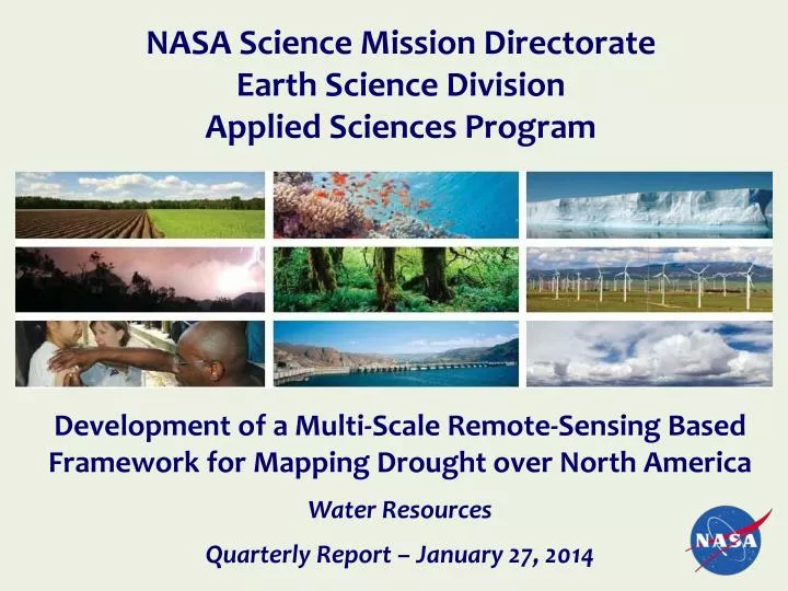
NASA Science Mission Directorate Earth Science Division Applied Sciences Program Development of a Multi-Scale Remote-Sensing Based Framework for Mapping Drought over North America Water Resources Quarterly Report – January 27, 2014
Water Resources – Project Summary • Title: Development of a Multi-Scale Remote-Sensing Based Framework for Mapping Drought over North America • Project PI: Christopher Hain (U. of Maryland) • NASA ROSES-2011, A.34: Earth Science Applications: Water Resources • Project Summary: Our research group is developing a drought monitoring tool for North America based on remotely sensed estimates of evapotranspiration (ESI; Evaporative Stress Index). ESI will be used by collaborators at the National Drought Mitigation Center (supporting the US Drought Monitor and the North American Drought Monitor) and collaborators at the USDA National Agricultural Statistics Service to establish utility of ESI in monitoring crop condition • Coverage Area: North America • Data Sources/Technology: GOES (geostationary TIR data); MODIS (LAI; Albedo; Emissivity; Landcover Type); Atmosphere Land Exchange Inverse (ALEXI) Two-Source Energy Balance Model; GLDAS (SM/ET for intercomparison with ESI) | 2
Development of a Multi-Scale Remote-Sensing Based Framework for Mapping Drought over North America Christopher Hain (U. of Maryland) Project Partners End-Users / Stakeholders | 3
Development of a Multi-Scale Remote-Sensing Based Framework for Mapping Drought over North America Christopher Hain (U. of Maryland) Performance/ARL • Start of project ARL = 3 (June 2012) • Current ARL = 5 (January 2014) The ALEXI ESI system will be a fully functioning, automated prototype, ingesting all necessary inputs, running in real-time and providing weekly ESI datasets to end users at NDMC and USDA NASS. The end users will provide evaluations of the ESI datasets and aid in quantifying the potential impact of the products in each of their specific application areas. • Expected Ending ARL = 7 (June 2016) The ALEXI ESI system will be a fully operational system at NOAA providing daily maps of evapotranspiration and ESI over the CONUS and North America. | 4
Development of a Multi-Scale Remote-Sensing Based Framework for Mapping Drought over North America Christopher Hain (U. of Maryland) Schedule Stage II: Year 3 Stage II: Year 2 Stage II: Year 1 | 5
Development of a Multi-Scale Remote-Sensing Based Framework for Mapping Drought over North America Christopher Hain (U. of Maryland) Project Budget, Obligations & Cost Status • Provide the budget status for current year, prior FY, and project to date. | 6
Development of a Multi-Scale Remote-Sensing Based Framework for Mapping Drought over North America Christopher Hain (U. of Maryland) Project Risks
Development of a Multi-Scale Remote-Sensing Based Framework for Mapping Drought over North America Christopher Hain (U. of Maryland) Stakeholder / End-User Engagement • Brief summary of stakeholder / end-user interactions and status • October 2012: NOAA/NESDIS OSD approves proposal for developing an operational version of ALEXI (tentative project start date: Summer 2013 [tentative operational delivery: Summer 2015]). • January 2013: Delivered first set of retrospective (2000-2011) ESI maps to end-users (Mark Svoboda [NDMC]) for evaluation. • January 2013: Begin to process retrospective North American Drought Monitor commonly used drought metrics to begin evaluation of retrospective ESI maps. Evaluation will occur both internally at NOAA/USDA and externally with end-users at NDMC and NASS. Evaluation methodology is currently being developed and will be employed as soon as possible. • April 2013: Project to transition ALEXI into operations at NOAA OSPO begin – initial operational delivery of system in 2015. • January 2014: Continued evaluation of prototype CONUS and North America ESI maps at NDMC, NOAA and NASS. | 8
Development of a Multi-Scale Remote-Sensing Based Framework for Mapping Drought over North America Christopher Hain (U. of Maryland) Accomplishments/Results • Finish the generation of Version 2 of the North American ESI product (retrospective 2000-2013) – currently being assembled for delivery to all end-users for initial evaluation period (see Fig. 2 on Slide 13). • Finish the generation of Version 1 of the 4-km CONUS ESI product (2000-2013); NRT production will begin in Feb. 2014 and replace the current 10-km CONUS ESI product. • Transition and development of the GET-D system at NOAA is underway and the tentative day for operational transition remains Spring 2015. • Preliminary research completed with USDA NASS shows that correlations between ESI and end-of-season yields are maximized in the central US in early August – coincident with the release of the first set of yield forecasts issued by NASS. • Co-I Anderson will give an invited presentations at the 2014 AMS meeting about current ESI research. • PI-Hain and Co-I Anderson were each invited to give presentations at InterDrought project workshop “Remote sensing tools in drought monitoring” in Brno, Czech Republic in Feb. 2014. • Co-I Otkin an Co-I Svoboda will conduct a one-day workshop in Oklahoma with a group of end-users addressing how ESI and ESI Rapid Change Indices (RCI) can be used in “flash drought” scenarios and how ESI can aid in agricultural drought mitigation practices. | 9
Development of a Multi-Scale Remote-Sensing Based Framework for Mapping Drought over North America Christopher Hain (U. of Maryland) Transition to 4-km CONUS Domain – will be produced in NRT mode in 2014
Development of a Multi-Scale Remote-Sensing Based Framework for Mapping Drought over North America Christopher Hain (U. of Maryland) Transition to 4-km CONUS Domain – will be produced in NRT mode in 2014 Current 10-km Resolution New 4-km Resolution
Development of a Multi-Scale Remote-Sensing Based Framework for Mapping Drought over North America Christopher Hain (U. of Maryland) Version 2 of NAMR ESI (10-km)
Development of a Multi-Scale Remote-Sensing Based Framework for Mapping Drought over North America Christopher Hain (U. of Maryland) Version 2 of NAMR ESI (10-km)
Development of a Multi-Scale Remote-Sensing Based Framework for Mapping Drought over North America Christopher Hain (U. of Maryland) Version 2 of NAMR ESI (10-km)
Development of a Multi-Scale Remote-Sensing Based Framework for Mapping Drought over North America Christopher Hain (U. of Maryland) 2013/2014 California Drought
Development of a Multi-Scale Remote-Sensing Based Framework for Mapping Drought over North America C. Hain (UMD), M. Anderson (USDA), X. Zhan (NOAA), M. Svoboda (NDMC), B. Wardlow (NDMC), F. Gao (USDA) • Highlights: • The ALEXI Evaporative Stress Index (ESI) has been shown to be an effective, fast-response indicator for monitoring agricultural drought over CONUS. • The ESI uses GOES-derived land-surface temperature data to assess crop and soil moisture stress, and is an independent check on precipitation-based indices. • To address the need for additional remote sensing-based drought monitoring tools covering North America, the current ESI domain has been expanded to include Canada, Mexico and Central America. • ALEXI ESI provides the unique opportunity for a potential early warning system through detection of water stress on vegetation that is detectable through elevated canopy temperatures, which occurs well before drought-related plant damage observable through changes in NDVI. This was evidenced during the flash drought of 2012, where the ESI signal preceded that of precipitation-based indicators. • Relevance to ESD Applied Sciences: • Access and availability of actionable drought information -- ALEXI ESI provides high-resolution spatial information about drought that is independent of many of the most commonly used drought indicators which rely on accurate specification of precipitation as an inputs • Drought prediction, assessment, adaptation and mitigation in support of food security and natural resource conservation -- ALEXI ESI can provide information to end-users with can aid in the decision making process of drought mitigation, yield estimation, plant health, and water use (especially in the agricultural sector). ESD Applied Sciences ̶ Water Resources
Christopher Hain (University of Maryland / NOAA / NESDIS) chris.hain@noaa.gov (301) 683-3577 The project is developing and evaluating a remote sensing evapotranspiration-based drought index (ALEXI ESI) over North America to support the decision making process for end-users at NDMC, NOAA and USDA NASS. ALEXI ESI requires no precipitation data as input, providing an independent assessment of drought conditions and will be a valuable supplement to the current suite of drought indicators used by decision makers. Scientific Heritage: The ALEXI Evaporative Stress Index (ESI) represents standardized anomalies in the ratio of actual-to-potential ET (Anderson et al. 2011). Methods such as ALEXI (Anderson et al. 1997), which rely on thermal infrared remote sensing, require no information regarding antecedent precipitation – the current surface soil moisture status is deduced directly from the remotely sensed land surface temperature signal (Anderson et al. 2007; Hain et al. 2011). ESI is also different than many commonly used drought indicators based on vegetation indices (NDVI, VHI), vegetetion health is a relatively slow response variable to soil moisture, showing decline only after the damage has been done, ESI has the potential to provide valuable drought early warning (through detection of water stress in canopy temperatures) preceding detectable degradations in vegetation health. Earth Science Data Products: The project exploits several NASA Earth Science research results including: 1) land surface products from MODIS (leaf area index, surface albedo, surface emissivity, and landcover type); 2) atmospheric analyses from GEOS-5 (realtime implementation) and MERRA (retrospective implementation); and 3) soil moisture and ET prediction from GLDAS. In addition, geostationary-based satellite retrievals of land surface temperature and incoming solar radiation from GOES are needed as inputs to ALEXI. Technical Description of Figures: Figure 1: a) ALEXI Evaporative Stress Index (ESI) for August 2006 and b) GLDAS Noah 0-200 cm total soil moisture normalized anomalies for August 2006. ALEXI ESI and GLDAS soil moisture show strong agreement across North America, denoting anomalously dry conditions across the northern tier of the US and southern Canada, along with dry conditions over the south central and southeast US. The agreement is significant as the two data products are independent of one another (ALEXI predominantly forced with TIR LST and GLDAS predominantly forced with precipitation inputs). Application to ESDAS: This project addresses the following priority topics in the Applied Science Program in Water Resources: 1) Drought prediction, assessment, adaptation and mitigation in support of food security and 2) Drought prediction, assessment, adaptation and mitigation in support of natural resource conservation security/efficiency – ALEXI ESI provides high resolution drought mapping which can aid in informing decision makers with regards to yield estimation and plant health, along with information about current soil moisture status available which can aid in mitigation of the effects of deficits in available water (especially in the agricultural sector). Finally, 3) Access and availability of actionable drought information – ALEXI ESI complements an increasing demand for drought indictors, especially those which are satellite-based and independent of precipitation inputs, which can provide drought information over regions where ground-based precipitation monitoring platforms are spatially sparse. References: Anderson, M.C., J. M. Norman, G. R. Diak, W. P. Kustas, and J. R. Mecikalski, 1997: A twosource time-integrated model for estimating surface fluxes using thermal infrared remote sensing, Remote Sensing Environment 60, 195-216. Anderson, M. C., J. M. Norman, J. R. Mecikalski, J. P. Otkin, and W. P Kustas, 2007a: A climatological study of evapotranspiration and moisture stress across the continental U.S. based on thermal remote sensing: I. Model formulation, Journal of Geophysical Research, 112, D10117, doi:10110.11029/12006JD007506. Anderson, Martha C., Christopher Hain, Brian Wardlow, Agustin Pimstein, John R. Mecikalski, William P. Kustas, 2011: Evaluation of Drought Indices Based on Thermal Remote Sensing of Evapotranspiration over the Continental United States. J. Climate, 24, 2025–2044. doi: http://dx.doi.org/10.1175/2010JCLI3812.1 Hain, C. R., W. T. Crow, J. R. Mecikalski, M. C. Anderson, and T. Holmes (2011), An intercomparison of available soil moisture estimates from thermal infrared and passive microwave remote sensing and land surface modeling, Journal of Geophysical Research, 116, D15107, doi:10.1029/2011JD015633. ESD Applied Sciences ̶ Water Resources