Download
1 / 11
110 likes | 326 Views
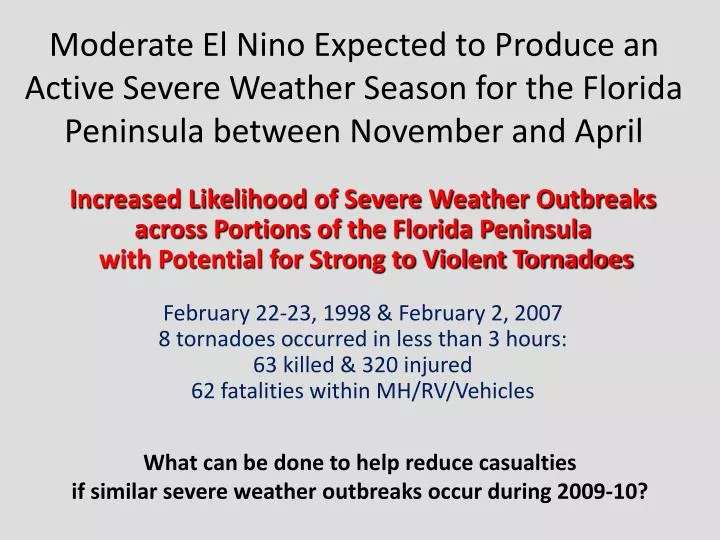
Moderate El Nino Expected to Produce an Active Severe Weather Season for the Florida Peninsula between November and April . Increased Likelihood of Severe Weather Outbreaks across Portions of the Florida Peninsula with Potential for Strong to Violent Tornadoes

E N D
Moderate El Nino Expected to Produce an Active Severe Weather Season for the Florida Peninsula between November and April Increased Likelihood of Severe Weather Outbreaks across Portions of the Florida Peninsula with Potential for Strong to Violent Tornadoes February 22-23, 1998 & February 2, 2007 8 tornadoes occurred in less than 3 hours: 63 killed & 320 injured 62 fatalities within MH/RV/Vehicles What can be done to help reduce casualties if similar severe weather outbreaks occur during 2009-10?
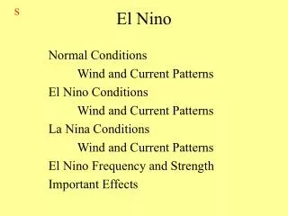
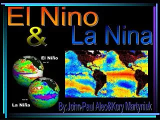
El Nino pattern translates to increased risk of tornadoes across the Florida Peninsula.
La Nina pattern produces much lower risk for tornadoes across the Florida Peninsula compared with El Nino years.
Increased Vulnerability • Enhanced El Nino-related severe weather risk across peninsula,exacerbated by social factors • Large MH (pre 94) population • Peak seasonal home occupancy • Peak tourist period • Upstream impacts rare • Primarily night-time events Due to EN night-time tornado maxima, awareness is reduced and fewer individuals hear Tornado Warnings
Proactive Preparedness Plan • Increase public awareness of potential threats; describe impacts and provide safety rules • Kick-off: “El Nino Road Shows” • CIEM Workshop; Tallahassee, October 6 & 7 • NWS Media Workshop; Melbourne, October 27 • IAEM Conference; Orlando, November 2-5 (opportunity available) • Potential Impacts • Greater number of cold front passages > squall lines > severe weather opportunities • Likelihood of severe weather outbreaks (with potential for strong to violent tornadoes) • Greater than normal chance for night-time tornadoes (when public awareness lowered) • Preparedness and Sheltering Recommendations • Plan in advance for the season; review All Hazards Family Plan (focus: tornado safety) • Review (joint NWS-American Red Cross) tornado safety guidelines: • http://www.nws.noaa.gov/om/severeweather/resources/NWS-ARC Revised Joint Statement on Tornado Safety_062209.pdf • If living in vulnerable housing (especially pre-1994 MH), strongly consider arranging in advance to spend the day/night with family/friends if severe weather outbreak expected (assistance may also be available from faith-based organizations). • Identify safest tornado shelter (MH/campground: club house, laundry room, Walmart, etc.) • Designate neighborhood/community coordinator to keep all informed (telephone tree, best possible shelter location(s), community drill) • Ensure ability to receive tornado warnings from at least two sources (NOAA Weather Radio, cell phone text messages)
Ability to receive Tornado Warnings, day or night, is vital to public safety! • Radios available w/ highly selective programming • EMs & Media relay warnings via text messaging
Enhancements to NWS Melbourne Forecast/Warning Services • Initial threat in Graphical Hazardous Weather Outlook (GHWO): http://weather.gov/melbourne/ghwo/ghwomain.shtml • Webinar briefings (for EMs, plus separate media session) • Usage of High or Extreme tornado threat in GHWO • for high confidence / high impact situations… • High/Extreme threat triggers additional NWS actions • Compare imminent event to past tornado events • Issue statement with explicit safety rules, mobile home safety • Ensure NWR is turned on and has fresh battery • Enact All Hazards Family Plan for tornadoes (upon issuance of • Tornado Watch) • Vulnerable housing – now is the time to stay with family/friends • Coordinate with SPC to enhance TOR Watch terminology; consider “Public Severe Weather Outlook” • (Special) SKYWARN Activation…“for potential tornado outbreak” • County EM’s can reinforce message to further increase public awareness • HazCollect (via State EM; Local Area Emergency > Civil Emergency Message > Civil Danger Warning) • Text Messaging, Twitter, Web pages, Public Affairs/Media • Utilize unique CTA (advice) within warnings • WORDS OF ADVICE FROM THOSE WHO HAVE SURVIVED TORNADOES INCLUDE PUTTING ON YOUR SHOES...PLACING YOUR CELL PHONE IN YOUR POCKET...MAKING GOOD USE OF ANY KIND OF HELMET...AND HOLDING ON TIGHTLY TO ONE ANOTHER. THESE ACTIONS MUST BE DONE QUICKLY AND PRIOR TO THE ARRIVAL OF THE TORNADO.
EM – NWS Partnership Working together every day to be as prepared as possible for low probability-high impact events for the protection of life and property.