Download
1 / 37
430 likes | 674 Views
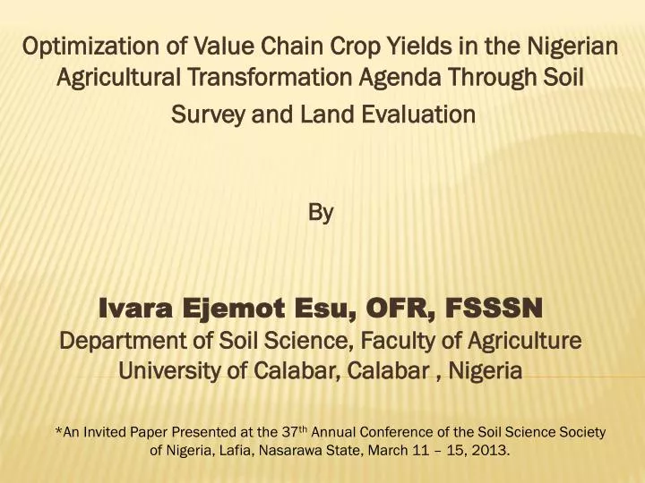
Optimization of Value Chain Crop Yields in the Nigerian Agricultural Transformation Agenda Through Soil Survey and Land Evaluation By Ivara Ejemot Esu , OFR, FSSSN Department of Soil Science, Faculty of Agriculture University of Calabar , Calabar , Nigeria.

E N D
Optimization of Value Chain Crop Yields in the Nigerian Agricultural Transformation Agenda Through Soil Survey and Land Evaluation By IvaraEjemotEsu, OFR, FSSSNDepartment of Soil Science, Faculty of AgricultureUniversity of Calabar, Calabar , Nigeria *An Invited Paper Presented at the 37th Annual Conference of the Soil Science Society of Nigeria, Lafia, Nasarawa State, March 11 – 15, 2013.
What is the Nigerian Agricultural Transformation Agenda? • A policy conceived by the President Goodluck Jonathan’s Administration as a major tool to help progress towards food security, poverty reduction, employment generation and unprecedented industrialization of the country. • To achieve a hunger-free Nigeria through an agricultural sector that will drive income and transform the country into a leading player in global food markets. • To create wealth for millions of Nigerian farmers. • Focuses on the development of agricultural value chains.
What is Agricultural Transformation? • Agricultural transformation is the process by which individual farms shift from highly diversified subsistence-oriented production towards more specialized production oriented towards the market or other systems of exchange. • The process involves a greater reliance on input and output delivery systems and increased integration of agriculture with other sectors of the domestic and international sectors. • Increasing productivity at the farm level is absolutely necessary. • The transformation action plan is focused on key aspects of value chains. • They include the provision and availability of improved inputs (seeds and fertilizers), increased productivity and production as well as the establishment of staple crop processing zones.
What is Agricultural Value Chains and What are the Crops Included? • The action focuses on the development or promotion of the following priority crops: Cassava, Rice, Maize, Sorghum, Cocoa, Oil palm, Soybean, Cotton, Tomato, and Onions. • Also focuses on other (non-crop) agricultural commodities such as Dairy, Beef, Leather, Poultry and Fisheries. • The commodity value chains are based on prioritization of the items along comparative advantage in the six geo-political zones of the country. • It also involves reform in the input supply sector to stop direct government involvement in the procurement, supply and distribution of fertilizer and seeds to farmers. • It also involves the establishment of private sector led commodity trade and market development corporations for the value chains in Nigeria.
Fundamental Flaw in the Initial Crafting of the Agenda • Near to complete absence of emphasis on the importance of the soil resource as the main engine to fuel the expected optimum yields of the crops in the value chains . • Establishment of crop processing zones on which the cluster-based value chain strategy are based, appear to have been mainly done on the basis of climatic and vegetal regimes of the country. • Soil survey and land evaluation techniques have the capacity to most appropriately guide farmers towards the selection and planting of the various value chain crops in land areas best suited for their production. • The techniques also have the capacity of clearly highlighting limitations, if any, that prevent the soils from being suitable or marginal for the intended land use type(s). • Thus, helps to pinpoint soil management issues which may militate against optimum crop production on such soils.
Objectives of Paper To outline the meaning, purposes and methodologies of soil surveys. (ii) To outline the definition, methodology and usefulness of the various land evaluation systems in use. (iii) To establish a nexus between soil survey, land evaluation and optimum yield of crops in the value chains of the Nigerian Agricultural Transformation Agenda.
What is Soil Survey? • Soil is often perceived as a continuum but actually, differences occur in soils, vertically (profile) and horizontally (polypedons) within short distances. • Soils differ in depth, wetness, texture, reaction, sodicity, salinity, nutrient content, etc. • Soil surveys provide a scientific inventory of the soils occurring within a specific land area (soil resource inventory). • Soil survey involves the systematic examination, description, classification and mapping of soils in a specified land area. • It is a major pre-requisite for land-use planning and sustainable development especially in agriculture.
Implementation Agencies of Soil Survey • In developed countries like the USA and Canada, it is a co-operative effort coordinated by USDA or Canadian Department of Agriculture. • Cooperating Agencies include • Natural Resources Conservation Service • Bureau of Land Management • Forestry Service • Geological Survey • Agricultural Experiment Stations of Universities in various States,etc. • Detailed soil surveys are organized for each county – Equivalent to Our Local Government Areas. • In Nigeria: FDALR – Established in the 1980s • Abolished soon after the production of the reconnaissance/ exploratory survey at 1:650,000 in 1991. • Current Efforts being made to commence semi-detailed soil surveys.
Procedures of conducting soil surveys • Rarely are soil surveys carried out these days without remote sensing data. However, there are two main methods of conducting soil surveys; • Conventional methods involving Rigid Grid and Grid methods • Methods involving Remote Sensing Data such as; • (a) Air Photos • (b) Satellite Imageries e.g. Landsat, GeoEye, Spot Image, RapidEye, etc. • (c) Digital Soil Mapping.
board software is the result of extensive testing and development since early 2006.Draganflyer X6 Flight Stability Reliable
Products of Soil Survey They are two main products of soil survey; Soil Map and (b) Soil Survey Report
Soil Survey Report Soil Survey Report often accompanies the soil map and normally contains but not limited to; A description of the environment of the survey area. Methods of investigation Description of mapped soils (soil mapping units) Soil data interpretation and land use Soil management recommendations and appendices showing profile descriptions, analytical data, etc. Land characteristics and land qualities often of great interest in soil data interpretation include (i) Slope (ii) Effective soil depth (iii) Soil texture/structure (iv) Drainage (v) Salinity (vi) Soil pH/Exch. Al3+ (vii) Organic carbon (viii) Major plant nutrients (NPK) (ix) CEC/Exch. Bases (Ca2+, Mg2+, K+) (x) Base saturation (xi) Micronutrients (Zn, Cu, B, Fe, Mn)
Table 2: Land Characteristics/Land Qualities Used for Evaluation of Soils for Agricultural Use in General
What is Land Evaluation? • Land evaluation can be defined in general terms as the assignment of land performance when used for specific purpose(s). • It may be evaluated directly e.g. through the collection and processing of crop-yield data (Rare in our situation). • Indirectly, diagnostic criteria which influence land performance in a reasonably predictable manner and that this performance can be deducted from the observation of those properties. • In the indirect method, land evaluation involves the execution and interpretation of surveys and studies of landforms, soils, vegetation, climatic and other aspects of land in order to identify and make comparisons of promising kinds of land use in terms applicable to the objectives of the evaluation. • Land characteristics/land qualities used in land evaluation are often obtained during a systematic soil survey.
Questions Land Evaluation Process Seek to Answer? What are the properties of the land of each soil mapping unit in a soil map and which type of use offers the best sustainable production and/or benefits? What is the present land use and what alternative uses are physically possible and socially, economically and environmentally relevant? What will happen if present practices remain unchanged? And how can the present practices be improved? What inputs are needed to achieve the desired sustainable production and minimize the adverse effects and risks? What are the adverse physical, economical, social and environmental effects and risks and what are the benefits of a given land use system or practice?
Major Systems of Agricultural Land Evaluation Land evaluation systems currently in use belong generally to four main groups: Capability or Categoric systems e.g. USDA Land Capability Classification (Klingebiel & Montgomery, 1961). Special purpose systems e.g. FAO Framework for Land Evaluation (FAO, 1976). Parametric systems e.g. The Storie Index (Storie, 1933, 1978), Riquier, Bramao and Cornet System (1970). Crop-Specific Assessments (Sys and Riquier, 1980; Sys, 1985).
Land Capability Classification • Based on detailed soil survey (1:10,000 – 1:24,000) in the USA • Groups soil mapping units “primarily on the basis of their capability to produce common cultivated crops and pasture plants over a long period of time”. • Capability groups are made of three levels (a) Land classes (b) Land subclasses (c) Land units • Land capability classes are eight (I-VIII) • Classes 1 – Best land, little or no limitation • Class I, II & III – Land suited for cultivation with increasing limitation • Class IV – Fairly good but has serious limitations but best use in pasture. • class V, VI & VIII – Not good for cultivation of common crops but ok for grazing or forestry. • Class VIII – Land suited for wildlife, recreation or watershed protection. Extreme steepness, roughness, wetness, erodibility, stoniness, etc unsafe for economic cultivation, grazing or forestry. • Land Subclasses, expresses kinds of limitation, e(erosion), w(wetness) s(soil conditions) and c(climate). • Land Units, kind of management and same kind of conservation treatment e.g. IIe-1, IIe-2, IIIes-1, IIIes-2 etc.
Land Suitability Classification (FAO, 1976) • Contains two Orders – Suitable (S) and Not Suitable (N) • Suitable Order has three(3) classes – Highly Suitable (S1), Moderately Suitable (S2) and Marginally Suitable (S3) • Not SuitableOrder has two(2) classes – Currently Not Suitable (N1) and Permanently Not Suitable (N2). • Suitability Subclasses: Indicate kinds of limitations e.g. moisture deficiency, erosion hazard, but no subclasses for S1, but subclasses exist for others e.g. S2e, S3d, etc. • Suitability Units: Subdivisions of Subclasses differing in detailed aspects of their production characteristics or management requirements. S2e-1, S2e-2, etc.
Parametric Systems • Parametric systems like all numerical correlations are a simple quantified expression of soil productivity. • Their reliability depends, however, heavily on the choice of the factor determinants, their weighting and the validity of the assumed interactions between the factors. • All factors with a relevant impact on the land use potential are allocated a numerical value ranging from 1.0 or 100 (for the highest potential) and almost 0.0 (for the lowest potential). • The final index is obtained by either multiplying or adding the individual rating values. This index is finally converted into a yield level or productivity class. • Example: (i) Riquier et al (1979) • IP = H X D X P X T X or X O X A X M N S
Where: IP=Index of Productivity, H=Soil Moisture, D=Drainage Condition, P=Effective soil depth, T=Texture/Structure, N=Base Saturation, S=Soluble salts, 0=Organic Matter, A=Nature/CEC of clay, M=Mineral Reserve. According to the resulting index of productivity, the soil is assigned to one of five productivity classes: Class1= Excellent with rating - 65-100 Class2= Good with rating - 35-64 Class3= Average with rating - 20-34 Class4= Poor with rating - 8-19 Class5= Extremely poor with rating - 0-7
Crop Specific Assessments (Sys, 1985) • Combines the FAO Framework for land evaluation (Land suitability classification) with the parametric system. • What is essential to the system is that the land characteristics/land qualities are compared with the crop requirements of each land utilization type. • Evaluation procedure consists of three(3) phases • Collection of the necessary land characteristics/land qualities. • Determination of the requirements of the land utilization type(s) • Evaluation senso-stricto by comparing land characteristics/qualities with the crop requirements and rating them.
Table 3: Land Requirements for Suitability Classes for Oil palm Cultivation (Modified from Sys, 1985 in Ogunkunle, 1993)
F0, no flooding; F1, 1-2 flooding months in >10years; F2, not more than 2-3months in 5 years out of 10; F3, 2-4 months almost every year; F4, >4months in almost every year. CL, clay loam; SCL, sandy clay loam; L, loam; LFS, loamy fine sand; C, clay; SC, sandy clay.
Table 4: Ratings of Limiting Characteristics (Ogunkunle, 1993)
Table 5: Suitability class scores for representative two pedons of the soil series in NIFOR (Ogunkunle, 1993)
Procedure for Evaluation in the Crop Specific Assessment Method • Match soil characteristics (climatic, topography, wetness, soil physical characteristic, soil fertility, salinity/alkalinity) with the crop requirement for each of these land qualities using the rating table (slight to none, 100-95; slight, 94-85… severe 59-40 and thus create a suitability class scores table e.g. Table 5. • Note that aggregate suitability of each land quality group is its most limiting characteristics because of Leibig’s Law of the minimum which states that “growth is controlled not by the total amount of resources available, but by the scarcest resource (limiting factor) • Calculate the index of productivity/suitability (IP) for each soil unit by using the equation below: • Where: A = Overall lowest characteristic rating within all the land quality groups • B, C, ……F = The lowest characteristic rating for each of the land quality groups e.g. Climate (c), Topography (t). . . . Chemical fertility (f)
Determine potential and current index of productivity by noting that in potential index of productivity (IPp), fertility values such as K mole fraction, Mg: K ratio, and other fertility characteristics which can easily be corrected by the application of fertilizer(s) are not considered in rating for the fertility land quality group but these are considered when rating for Current/Actual productivity (IPc). As an example in the Table 5 just considered index of productivity for Alagba series is calculated as: • and (f) (c) (t) (w) (s) (f) (c) (t) (w) (s)
Table 6: Current and potential yields of crops in the value chain of the Nigerian Agricultural Transformation Agenda
Conclusion • A very close nexus exists between soil survey, land evaluation and optimum crop yields in any given land area. • Soil survey generates the soil map and the land characteristics/land qualities of the map units. • The process of land evaluation matches the properties of the soils with the requirements of each crop for optimum production. • Land evaluation also results in the highlighting and drawing attention to certain management problems such as low nutrient fertility, soil acidity or alkalinity, salinity, low organic matter content, shallow effective soil depth and soil erosion hazard, as well as helping to seek for appropriate solutions. • Soil survey and land evaluation may thus be said to be a sine quanon to the optimum yield of crops like those included in the value chains of the Nigerian Agricultural Transformation Agenda.
Thanks For your Attention