Download
1 / 55
550 likes | 674 Views
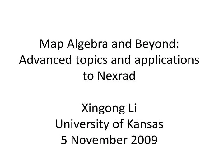
Map Algebra and Beyond: Advanced topics and applications to Nexrad Xingong Li University of Kansas 5 November 2009. Major Extensions to Map Algebra. Scott (1999) extended the original 2D MA operations into three dimensional raster datasets ( volumetric MA ) Solid earth Atmosphere Ocean

E N D
Map Algebra and Beyond:Advanced topics and applications to NexradXingong LiUniversity of Kansas5 November 2009
Major Extensions to Map Algebra • Scott (1999) extended the original 2D MA operations into three dimensional raster datasets (volumetric MA) • Solid earth • Atmosphere • Ocean • Li and Hodgson (2004) and Wang and Pullar (2005) developed MA operations for vector fields (cell values are vectors rather than scalars) • Aspect, surface normal • flow and wind fields • Mennis et al., 2005 developed cubic MA for spatio-temporal datasets where the third dimension is time • Spatio-temporal time series • French and Li (in press) proposed MA operations for the vector data model
Map Algebra for Vector Fields • Types of fields • Scalar fields—each cell stores a scalar value • Normal, ordinal, interval, and ratio • Vector fields—each cell stores a vector • 2D, 3D, Multi dimensional • Map algebra operations on vector fields
Aspect1 Aspect2 Mean Aspect How to calculate the mean aspect? MeanAspect = (Aspect1 + Aspect2)/2? What is the mean aspect within landuse (or elevation) zones?
Calculate Mean Aspect • What’s the mean aspect of 2 and 358 ? • (2 + 358) = 180 ? • Aspects are unit vectors • How to calculate mean aspects? • Vector algebra
y =330 =30 x Mean Aspect by Unit Vector
y A B x Angular Between Two Vectors
Friction and Movement Direction The cost distance operation in ArcGIS assumes that friction is independent of movement direction (cost per unit distance)
missing polygons Map Algebra for the Vector Data Model • No counterpart in the vector data model • Have to convert vector data into raster to use map algebra operations • Various problems during the conversion • Impose an arbitrary analysis resolution
Local Spatial Scope • A cell in the raster data model • A feature in the vector data model • Two types of vector layers (focus and value layer) • Each feature on the focus layer defines a local spatial scope of an operation • Value layer stores the features to which the features on the focus layer will be spatially compared • Focus and value layer can be the same
Focal Spatial Scope • Neighborhoods for points, lines, and polygons • Neighborhoods are not necessary polygons • Neighborhoods can be defined based topological relationships among features • Generic neighborhood could also be defined
Zonal Scope • A collection of features with the same values for a given field • May become a local scope if each feature has a unique value in the field
Value Feature Selection and Adjustment • The value features and their attributes associated with a focus feature may partially overlap with the focus feature • Four selection/adjustment options • No adjustment on geometry and attribute • Only on geometry • On geometry and attribute (over value feature) • On geometry and attribute (over spatial scope)
Select Value Features • Value features are selected based on the dimensionally extended 9-intersection model (DE9IM) developed by Egenhofer and Herring (1991) and Clementini et al. (1993) • The ‘within’ relationship (“T*F**F***”) • Geometric types which can have the ‘within’ relationship
Attribute Adjustment OVER_VALUE_FEATURE OVER_LNZ
A Possible Syntax NewLayer = FocusLayer.Operation (Scope, ValueLayer, Attribute, Adjustment, Normalization)
Examples (a) NewLayer = Siren.Sum (Radial (0, 0, 0, X), CensusBlock, POP, OVER_VALUE_FEATURE). (b) NewLayer = SirenZone. Sum (Zonal(ID), CensusBlock, POP, OVER_VALUE_FEATURE).
Examples (b) NewLayer = Subwatersheds. Majority (Local(), RadarCells, PRECIP, ON_GEOMETRY, Area) (c) NewLayer = Subwatersheds. Sum (Local(), RadarCells, PRECIP, OVER_LNZ)
Comparison to Raster Map Algebra • Vector MA does not impose any arbitrary resolutions but simply maintain the original resolution of the data through its operations • Raster MA has difficulty handling the neighborhoods which are defined for individual features or are based on the topological relationships between features • The vector cartographic modeling is more appropriate for characterizing discrete features and the relationships among the features
Spatiotemporal Map Algebra Cubic local functions Cubic Focal functions Mennis, J., Viger, R., and Tomlin, D. 2005, “Cubic map algebra functions for spatiotemporal analysis”. Cartography and Geographic Information Science, 32(1): 17- 32.
Cubic Zonal Operations vary only in time vary only in space vary both in space and time
Antecedent Precipitation and Water Quality Explore the relationship between water sample quality and antecedent rainfall (precipitation occurred before water samples were taken)
Water Samples in Space and Time 1049 water samples were collected from 89 locations at different times (from 1992 to 1999)
Defining Spatiotemporal Zones 1227a 1224b Zone = flow length + antecedent time
From Spatio-temporal precipitation data to precipitation events (storms) • The Eulerian view focuses on the change of state in space • While a sequence of changes in space may portray the movement of an entity across the space, there is no explicit representation of those entities. • no structured data object representing "a storm“ • no explicit representation of behaviors that storms can exhibit. • The Lagrangian view offers an alternative perspective that focuses on movement and uses an object-based approach
Study Area and Data • The study domain is the ABRFC (Stage III and P1 NEXRAD products, 4 km spatial resolution, hourly in time) • The precipitation data span a period of 11 years from 10/01/1995 to 09/30/2006
NEXRAD (Next generation Radar) • About 150 stations covering the entire U.S. • Provides hourly precipitation estimate by combining radar, satellite, and rain gauge data • Spatial resolution is about 4 km
NEXRAD Data • Precipitation data are broken down into 13 separate geographical regions • Each region covers a NWS-designated river basin (River Forecast Center) • Temporal coverage of the dataset varies in each river basin • Data can be downloaded from the NOAA website or from individual RFCs
Storm (Event) Extraction • A storm (event) is defined as a contiguous precipitation object in space and time • a set of connected precipitation cells delineated from stacked hourly NEXRAD precipitation layers. • The algorithm is based on the component labeling algorithm in digital image processing • Controlled by 3 parameters • the minimum hourly precipitation (MHP) in a cell • the minimum time span (MTS) of a storm • the definition of spatial and temporal connectivity t-1 t t+1
Projected on x-y plane Projected on to the x-time plane Projected on to the y-time plane A Storm Example
Storm Tracking and Representation • A directed graph is used to represent a storm • Nodes are precipitation-weighted centroids of spatially contiguous areas receiving rainfall in each hour • Directed edges indicate spatial and temporal linkage (split or merge) among the rainfall areas during the life span of the event
Warm Season Storm Spatio-temporal Characteristics • Warm season: April to September • 04/01/96—09/30/2006 • 519,562 storms
Spatial Characteristics Total number of storms that occurred during the 11 year period
Spatial Characteristics Total amount of storm precipitation in mm during the 11 year period
Spatial Characteristics • Precipitation-weighted centroids of the events were calculated and used to represent the events as points in space and time in storm density analysis • The number of events per km2 of the 11-year period • The amount of precipitation per km2 of the 11-year period
Storm Movement • Precipitation-weighted mean storm movement vector is calculated for each storm from the directed graph • All the data from 10/01/1995 to 09/30/2006 Length represents movement speed. Start point is precipitation-weighted centroid.
Storm Movement Directional distribution of storms (left) and storm precipitation (right)