Download
1 / 41
470 likes | 679 Views
A Retrospective of the June 1953 Flint and Worcester Tornadoes. How They Happened and What We Learned. Eleanor Vallier-Talbot NOAA/NWS Taunton, MA. Flint and Worcester. Set up for development of the tornadoes Synoptic and upper air features Massive damage that occurred

E N D
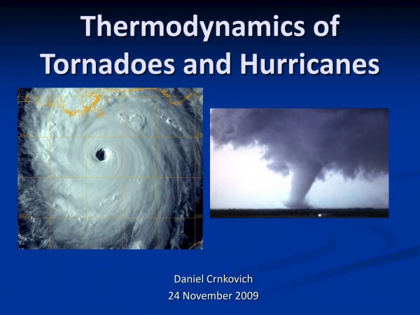
A Retrospective of the June 1953 Flint and Worcester Tornadoes How They Happened and What We Learned Eleanor Vallier-Talbot NOAA/NWS Taunton, MA
Flint and Worcester • Set up for development of the tornadoes • Synoptic and upper air features • Massive damage that occurred • Photos and reports • Aftermath • Changes and updates to technology and warning system • Research conducted with data from these storms
Monday, June 8, 1953 1200Z Surface Map
Credit: NWS Detroit/Pontiac, MI
Credit: NWS Detroit/Pontiac, MI
Credit: NWS Detroit/Pontiac, MI
If we had satellite and radar in 1953… • Using the 21Z Mt. Clemens (60 miles SE of Flint) sounding • NWS Detroit developed idealized simulations • Satellite • http://www.crh.noaa.gov/dtx/1953beecher/flash.php?image=3D • 2 KM radar • http://www.crh.noaa.gov/dtx/1953beecher/flash.php?image=rad2km
Erie, MI Tornado and Waterspout -- 30 miles over water Credit: Grazulis
Beecher, MI – June 9, 1953 Credits: NOAA News and Flint Public Library
Beecher and vicinity Damage Credit: Flint Public Library
Credit: NWS Detroit/Pontiac, MI
Michigan/Ohio Tornadoes • Large F5 tornado passed through Flint and Beecher (Only F5 in SE lower Michigan) • Killed 116 people…last tornado to kill over 100 people in U.S. history • 844 injured, occurred at 830 PM EST • 27 miles long, over 800 yards wide • Three F4 tornadoes in MI/OH • Temperance/Erie; Deshler/Cygnet; Kings Mill • Four F3 tornadoes in MI/OH • $19M damage (1953); $127M damage (2002 dollars)
Boston Globe June 9, 1953
The June 9th Forecast
Tuesday, June 9, 1953 1200Z Surface Map
Discussions at WBO Boston • Knew history of this weather system and saw potential of damaging/tornadic development in Massachusetts • Meteorologist Al Flahive and other staff met at 10 AM to discuss mention of “Tornado” for their next forecast issuance • Decided against it so not to be “unnecessarily alarming” • Opted for first-ever severe thunderstorm forecast wording in New England issued at 1130 AM • “Windy, partly cloudy, hot and humid with thunderstorms, some locally severe, developing this afternoon” (Credit: Chittick)
Tuesday, June 9, 1953 1830Z Surface map
Hand drawn map from WB office in Worcester “Rotating” wind damage and 3 inch diameter hail reported in Colrain and baseball hail in Northfield at about 345 PM EDT around 3 PM
Taken at 455 PM EDT Lexington, MA MIT Radar Hook Echo Signature (Holden, MA) Credit: BAMS
Hail in Rutland… Next to a light bulb Credit: Chittick
457 PM Credit: Grazulis
Twin Funnels Seen on Brattle Street, Worcester at 508 PM Courtesy: Chittick Photo by: Howard Smith Worcester Telegram & Gazette
Barograph Trace found in north Worcester (Worcester/Holden) Bottomed out at 27.54 inches at 4 PM EST (5 PM ESDT) Lowest recorded pressure in eastern U.S. (N. of Florida)
Worcester Tornadonear Lake Quinsigamond,Shrewsbury522 PM Mile 35 – Viewed toward NNE Funnel about one mile wide Photo taken by the late Henry LaPrade
Warning Issued! • Phone call made after 5 PM from Blue Hill Observatory (Milton, MA) to WBO Boston • Observer John Conover reported debris falling out of the sky • “…It’s coming from great heights, shingles, small branches, paper…boards several feet long…” • “I’m afraid there’s been a bad tornado somewhere.” • Forecaster Drebert agreed, issued first ever tornado warning in New England! • “…Caution advised on severe thunderstorms with isolated tornado activity in the Boston area between 6 and 8 PM this evening.” • Sent via teletype at 545 PM!! (Credit: Chittick)
Assumption College Before…
and After… Credit: Chittick
Uncantena Avenue, off Clark Street in the upper Burncoat area Credit: Chittick
Sheet metal wrapped around debarked trees… Corner of Holden St. and Brentwood Dr., Holden, MA
Overshooting top from parent thunderstorm as it moved away… Estimated tops over 70,000 feet! (B. Vonnegut & A. Bemis) Credit: Chittick
F3 Tornado in Exeter at about 520 PM Hand drawn tracks of three tornadoes that affected New England on June 9, 1953 from the Worcester Weather Bureau office F3 Tornado from Sutton to northern Mansfield
Official Tracks of Massachusetts Tornadoes – June 9, 1953 Credit: BAMS
Worcester’s Final Statistics • F4 damage • On ground 84 minutes and 46 miles, up to one mile wide • 94 people killed, 1300 injured (#4 in U.S.) • 4000 buildings damaged or destroyed • Debris found in the Boston area and on Cape Cod • Frozen mattress found in Massachusetts Bay near Weymouth • Books and clothing found at Blue Hill and on outer Cape Cod (Provincetown/Chatham/Eastham <110 miles away>) • Reports of hail from Portland-Bangor-Eastport, ME • 1/4 to 3/4 inch in squall line, no tornadoes reported • $52.1M damage (1953 dollars); $1.14B (1997 dollars <adjusted for wealth & inflation>)
Aftermath • Recently formed Weather Bureau Severe Weather Unit (SWU) in mid 1952 (SPC history) • Did well in forecasting the Iowa and Flint tornadoes, but “caught by surprise” by New England tornadoes on June 9, especially the severity of the Worcester storm • Renamed Severe Local Storms Warning Center (SELS) on June 17, 1953 • Reorganized in part because of these storms as well as Waco, TX in May (114 dead) • One forecaster and SELS supervisor requested transfer out of unit by end of 1953 • Moved to Kansas City from Washington in 1954 • Worcester Rating re-assessment • Blue ribbon committee held in summer 2005 to possibly re-rate tornado to an F5 • Only storm other than Hurricane Andrew that this was done for
Aftermath • Eventual deployment of weather radar nationwide • Research radar at MIT saw Worcester tornado, only the 4th tornado seen on radar at that time • Warning system • Noted that several warnings were received by various agencies in central Massachusetts, but never passed on to other communities • Eventual development of warning system for emergency management and citizens • Improvement of radio and television communications
Research • Cloud electrification of severe thunderstorms • Paper in Atmospheric Research in 1999 in honor of Bernard Vonnegut (Williams, et al) • Vonnegut researched severe storms, lightning and tornadic activity after his experience with Worcester tornado • Vonnegut and Bemus noted from 600-1200 flashes per minute in the Worcester storm • Only visual observation of stroke rate in nighttime tornadic supercell • Lightning from the storm could be seen offshore until midnight June 10 • Debris fallout from tornadic thunderstorms • Former Tornado Debris Project out of Oklahoma University • Used Worcester reports in their historic research for BAMS article in 1995 (J. Snow, et al)
Credits and References • Significant Tornadoes 1680 – 1991 by Thomas P. Grazulis • What Is So Rare as a Day in June: Worcester Tornado June 9, 1953 (Multimedia presentation)by William Chittick • Tornado! 84 Minutes, 94 Lives by John O’Toole • “The Squall Line and Massachusetts Tornadoes of June 9, 1953,” Bulletin of the American Meteorological Society (BAMS), Vol. 36 No. 3, March 1955, pp. 109-122. • NOAA Central Library Data Imaging Project – U.S. Daily Weather Maps (online)
Credits and References • Plymouth State College WXP NCEP/NCAR Reanalysis Map Generator (online) • Boston Globe • Worcester Telegram and Gazette • NWS Taunton archival data • NWS Detroit/Pontiac, MI website • http://www.crh.noaa.gov/dtx/1953beecher/ • NOAA News Online, May 5, 2003 article • Flint, MI, Public Library • http://www.flint.lib.mi.us/gallery/beechertornado/ index.shtml