Download
1 / 36
360 likes | 372 Views
Update on the Northwest Regional Modeling System. Cliff Mass, Dave Ovens, Jeff Baars , Mark Albright, Phil Regulski , Dave Carey University of Washington. The current model domains 36-12-4/1.33 km. Major Changes and Improvements.

E N D
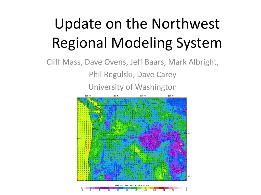
Update on the Northwest Regional Modeling System Cliff Mass, Dave Ovens, Jeff Baars, Mark Albright, Phil Regulski, Dave Carey University of Washington
The current model domains 36-12-4/1.33 km
Major Changes and Improvements • Beginning with the December 31, 2009 0000 UTC run, the WRF-GFS, our flagship system, has switched to the latest version of WRF (3.1.1.) • Bug fixes in several of parameterizations we use. • Better microphysics (should get start of light rain better). • More boundary layer options (a major problem) • More stable. • But as we will see, the new system has created some problems too.
Added an Operational Ultra High Resolution 1.33 km Nest to Our Current 36 km/12 km/4 km system • Western WA only • Once a day (0000 UTC cycle) to 36 h • Attempt to answer questions: • What is the payoff in getting the land-water boundaries and smaller scale terrain much better (4-km hardly has Puget Sound!) • Does ultra high resolution improve objective verification or subjective structures?
4 km 1.3
1.3 Land Use 4 km
Future Evaluation • Beginning intensive objective verification • Improving boundary layer schemes, surface drag, and surface physics may preferentially help 1.3 km (more later)
The Greenest Computer Facility in the U.S.? • We have roughly 150 processors for the high resolution and ensemble runs • Approximately, 200 Terabytes of storage. • Needs very little air conditioning and we had no trouble getting through the 103F heat last summer. • Why?
The Problem: Where There is Snow on the Ground and High ElevationThe Problem Is Probably in the Land Surface Model
Wind Direction Errors: Stable and Generally Better than NWS 12-km NAM
Wind Speed is Another Issue: UW WRF too strong, NWS NAM too Weak
A Major Problem Has Been Surface Winds Over Land • Winds too strong over land • Winds too geostrophic over land • Winds over land and water too similar
Fixing the Problem • No magic bullet in testing various planetary boundary layer (PBL) schemes • Recently, we tried two approaches that are very promising: • Increasing the friction veloc (ustar) in the PBL. Essentially adds low-level drag. • Decreasing vertical diffusion in the model (less vertical mixing of high momentum air down to the surface).
Changing Surface Drag Standard Low Diffusion
The Fix • We are testing these new approaches singly and together. • Verification statistics show we can reduce the wind bias without harming other parameters. • Next month we should put the fix into place and expect a radical improvement in the wind bias.
A Lot More To Talk About But no Time • A high resolution local data assimilation system (EnKF) is being tested and developed. • Very high quality local analyses and very good short-term forecasts should be available this year. • We are testing this system for use with the new coastal radar: may see much better local short-term forecasts if this works.