Download
1 / 24
970 likes | 2.44k Views
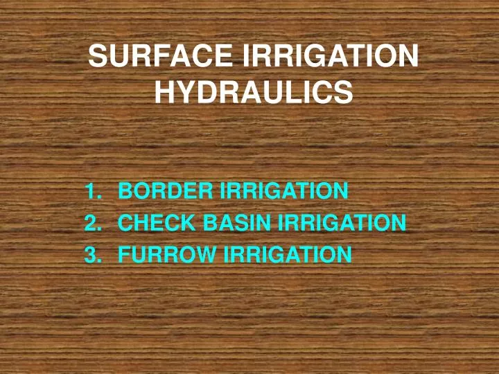
SURFACE IRRIGATION HYDRAULICS. BORDER IRRIGATION CHECK BASIN IRRIGATION FURROW IRRIGATION. BORDER IRRIGATION Land is divided into a number of strips, separated by low levees called "borders". Each strip is 3 to 15 meters in width depending on stream size available and levelling.

E N D
SURFACE IRRIGATION HYDRAULICS BORDER IRRIGATION CHECK BASIN IRRIGATION FURROW IRRIGATION
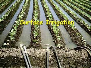
BORDER IRRIGATION • Land is divided into a number of strips, separated by low levees called "borders". • Each strip is 3 to 15 meters in width depending on stream size available and levelling. • Ridges between borders should be sufficiently high to prevent overtopping during irrigation. • The land should be levelled perpendicular to the flow. • When the advancing water reaches the lower end of the strip, the supply of water to the strip is turned off.
Parker & Israelson’s approach Let Q = Discharge through the supply ditch. y = Depth of water flowing over the border strip. f = rate of infiltration of soil. A = Area of land strip to be irrigated. t = Time required to cover the given area. I = constant rate of infiltration
Let an area of dA is covered in time dt after t. Then by volume balance, Q.dt = I.dt (A+dA) + y.dA Neglecting second order differential term and re-writing, we get, dt = y.dA/ (Q-IA) Integrating both sides of the equation bet’ limits,
Solving the above equation for A, we get For a uniform width border (W), the advance distance x at any time t is given by
CHECK BASIN IRRIGATION • Bunds or ridges are constructed around the areas forming basins. • The basins are filled to the desired depth and the water is retained until it infiltrates into the soil. • When irrigating rice or impounding water for leaching salts from the soil, the depth of water may be maintained for considerable periods of time by allowing water to continue to flow into the basins.
HYDRAULICS OF CHECK BASIN IRRIGATION The hydraulics of flow in check basins may comprise four stages. • Initial spreading of the entrance stream to cover the full width of the basin and simultaneous advance of the irrigation stream. • Advance of the water front after the initial spreading. • Rise of water level after the advancing stream reaches the down stream end. • Subsidence of water after the irrigation stream is stopped.
Vs = q.ts-Is.ts = Ac.ds In which Vs = volume of water stored in a given time ts, cm3 q = average size of the entrance stream, cm3 / min ts = storage time, min Is = average infiltration rate during the storage time, cm/min Ac = area of check basin, cm2, and Ds = depth of storage during ts,cm Rate of rise of water level = d (ds) / dts
FURROW IRRIGATION The water is applied to the land through a series of long, narrow channels, called furrows. The furrows are dug at a regular interval at right angle to the field channels. The water flowing in the furrows infiltrates the soil and spreads laterally and reaches the roots of the plants between the furrows. The wetted area varies from 1/5 to ½ of the total area. It helps in reducing the evaporation losses and achieving a high water-application efficiency.
ADVANTAGES OF FURROW METHOD • The method is quite suitable for row crops such as maize, cotton, potatoes, sugar cane, sugar beet, groundnut, tobacco, etc. • The evaporation losses are smaller because only a part pf the land comes in contact with water. • The puddling heavy clayey soil is less in the furrows method. Hence, it is possible to cultivate soon after irrigation. • There is no wastage of land for the construction of the field channels required in other methods. • The cost of land preparation is less • 6. Suitable for water logging sensitive crop like maize
The size, shape, spacing and length of furrows depend upon • The soil type, • The type of crop • The topography of the land.
Width and depth of furrow Depth of furrow is 20 and 30 cm for orchards. For vegetables and the row crops , such as sugar beet ,potatoes cotton and tobacco the depth is @ 7.5 to 12.5 cm Length of furrow The length varies from 30 to 60 m for sandy soil and 100 to 500 m for clayey soils. garden crops, the length is usually kept shorter as compared to the field crops.
Slope of furrow Furrows should be provided with a proper longitudinal slope. The steeper slopes lead to high velocity of flow, which may cause erosion of the bed and sides of the furrows. Spacing of furrow Vegetable crop such as carrots and onions, planted at 30 to 40 cm apart, may have two rows of plants between two successive furrows. Crops like potato and cotton planted at 60 to 90 cm apart, have one row of plants between two successive furrows.
Furrow stream The size of the furrow stream usually varies from 0.5to 2.5 litres per second. The maximum non-erosive flow rate is estimated by the following empirical equation: qm = 0.6/S qm = maximum non erosive stream , lps. s = slope of furrow, %.
The average depth of water applied during an irrigation can be calculated from the following relationship: d = d = average depth of water applied, cm q = stream size , litres per second t = duration of irrigation, hour w = furrow spacing , m l = furrow length, m
Projecting the border equation derived for the furrow, we get, X= Q / I * T. (1- e –(I * T * t) / a) Where, X = distance traveled by wetting front, cm Q = discharge, cm3 / sec I = rate of infiltration, cm / sec T = Top width of furrow, cm t = Time of application of water, sec a = Area of c/s of furrow, cm2