Download
1 / 32
320 likes | 475 Views
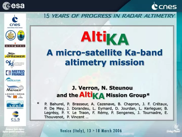
Alti. KA. A micro-satellite Ka-band altimetry mission. J. Verron, N. Steunou and the Mission Group*

E N D
Alti KA A micro-satellite Ka-band altimetry mission J. Verron, N. Steunou and the Mission Group* * P. Bahurel, P. Brasseur, A. Cazenave, B. Chapron, J. F. Crétaux, P. De Mey, J. Dorandeu, L. Eymard, D. Jourdan, L. Kerleguer, B. Legrésy, P. Y. Le Traon, F. Rémy, P. Sengenes, J. Tournadre, E. Thouvenot, P. Vincent … Alti KA
Motivations • Scientific objectives • The AltiKA solution • Status Venice 15-3-2006
1. Motivations • IGOS and GODAE since 2000: « Continuity of high accuracy, high resolution near-real time observations of the ocean surface topography is required. At least, 2 simultaneous altimetric missions are required (including one of the Jason reference class) » • HOT SWG, 2001: « The HOT SWG recommends that planning begin immediately to build and launch a constellation of low-cost, low-risk altimeters (e.g. WITTEX or AltiKa) as a follow-on of ENVISAT and Jason-2 » • GAMBLE (5th PCRD), 2004: « To agree, within the next few months, to fly at least one complementary mission in 2008 » Venice 15-3-2006
1. Motivations • IGOS and GODAE since 2000: « Continuity of high accuracy, high resolution near-real time observations of the ocean surface topography is required.At least, 2 simultaneous altimetric missions are required(including one of the Jason reference class) » • HOT SWG, 2001: « The HOT SWG recommends that planning begin immediately to build and launch a constellation oflow-cost, low-risk altimeters(e.g. WITTEX or AltiKa) as a follow-on of ENVISAT and Jason-2 » • GAMBLE (5th PCRD), 2004: « To agree, within the next few months,to fly at least one complementary mission in 2008 » Venice 15-3-2006
ALTIMETRIC MEASUREMENTS: SSH, SWH, WIND SPEED AT NADIR POSSIBLE SCENARIO FOR OPERATIONAL CONVERGENCE BETWEEN THE USA & EUROPE 97 98 99 00 01 02 03 04 05 06 07 08 09 10 11 12 66 deg inclination JASON-2 TOPEX-POSEIDON EUR-US M1 JASON-1 US-European Convergence on joint operational system High inclination (2 orbits) ERS -2 ENVISAT GMES-1/S3 G F O GODAE In orbit Approved Planned/pending approval Proposed Scenario * An ocean circulation observing system requires two altimeter missions simultaneously in orbit for proper sampling/coverage. * US contribution to joint operational system part of NPOESS ( altimetry is part of NPOESS baseline) Venice 15-3-2006
ALTIMETRIC MEASUREMENTS: SSH, SWH, WIND SPEED AT NADIR POSSIBLE SCENARIO FOR OPERATIONAL CONVERGENCE BETWEEN THE USA & EUROPE 97 98 99 00 01 02 03 04 05 06 07 08 09 10 11 12 66 deg inclination JASON-2 TOPEX-POSEIDON EUR-US M1 JASON-1 ? US-European Convergence on joint operational system ? High inclination (2 orbits) ERS -2 ENVISAT GMES-1/S3 G F O GODAE In orbit Approved Planned/pending approval Proposed Scenario * An ocean circulation observing system requires two altimeter missions simultaneously in orbit for proper sampling/coverage. * US contribution to joint operational system part of NPOESS ( altimetry is part of NPOESS baseline) Venice 15-3-2006
ALTIMETRIC MEASUREMENTS: SSH, SWH, WIND SPEED AT NADIR POSSIBLE SCENARIO FOR OPERATIONAL CONVERGENCE BETWEEN THE USA & EUROPE 97 98 99 00 01 02 03 04 05 06 07 08 09 10 11 12 66 deg inclination JASON-2 TOPEX-POSEIDON EUR-US M1 JASON-1 US-European Convergence on joint operational system High inclination (2 orbits) ERS -2 ENVISAT AltiKa GMES-1/S3 G F O GODAE In orbit Approved Planned/pending approval Proposed Scenario * An ocean circulation observing system requires two altimeter missions simultaneously in orbit for proper sampling/coverage. * US contribution to joint operational system part of NPOESS ( altimetry is part of NPOESS baseline) Venice 15-3-2006
Necessity… • Fill the gap after the 5 year ENVISAT mission • Complement the JASON-2 mission • Continuity… • No technological risk • No experimentation in orbit required • Technological maturity • Innovation…. • Number of technological improvements due to KA range • Account for the post-GODAE and IGOS requirements on instrument performances (in particular for the coastal ocean) Venice 15-3-2006
2. Scientific objectives • Ocean mesoscale variability • Coastal ocean altimetry • Continental waters • Ice sheet monitoring • Sea level change and other applications • Low-rain systems characterization • … Venice 15-3-2006
Observe the global meso-scales to: • Analyze and forecast the ocean «weather», operationally,at global scales • Study «the climate of the oceans» -in particular through the continuous monitoring of the sea-level parameter- and improve seasonal forecasting • Contribute to understand the marine ecosystems throughphysico-biogeochemical coupling processes Venice 15-3-2006
Sea state Geodesy Low-rains Ice sheet monitoring Mesoscale Variability Sea level Operational Oceanography Continental waters Coastal ocean Venice 15-3-2006
A combined Jason2+AltiKa sampling Venice 15-3-2006
1, 2, 3 satellites ? Surface topography % of residual error (mean+st. dev.) on the SSH • A surface mapping view (Le Traon & Dibarboure, 1999) Venice 15-3-2006
90 80 70 60 50 40 30 20 10 0 JASON 3 JASON T/P+JASON 3 AltiKA35 DT 1, 2, 3 satellites ? Continental shelves % of residual error on the SSH • A barotropic data assimilation, OSSE experiment (Mourre et al., 2005) Venice 15-3-2006
Eddy-resolving general circulation 1, 2, 3 satellites ? • 3D data assimilation OSSE experiments (Debost et al., 2006) % of residual error on the meridional heat transport Venice 15-3-2006
3. The AltiKa solution • Orbit • Sun-synchronous • ~ 720 km • 98.28° • ~ 35 days ? • The AltiKa payload • Single frequency Ka-band altimeter • Dual-frequency radiometer • DORIS receiver • Passive laser retroflector array >>> See the poster by N. Steunou et al. for more details Venice 15-3-2006
The compact combined Altimeter/Radiometer of the AltiKa payload • The Ka-band altimeter 35.75 GHz ionospheric effects are negligible • 480 MHz bandwidth instead of 320 MHz in the classical Ku-band Higher vertical resolution (30 cm vs 48 cm in Ku-band) • 4 KHz PRF that may be adjusted along the orbit Shorter decorrelation time of sea echoes • Dual-frequency radiometer 24 and 37 GHz required for tropospheric correction Venice 15-3-2006
Additional required elementsfor a consistent altimetry system • A Laser Retro-reflector Array minimum for orbitography and system calibration • A Precise Orbitography system such as DORIS to achieve adequate orbitography performances in low Earth orbits to have similar performances than reference missions like T/P, JASON, ENVISAT required for mean sea level analysis and coastal/inland applications (real-time coupling with altimeter) Venice 15-3-2006
Ka vs. Ku • Improved vertical resolution • Smaller footprints • Improved along-track resolution • Better discrimination in transition zones • Shorter decorrelation times for sea echoes • Lesser ionospheric errors • But sensitivity to small rains Q: Why wouldn’t we use Ka band before ? Venice 15-3-2006
Comparison of range noise POSEIDON2 and AltiKa 4.5 Ku/C320 4 3.5 Ku 3 Range noise 1 second (cm) 2.5 2 Ka 1.5 1 0.5 0 1 2 3 4 5 6 7 8 9 10 H 1/3 (m) Improved error budget on distance measurements • AltiKa: Noise reduction by a factor of 2 compared to POSEIDON for wave heights larger than 1 m Venice 15-3-2006
10 9 8 7 6 5 4 3 2 1 0 The footprint is reduced Comparison of POSEIDON2 & AltiKa footprints for leading edge • Altimetric information will be available at less than 5 km from the coast (today 10 km) POSEIDON2 Footprint diameter (km) AltiKa 0 1 2 3 4 5 6 H 1/3 (m) Venice 15-3-2006
The observation in coastal areas is improved • Performance of altimeters for coastal applications depends • on waveform/footprint relationship • on antenna diagram/footprint relationship (to obtain attenuation of land contribution to echo) • on tracking performance for complex echoes • AltiKa characteristics have been optimized for these issues: • Ka-band altimeter close to a beam limited altimeter • Altimeter tracking mode optimised • Burst mode Venice 15-3-2006
The observation of continental ice is improved… • Radar echo over ice is a combination of surface and volume, from Ku to Ka • Scattering coefficient increase by a factor of 55 • Volum scattering dominant • Electromagnetic wave penetration minimized • Penetration depth between 0.1 and 0.4 m (instead of 2 to 10m) The altimetric observation and height restitution will correspond to a thin subsurface layer • Active (altimeter) and passive (radiometer) simultaneous measurements Access to surface rugosity and snow granulometry Venice 15-3-2006
The observation of continental ice is improved… Venice 15-3-2006
Sensitivity to small rains • Non-operationality for rain rates > ~ 2 mm/h (2 to 7% of time depending on location) • Attenuation by rain and cloud liquid water • Distortions of the waveform shape rain flag to be defined • Should not be a strong constraint when associated to JASON2 • Reversely, AltiKA may be used to complement JASON2 for low-rain climatology Tournadre, 2006 Venice 15-3-2006
Accommodation • On a micro-satellite • As a passenger on an opportunity mission Venice 15-3-2006
Compacity • Accom-modation AltiKA Venice 15-3-2006
Compacity Jason 500 kg TOPEX/Poseidon 2500 kg AltiKa 140 kg Venice 15-3-2006
4. Today’s Status • CNES: • Exploratory development: 1998-2002 • Phase B (instrument): June 2003 • Phase 0 (satellite): completed on 2 types of microsatellites (CNES & SSTL) • Approved by CNES (instrument): Dec. 2005 • Launch: first half 2009 • Satellite accommodation ? • With ISRO (India) on OCEANSAT3 • With ISRO on another platform • A dedicated microsatellite Venice 15-3-2006
Conclusions • AltiKa designed to… • Fill the post-ENVISAT «gap» • Reach the mission objectives derived from post-GODAE/IGOS requirements • … in complement to the operational Jason-2 mission Venice 15-3-2006
Conclusions (2) • AltiKa Payload as a precursor for future altimetry systems • At a longer time scale, AltiKa payload could be the core of a permanent, operational, high-resolution altimetry system, • flying as a multi-microsatellite system embarking the same payload, • or as a combination of microsatellites and minisatellites • It may be possible to conceive a robust dual-technique altimetry system based on Ka-band altimeters and wide swath altimeters for meso-scale and/or other applications… Venice 15-3-2006
AltiKA and companion projects… • The WatER project • Objective: hydrology (ocean ?) • Ka-band Radar Interferometer (KaRIN) • Ka-band altimetry payload (AltiKA) • DORIS, TRSR GPS • http://www.legos.obs-mip.fr/fr/recherches/missions/water/ Venice 15-3-2006