Download
1 / 23
230 likes | 378 Views
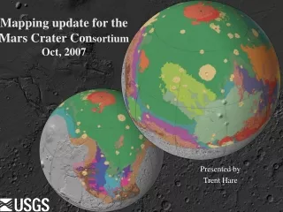
Mapping update for the Mars Crater Con sortium Oct, 2007. Presented by Trent Hare. define: OGC Web Services. WMS: Web Map Service – simple image WFS: Web Feature Service – features WCS: Web Coverage Service – complex data WPS: Web Processing Service – data processing

E N D
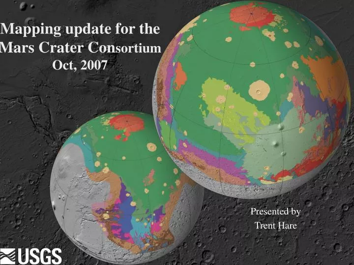
Mapping update for the Mars Crater ConsortiumOct, 2007 Presented by Trent Hare
define: OGC Web Services • WMS: Web Map Service – simple image • WFS: Web Feature Service – features • WCS: Web Coverage Service – complex data • WPS: Web Processing Service – data processing • Catalog Service – metadata spatial searching • For some Planetary WMS servers: • http://webgis.wr.usgs.gov/ogc/Examples.htm Mars Crater Consortium
NASA World Wind (WMS) Download PIGWAD XML: http://forum.worldwindcentral.com/showthread.php?p=50150 Download WMS Query plug-in: http://forum.worldwindcentral.com/showthread.php?t=9333 Download onMars: http://forum.worldwindcentral.com/showthread.php?t=7085 Download MSL points: http://isis.astrogeology.usgs.gov/IsisSupport/viewtopic.php?t=1152 Mars Crater Consortium
NASA WW (showing profiler) Download profiler: http://forum.worldwindcentral.com/showthread.php?t=8334 Mars Crater Consortium
News: HiRISE should have GIS headers soon That means in many GIS applications they will automatically register. Shown is the onMars WMS server showing the THEMIS IR mosaic, MOC NA mosaic and a THEMIS geoJpeg2000 in ArcMap. Mars Crater Consortium
Crater Density Tool - revisited Help overview finally added webgis.wr.usgs.gov/pigwad/down/ mars_crater_consortium.htm Mars Crater Consortium
ISIS2.1 and ISIS3 Virtual Machine Unofficial release of ISIS2 and ISIS3 under the free VMWare Player and VMWare Fusion for Mac. Why? It is a easy, preconfigured virtual machine running SUSE10.2 that works on nearly any platform – just a little slower. If you want to try, contact me: thare@usgs.gov Mars Crater Consortium
What’s on the DVD GIS showing 64 layers; many PDS released This DVD example comes with free viewer for Windows, Linux, Sun. There is a Mac viewer but it doesn’t have all the features Mars Crater Consortium
What’s on the DVD • ArcMap_addins\ • Plug-ins • Tool boxes • Scripts • Conversion programs • Mars definitions • Wbin • DATA! Mars Crater Consortium
What’s on the DVD • Plug-ins (are usually *.dll – Windows dynamic linked libraries) • USGS tools • Hawth’s tools • Ez profiler • Ez geowizards • EZ calculate • DS Mapbook • Find more at Arcscripts (search Arc/Info Desktop) • http://arcscripts.esri.com • How to install: http://acadnt.admcs.wwu.edu/gis/tutorials/ArcScripts.htm#2_VBdll • Good site with many other tutorials: http://acadnt.admcs.wwu.edu/gis/tutorials/. Image registration, vector registration, GPS loading, model schematic examples, etc Mars Crater Consortium
What’s on the DVD • Scripting • EZ calculate scripts ( load scripts \ArcMap9_addins\ec50\ ) • Calculate features fields (area, angle) • Create/Modify features • VB, Java script, Python • Simple label script How to install VB macros, Python: http://acadnt.admcs.wwu.edu/gis/tutorials/ArcScripts.htm THEMIS IR label example Mars Crater Consortium
What’s on the DVD • Conversion programs • PERL scripts to add GIS headers (map projected) • PDS • ISIS v2 • ISIS v3 (make sure to export BSQ file type) • VICAR (not well tested) • FWTools (Windows, Linux, UNIX, Mac?) • Gdalinfo – image information • Gdal_translate – convert to/from raster GIS formats • Openev – simple GIS viewer/editor • Ogr2ogr – convert to/from vector GIS formats • Some support for streaming (opendap, mapserver) • Wbin – be happy with UNIX commands in your command prompt • view readme.txt for installation (includes PERL and gdal programs) Mars Crater Consortium
What’s on the DVD • Mars DATA • Equidistant cylindrical (clat=0,clon=180,ocentric,sphere) • MOLA DEM (463m/p, 88N-88S, 16bit) • hillshade (geoJpeg2000) • Count (number of mola “hits” per pixel) • Roughness (pulse width) – not sure how to interprete • MDIM 2.1 (geoJpeg2000) • MSSS Atlas (geoJpeg2000) • TES thermal inertia, mineral maps • Other (magnetic, gamma ray spectrometer, gravity, etc) Mars Crater Consortium
What’s on the DVD • Mars DATA • Geographic/Geocentric (decimal degrees or lat/lon coords) • Image footprints (approx located, ocentric) • MOC • THEMIS • Viking • HRSC image footprints • CTX • USGS/RAND control points (used for MDIM21, MOLA registered) • Dune Database (ocentric, MOLA registered) • Geologic maps (located on older bases, ographic) • Crater catalogs (located on older bases, ographic) • Nomenclature (MDIM2.0 located, ographic) • Other (lat/lon grids, MC1:5M quads, etc) Mars Crater Consortium
How to use high-level PDS • Using high-level PDS products (map projected) • Try pds2world.pl PERL script • Perl pds2world.pl –e my_image.img • This creates an ERDAS *.raw header and *.rww worldfile. Read into ArcMap and use 16, 32 “image toolbox” to recognized NODATA. • Note that the PDS uses the *.img. So do regular ERDAS files. PDS *.img will not open in ArcMap. • Pds2world.pl then convert using GDAL (watch for mulit ext e.g, *.lev.img) • Perl pds2world.pl –p my_image.img (PCI Geomatic raw header) • Gdal_translate (type by itself to list options) • Gdal_translate –t my_image.aux my_output.tif (defaults to geotiff) • Gdal_translate –co “compress=packbits” my_image.aux my_output.tif • Gddal_translate –of JP2KAK –co “quality=10” my_image.aux out.jp2 • Gdal_translate –of PNG –worldfile my_image.aux my_output.png Mars Crater Consortium
How to use high-level PDS • Download the 16ppd MOLA DEM and label from: • megt90n000cb.img • megt90n000cb.lbl Open a Command Prompt window (start bar - accessories) • Use “cd” to change directory (use only “cd d:” to change drive) • Let’s cheat, install this: CmdHere.exe, install, now right click on your folder and hit “Command ... Here” • Type: • Pds2world -e file.lbl (notice we are running on the label) OR • Pds2world -p file.lbl • Gdal_translate –of GTiff file.aux file.tif Or Gdal_translate –of ENVI file.aux file http://pds-geosciences.wustl.edu/missions/mgs/megdr.html Mars Crater Consortium
How to use high-level PDS • Served data (WMS) Add a new dataframe, Now add a “GIS Servers”, Add WMS, type in http://onMars.jpl.nasa.gov/wms.cgi? hit OK, now click on the new link “JPL Planetary Map Service on …” “JPL Planetary Map Service”, Add For more Planetary WMS servers: http://webgis.wr.usgs.gov/ogc/Examples.htm WMS Mars Crater Consortium
How to use high-level PDS • Served data (ArcIMS) Now add a “GIS Servers”, Add ArcIMS, type in http://webgis.wr.usgs.gov , hit OK, now click on the new link “webgis.wr.usgs.gov”, add “Mars_crater_image”, Add ArcIMS Mars Crater Consortium
WMS Connect (client builds local layers) Novel approach to use WMS servers Download: http://arcscripts.esri.com/details.asp?dbid=14997 Mars Crater Consortium
Planetary Projections in ArcMap http://isis.astrogeology.usgs.gov/IsisSupport/viewtopic.php?t=389 • Setting planetary bodies in ArcMap • Example for the ArcMap dataframe or for MOLA and most raster datasets on the data DVD. To define a new projection “not body i.e. Mars” click on New, “Projected” Mars Crater Consortium
How to use low-level PDS • Low-level PDS image is basically “raw” – no map projection – you should not bring it into a GIS • Okay how do you map project raw PDS image • ISIS - Integrated Software for Imagers and Spectrometers • Suse Linux, Solaris UNIX, Mac OSX http://isis.astrogeology.usgs.gov/ • VICAR - Video Image Communication And Retrieval http://www-mipl.jpl.nasa.gov/ also maintained at DLR Other software (Malin Space Science Systems?) For more: http://isis.astrogeology.usgs.gov/IsisSupport/viewtopic.php?t=423 Mars Crater Consortium
How to use low-level PDS To find tutorials for ISIS 2.1, go to: http://isis.astrogeology.usgs.gov/Isis2/isis-bin//documentation.cgi I would recommend that you first read the "Overview of ISIS Architecture." Then, the "Production of Digital Image Models with ISIS" contains a general description of the overall processing functions. The document "Mars Odyssey THEMIS Geometry Processing with ISIS" describes specifics of THEMIS processing. For additional information on how to create mosaics, start up TAE, tutor the "mosaic" program and type "help *" (without the quotes). This will give you an overall description of the "mosaic" program. Let us know if you have any problems with this. By Jim T. Mars Crater Consortium
How to use low-level PDS To find tutorials for ISIS2.1 and ISIS 3, go to: http://isis.astrogeology.usgs.gov/ Mars Crater Consortium