1 / 0

Alberta Mapping

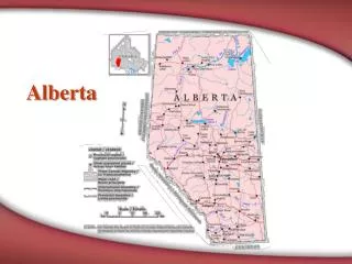
Alberta Mapping. Question 1 - 10. Map has major highways, roads, railway tracks, airports and places of interest. Answer 1 – 10 . Road. Question 1 - 20. Weather and precipitation conditions prevalant in a region. Answer 1 – 20 . Climate. Question 1 - 30.

sen
Download Presentation

Alberta Mapping

An Image/Link below is provided (as is) to download presentation Download Policy: Content on the Website is provided to you AS IS for your information and personal use and may not be sold / licensed / shared on other websites without getting consent from its author. Content is provided to you AS IS for your information and personal use only. Download presentation by click this link. While downloading, if for some reason you are not able to download a presentation, the publisher may have deleted the file from their server. During download, if you can't get a presentation, the file might be deleted by the publisher.

E N D

Presentation Transcript


  1. Alberta Mapping
  2. Question 1 - 10 Map has major highways, roads, railway tracks, airports and places of interest.
  3. Answer 1 – 10 Road
  4. Question 1 - 20 Weather and precipitation conditions prevalant in a region
  5. Answer 1 – 20 Climate
  6. Question 1 - 30 Provincial and national boundaries
  7. Answer 1 – 30 Political
  8. Question 1 - 40 Features of an area, such as mountains and rivers
  9. Answer 1 – 40 Physical
  10. Question 1 - 50 Use of contour lines to highlight the shape and elevation of an area
  11. Answer 1 – 50 Topographic
  12. Question 2 - 10
  13. Answer 2 – 10 Compass rose
  14. Question 2 - 20 Gives the name or purpose of the map
  15. Answer 2 – 20 Title
  16. Question 2 - 30
  17. Answer 2 – 30 Legend
  18. Question 2 - 40
  19. Answer 2 – 40 Symbols
  20. Question 2 - 50
  21. Answer 2 – 50 Scale
  22. Question 3 - 10 Province in yellow
  23. Answer 3 – 10 Alberta
  24. Question 3 - 20 Province in yellow
  25. Answer 3 – 20 British Columbia
  26. Question 3 - 30 Province in yellow
  27. Answer 3 – 30 Saskatchewan
  28. Question 3 - 40 Territory in yellow
  29. Answer 3 – 40 Yukon
  30. Question 3 - 50 Province in yellow
  31. Answer 3 – 50 Ontario
  32. Question 4 - 10 The distance between Medicine Hat and Lethbridge is about 1.5 centimetres and each centimetre equals 100 kilometres, the number of kilometres between these 2 cities
  33. Answer 4 – 10 About 150 kilometres
  34. Question 4 - 20 The distance between Lethbridge and Calgary is about 2 centimetres. Each centimetre equals 100 kilometres. The number of kilometres between these 2 cities
  35. Answer 4 – 20 About 200 kilometres
  36. Question 4 - 30 The distance between Calgary and Red Deer is 2 centimetres. Each centimetre equals 75 kilometres. The number of kilometres between these 2 cities is
  37. Answer 4 – 30 About 150 kilometres
  38. Question 4 - 40 The distance between Drumheller and Calgary is about 1.5 centimetres. Each centimetre is 75 kilometres. The number of kilometres between these 2 cities is
  39. Answer 4 – 40 About 110 to 115 kilometres
  40. Question 4 - 50 The distance from Edmonton to Ft. McMurray is about 8.5 centimetres. Each centimetre is 50 kilometres. The number of kilometres between these 2 cities are
  41. Answer 4 – 50 About 425 kilometres
  42. Question 5 - 10 The direction to travel from Taber to Brooks
  43. Answer 5 – 10 N or North
  44. Question 5 - 20 The direction you go travelling from Medicine Hat to Pincher Creek
  45. Answer 5 – 20 SW or South West
  46. Question 5 - 30 In what direction do you go if you travel from Stettler to Hanna
  47. Answer 5 – 30 SE or South East
  48. Question 5 - 40 In what direction do you go if you travel from Alberta to the Yukon
  49. Answer 5 – 40 NW or North West
  50. Question 5 - 50 In what direction would you go if you travelled from Edmonton to Ottawa
  51. Answer 5 – 50 SE or South East
More Related