Download
1 / 32
320 likes | 349 Views
Be the Block: The Geologic Block Diagram as an Inquiry Tool. Eric J. Pyle James Madison University pyleej@jmu.edu With support from Lynn S. Fichter, JMU. Nicolas Steno Principles.

E N D
Be the Block:The Geologic Block Diagram as an Inquiry Tool Eric J. Pyle James Madison University pyleej@jmu.edu With support from Lynn S. Fichter, JMU
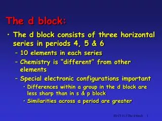
Nicolas Steno Principles Steno established several principles about the origin and interpretation of rocks. These are still the foundation of all geological studies. They are stated below in their modern wording. Steno expressed these ideas in what would be for us more arcane and florid language. 1. Principle of Superposition – rock layers on the bottom are deposited first and are the oldest; those on top are deposited last and are the youngest. 2. Principle of Original Horizontality – rocks are deposited horizontally. Rocks that are no longer horizontal have been displaced from their original positions by later events. 3. Principle of Lateral Continuity – identical rocks that are now separated at one time must have been connected and continuous.
A trip back 200 years… • The rocks of England… • The fossils in those rocks… • How do these relate to the geology we see and seek?
18th Century Crises • Energy Crisis - fueling the factories • Deforestation removed wood as fuel • Large amounts of coal were available • Transportation Crisis - fuel to where it was needed • Coal was not always where the factories were • Roads were small and terrible • Food Crisis - fueling the factory workers • Small freehold farms were not very efficient • Much of the population had moved to urban areas
18th Century Crises:Solutions • Energy Crisis - promote the expansion of coal mining • Transportation Crisis - promote the development of canals • Food Crisis - Acts of Enclosure and expansion of water meadows • Each solution required geological and geotechnical expertise
“In eighteenth century Britain it was a mark of refinement and impeccable good taste to own and display a collection of fossils. . . . Not only were the objects themselves rare and beautiful, well worthy of display in specially constructed glass cabinets; the simple possession of them hinted at a thirst for knowledge, an awareness of natural philosophy, a sympathetic understanding of the mysterious processes of the earth.”
Types of Mines Drift Mine - cut into the side of a hill into horizontal strata. Shaft Mine - vertical tunnel dug to deep horizontal or angled strata. Slope Mine - inclined tunnel dug to relatively shallow layers. http://66.113.204.26/mining/coal/undergnd_mining.htm
Money to be made… Anybody that owned land wanted to know if there was coal beneath the surface. Overhead costs, including worker safety and working conditions, were to be kept at an absolute minimum.
The Mearns Coal Pit in Somerset, England For the Mearns Pit at High Littleton has a standing in the history of geology that is comparable to the one that Gregor Mendel's Moravian pea garden has in the science of genetics, the Galapagos Islands in evolutionary theory, and the University of Chicago football stadium in the story of nuclear fission. View into Somerset from Chedington Yet this Somerset coal mine also goes unremembered today, just like Rugborne Farm. There is no blue plaque, no brass plate, nothing. Just a small lump in a field that marks a scarified hillock of grassed-over mining waste, a mound that Somerset people still call a batch. And a scrap of paper in the University Museum in Oxford, recording what William Smith saw, felt, thought, and concluded when first he ventured into the dripping darkness of that dreary little West Country colliery. http://www.britainexpress.com/countryside/dorset/chedington-p2.htm
http://www.durhamrecordsonline.com/literature/coalfields-british.gifhttp://www.durhamrecordsonline.com/literature/coalfields-british.gif
Getting fuel and food to where it was needed Another money-making scheme was to build canals to take coal and food to industrial centers. There was very little government funding for these operations. Costs were underwritten by wealthy investors and individual stock subscriptions.
Getting fuel and food to where it was needed Canal building required extensive surveying work along with excavation of watercourses and tunnels, as well as building aqueducts.
Somerset Coal Canal Map shows the two near-parallel branches of the Somerset canal that later helped Smith in confirming his theories about how rocks were distributed in the Earth. The entrance to the former Somerset Coal Canal at the Dundas Aqueduct. http://www.redadmiral.freeserve.co.uk/canalling.htm
Scenes of the Somerset Coal Canal where William Smith Worked Out His Stratigraphy “I observed a variation of the strata on the same line of level, and found that the Lias rock which about three miles back was a full 300 feet above this line was now 30 feet below it, and became the bed of a river, and did not appear any more at the surface," This induced me to note the inclination of the same rock, which I knew was to be found at the head of two other valleys lying each about a mile distant from, and in a parallel direction to the one Just described and accordingly found it to dip to the south-east, and sink under the rivers in a similar manner.” Dundus Aquaduct “ From this I began to consider that other strata might also have the same general inclination as well as this. By tracing them through the country some miles I found the inclination of every bed to be nearly the same as the Lias; and not-withstanding the partial and local dips of many quarries which varied from this rule, I was thoroughly satisfied by these observations that everything had a general tendency to the south-east and that there could be none of these beds to the north-west.”
http://www.durhamrecordsonline.com/literature/coalfields-british.gifhttp://www.durhamrecordsonline.com/literature/coalfields-british.gif
Acts of Enclosure Land that was previously held in “common” for animal grazing, or land occupied by small tenant farm operations, was turned over to the control of large landowners for their use in agricultural production. Agricultural production increased dramatically, but tenant farmers were turned out of their farms and forced to work in mines and factories.
Acts of Enclosure Land that was previously held in “common” for animal grazing, or land occupied by small tenant farm operations, was turned over to the control of large landowners for their use in agricultural production. Agricultural production increased dramatically, but tenant farmers were turned out of their farms and forced to work in mines and factories.
William Smith’s Geologic Map of Great Britain http://www.geolsoc.org.uk/template.cfm?name=SmithMap http://www.ethicalatheist.com/img/william_smith_map_big.jpg
The Geologic Map as Inquiry • Simple Explanation of Smith’s work: • Observed rocks and fossils • Predicted locations • Verified/tested predictions • Inferred extent • Complex Explanation: • Applied Inquiry techniques
Descriptions of Materials, Space, & Time Interpolations & Extrapolations Interactions of Materials, Space, & Time Observations Models Historical Narratives Interpretations Defining Questions Choosing Methods Arriving at Solutions
Engagement – students are asked to reflect on their prior knowledge of Steno’s Principles as well as the social, scientific, and technological climate of the late 18th and early 19th Century England. A few slides about Steno and the industrial age crises in England are presented.
Exploration – placed around the room are a series of stratigraphic columns and surface expressions, with lithologies represented by different colored squares of construction paper. Some of these have overprinted on them sedimentary structures or fossils. The columns are placed in such a manner as to represent the corners and the middle of the sides of a block diagram, rendered flat as a cut-out and foldable object. Students then plot the lithologies in order on the block, connecting similar lithologies to reveal not just the cross-sections but also the surface expression. The block is then cut-out and folded into the standard block diagram.
Explanation – the structures created by the students are evaluated compared to a master block diagram and corrections made. The remainder of the slide presentation is shared, relating the development of the geologic map by William Smith and its basis in his observations of coal mine shafts, canal excavations, and related fossils.
Elaboration – Students are given additional block diagrams, containing only partial information, and asked to infer what would exist in the blank areas. • Evaluation – students are given a complete block with more complex structures and asked to design, through inference, a set of columns and surface expressions that would represent the diagram and allow another student to recreate the structures.