1 / 23

CRWR-PrePro HMS Schematic and Basin File

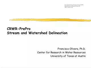
Texas Department of Transportation (TxDOT) Water Resources Modeling Using GIS 2000 - Austin, Texas. CRWR-PrePro HMS Schematic and Basin File. Francisco Olivera, Ph.D. Center for Research in Water Resources University of Texas at Austin. Hydrologic Sub-System. Hydrologic Sub-System.

Download Presentation

CRWR-PrePro HMS Schematic and Basin File

An Image/Link below is provided (as is) to download presentation Download Policy: Content on the Website is provided to you AS IS for your information and personal use and may not be sold / licensed / shared on other websites without getting consent from its author. Content is provided to you AS IS for your information and personal use only. Download presentation by click this link. While downloading, if for some reason you are not able to download a presentation, the publisher may have deleted the file from their server. During download, if you can't get a presentation, the file might be deleted by the publisher.

E N D

Presentation Transcript


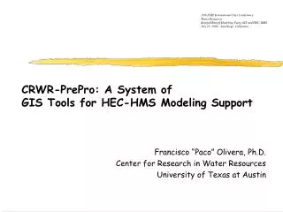
  1. Texas Department of Transportation (TxDOT) Water Resources Modeling Using GIS 2000 - Austin, Texas CRWR-PreProHMS Schematic and Basin File Francisco Olivera, Ph.D. Center for Research in Water Resources University of Texas at Austin

  2. Hydrologic Sub-System

  3. Hydrologic Sub-System Watersheds Polygons Streams andsource streams Shape Files of Watersheds and Streams

  4. Hydrologic Sub-System • Manual selection of sub-basin polygons

  5. Hydrologic Sub-System • Manual selection of most downstream sub-basin polygon.

  6. Model Schematic and HEC-HMS Basin File

  7. Hydrologic Model

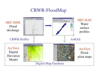
  8. Model Schematic • HEC-HMS schematic in ArcView.

  9. HEC-HMS Basin File Connection to HEC-HMS Model Schematic Parameter Transfer

  10. HEC-HMS Basin File (1)

  11. HEC-HMS Basin File (2)

  12. HEC-HMS Basin File (3)

  13. HEC-HMS

  14. HEC-HMS Basin File • Model schematic in HMS.

  15. Basin FileSystem Schematic

  16. Basin FileWatershed Parameters

  17. Basin FileWatershed Parameters

  18. Basin FileStream Parameters

  19. Precipitation File

  20. Control File

  21. Hydrograph Time Table

  22. Hydrograph Summary

  23. Hydrograph Plot

More Related