Download
1 / 30
300 likes | 302 Views
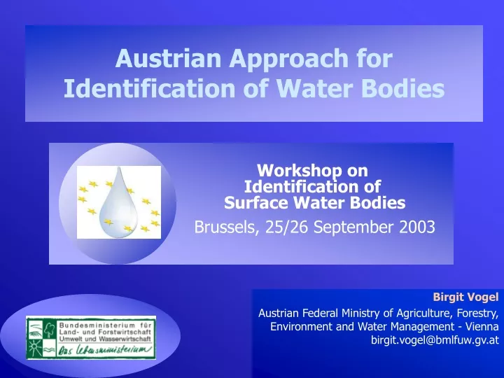
Austrian Approach for Identification of Water Bodies. Workshop on Identification of Surface Water Bodies Brussels, 25/26 September 2003. Birgit Vogel Austrian Federal Ministry of Agriculture, Forestry, Environment and Water Management - Vienna birgit.vogel@bmlfuw.gv.at. CONTENT = PROCEDURE.

E N D
Austrian Approach for Identification of Water Bodies Workshop on Identification of Surface Water Bodies Brussels, 25/26 September 2003 Birgit Vogel Austrian Federal Ministry of Agriculture, Forestry, Environment and Water Management - Vienna birgit.vogel@bmlfuw.gv.at
CONTENT = PROCEDURE • Typology process • System B (macrozoobenthos, phytobenthos, fish) • Identification of Water Bodies • Following EC Guidance • Step 1: Basic delineation • Based on typology using saprobic basic conditions • Step 2: Detailed status delineation • First approaches
surface water CATEGORIESlake, river etc. BASICDELINEATION surface water TYPES Sub-Divisionphysical characteristics REFINEMENT DETAILED DELINEATION NOTHeavily modified Heavily modified Sub-DivisionSTATUS classespressures, impacts
BASIC DELINEATION BASIC DELINEATIONSTEP 1 TYPOLOGY
River Typology – System B • step 1 - a priori approach „abiotic“ typology • step 2 - a posteriori approach biological check (all biological elements) • step 3 - final definition of river typesaccording to the results of step 2 • IDENTIFICATION OF WATER BODIES
Carpa- thians Central Mountains Alps Hungarian Plains Balcan Ecoregions of Austria Moog, Nesemann & Ofenböck (2001); Österr. Wasser- & Abfallwirtschaft Jg. 53, Heft 7/8 a priori approach: expert consensus, geo-ecological criteria
Descriptors • ecoregionAlps, Central Midlands, Hungarian Plains, Dinaric West-Balcan • altitude5 classes: <200, 200-500, 500-800, 800-1500, >1500 m • catchment area6 classes: 10-100, 100-500, 500-1.000, 1.000-2.500, 2.500-10.000, >10.000 • geology4 classes: calcareous, crystaline, Flysch & Helveticum, tertiar and quartar Sediments • stream order (1-9) • flow regime • 42 ecological river landscape-types
Top down result • 17 Aquatic landscape Units + 9 Large Rivers • parameters of system A • ecoregion • catchment area • altitude • geology • additional parameters • flow regime • stream order • river landscape types
Combining top-down and bottom-up approach A posteriori - Approach Distribution of Benthic Invertebrate Species Multivariate Benthic Community Analysis A priori - Approach Ecoregions River-Landscape-Types Aquatic Landscape Units Bioregions
Austrian River typology - Biological check Macroinvertebrates - Phytobenthos -Fish • Abiotic typology proved to be also valid for the aquatic community • Only minor changes were needed (splitting, combining) • highest differentiation is needed for macrozoobenthos
Typology Result Ecoregions nach ILLIES 26 abiotic basic types 17 type regions and 9 large rivers biological check ---> 15 Bioregions + Donau, Rhein, large alpine rivers, March/Thaya
BASIC DELINEATION BASIC DELINEATION:STEP 2TOWARDS WATER BODIES
TOWARDS WATER BODIES • Biological check of abiotic types finished. Adaptations performed. • Therefore: Typology in Austria finalised (each type proven by abiotic factors and biology) • Sound basis for water body delineation • Zoom into longitudinal detail of typology • Digital crossover of • Basic saprobic conditions • Altitude classes • Catchment size classes FOR EACH BIOREGION
Result Basic Delineation Example: Lower Austria Differentiation using basicsaprobic conditions
TOWARDS WATER BODIES • Result: Integrated parameters containing manifold information • Abiotic parameters (slope, sediment structure) • Biological aspects (basic trophic level, organic pollution and corresponding oxygen demand).
TOWARDS WATER BODIES PRODUCT = BASIC WATER BODIES • Map which illustrates changes of basic types over longitudinal extend • Maximum length of water bodies illustrated - defined by natural conditions • Basic number of sections (no further changes)
TOWARDS WATER BODIES • Types clearly differentiated from each other • therefore qualitive objective clear for each type • Result confirms that the criteria correctly reflect the bioregions • Sound basis for detailed delineation (status/pressures/impacts) and • later aggregation process • similar basic characteristics • plus similar pressures/impacts
DETAILED DELINEATION DETAILED DELINEATION:WATER BODIES BASED ON STATUS
DEFINITION-PROCESS DETAILED DELINEATION • Objective: Status assessments are used for final identification of water bodies • Main aspect: Identification of significant pressuresand impacts on ecological status
DETAILED DELINEATION • Based on Basic Delineation • Step-wise definition process • Increasing information on pressures and impacts will refine the identification of water bodies • Present data are used • Continuous up-date of information and refinement of delineation until first River Basin Management Plan • Preliminary Identification of water bodies
INTERACTIONS MONITORINGsampling stations Ecological Status IdentificationWATER BODIES
BASIC CONSIDERATIONS Detailed status assessment Monitoring network: many sampling stations Aggregation of similar water bodies leads to reduction of sampling stations Many small water bodies • Un-detailed pressure/impact identification (pressures might not be identified, good status) • Low number of sampling stations? • Assessment of impacts • Low/merged number of water bodies brings not necessarily reduction of sampling stations along • Degradation not identified? Few large water bodies
DETAILED DELINEATION pressures High status Bad status Good status water body 1 water body 3 water body 2 • Manageable approach: Water body must clearly be defined by a status class • What is the most dominant factor (status) within a water body?
Szenario pressure pressure WB1 pressure Good status pressure Good status pressure Not dominant pressure pressure pressure pressures (dominant)/ good status (z.B. <certain % of length) Good status / pressures WB1 WB2 Degradation??
Szenario pressure Good status pressure dominant Good status (dominant) / pressure (<certain%) WB1
SUMMARY • Manageable approach and efficient • Question for „reasonable“ number of water bodies • Most dominant factors within surface water system • Aggregation of WBs – Reduction of sampling stations!! • Similarities based on types of basic delineation and same pressures • Number of basic delineation = unchanged • Number of detailed delineation = flexible; changes • stepwise refinement
CONCLUSION • Basic delineation finished end of 2003 for whole Austria • Detailed delineation performed during 2004 as a first step • Refined with growing monitoring/status information Workshop on Identification of Water Bodies using status criteria next week (2 catchments)