Download
1 / 41
410 likes | 511 Views
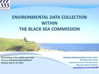
Environmental Data collection within The Black Sea Commission status, challenges, solutions. Black Sea OUTLOOK Conference Odessa, Ukraine November 1-4, 2011. Volodymyr Myroshnychenko, Project Expert Permanent Secretariat Commission on the Protection of the Black Sea Against Pollution

E N D
Environmental Data collection within The Black Sea Commission status, challenges, solutions Black Sea OUTLOOK Conference Odessa, Ukraine November 1-4, 2011 Volodymyr Myroshnychenko, Project Expert Permanent Secretariat Commission on the Protection of the Black Sea Against Pollution www.blacksea-commission.org
Content Legal framework Institutional framework Monitoring Reporting Challenges Solutions and targets Recommendations
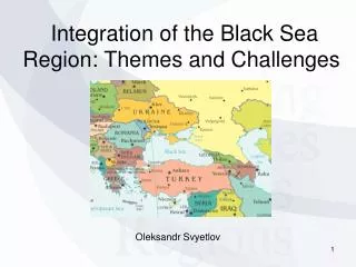
Bucharest Convention Bulgaria Georgia Romania Russian Federation Turkey Ukraine In April 1992 six Black Sea countries (Bulgaria, Georgia, Romania, Russian Federation, Turkey and Ukraine) signed and shortly thereafter ratified the Convention on the Protection of the Black Sea Against Pollution (Bucharest Convention) with its (three) integrated protocols.
Obligations of Contracting Parties General obligation: to prevent, reduce and control the pollution in the Black Sea in order to protect and preserve the marine environment and to provide legal framework for co-operation and concerted actions to fulfill this obligation. To protect the biodiversity and the marine living resources; To provide framework for scientific and technical co-operation and monitoring activities.
The Strategic Action Plan for the Rehabilitation and Protection of the Black Sea Signed on October 31, 1996 (commemorated as the Black Sea Day) Adopted by all Black Sea countries Updated in 2009 Ecosystem approach
SAP-1996: Assessment and monitoring of pollutants A Black Sea Monitoring System, based upon biological effects measurements and measurements of key contaminants, will be established in compliance with the Bucharest Convention. A “State of Pollution of the Black Sea” report will be prepared and published every five years, beginning 2006. It will be based on the data collected through the coordinated pollution monitoring and assessment programmes. Data regarding actual and assessed contaminant discharge measurements for point sources, rivers, and, where possible, diffuse sources, shall be compiled and freely exchanged beginning 2002 on an annual basis. It is advised that the Advisory Group Control of Pollution from Land Based Sources make these compilations in future. SAP-2009: Develop/improve the existing monitoring system to provide comparable data sets for pollutant loads (from direct discharges and river inputs) and for other parameters.
Black Sea Commission Intergovernmental body for promoting the implementation of the provisions of Bucharest Convention, its protocols and Strategic Action Plan The regional focal point for any aspects of the coastal and marine environment of the Black Sea Made up of 6 Commissioners (one for each coastal country) and a chairman` Chairmanship for one year and rotates between coastal countries
Black Sea Integrated Monitoring and Assessment Programme (BSIMAP) Implemented since 2001. Build on established national monitoring programmes Operational Last version of BSIMAP was adopted in 2006.
BSIMAP monitoring requirements (1) Sampling media: sediments Parameters: organic contaminants, heavy metals Frequency: 1 time per year Sampling media: biota Parameters: organic contaminants, heavy metals Frequency: 1 time per year Sampling media: water Parameters: nutrients, oxygen, physical & chemical parameters, petroleum hydrocarbons, suspended solids Frequency: 4 times per year
BSIMAP monitoring requirements (2) Problem: response of biodiversity on pollution and destruction of habitats
Monitoring of pressures:BSIMAP LBS component Complementary to the Pollution Monitoring, the BSIMAP LBS component includes monitoring of pollution loads from LBS, including: • River discharges • Industrial discharges • Municipal (WWTP) discharges The emphasis is given to the Pollution Hot Spots.
Parameters BOD5 Total Nitrogen (TN) Total Phosphorus (TP) Total Suspended Solids (TSS) Flow (Q) Heavy metals Total Petroleum Hydrocarbons
Reporting Who: National Focal Points / Members of Advisory Groups What: Different parameters of the Black Sea ecosystem state, pressures, impacts, measures, changes in legislation/policy, programs, investments, etc. • PMA (pollution in water, sediments, biota) • LBS (pollution loads) • CBD (phyto- and zoo-plankton, conservation status…) • ESAS (ship traffic, oil spilled during accidents, fines…) • ICZM (state of the coast and management) • FOMLR (stocks, landings, fishing fleet, measures…) When: annually (in Autumn), data for previous year How: in standardized formats
Data flow National ministries and agencies BSC focal points Standardized format Implementing agencies and laboratories BSC PS BSIS (Black Sea Information System) Users: scientists, decision-makers, public
Usage of monitoring data & information Transboundary diagnostic analysis State of Environment reporting (SoE) Impact assessments of major pollutant sources Monitoring data & information BSIS Assesment of SAP implementation and SAP revision Trend analysis GIS, mapping
Analysis of official data reporting Source: ‘Diagnostic Report’ to guide improvements to the regular reporting process on the state of the Black Sea environment”
Suitability of data for calculating indicators • Insufficient time-series data in BSIS for trend analysis Source: ‘Diagnostic Report’ to guide improvements to the regular reporting process on the state of the Black Sea environment”
Reasons for data gaps (1) Mandatory parameters of BSIMAP are often not covered Recommended frequency of observations is not always observed Gaps in countries’ monitoring programs: the monitoring is mainly not integrated Different approach in assessment of environmental status Pure coordination between responsible authorities Insufficient financial support of monitoring
Reasons for data gaps (2) Gaps in data availability (i.e. data have not been collected due to some reasons) Gaps in data reporting (i.e. data are available in the country but due to lack of inter-agency coordination did not became available to AG members for including in reports) Besides, the Focal Points have no dedicated time in their ToRs officially to work for the BSC
Improvement of monitoring • Strengthening of existing program: mandatory parameters covered, monitoring frequencies observed • Further harmonization of monitoring program: • Meet requirement of new SAP and LBS protocol, • Coherence with MSFD and WFD • Common understanding of Good Environmental Status (GES) and indicators • Further development of guidelines, inter-comparison exercises, etc. • Proper geographical coverage, networks development • Sustain stations and transects with long-terms observations • Sustainable quality control and assurance
Utilizing capacities of all marine organizations in the Region Marine Organizations in the Black Sea region* BSIMAP Monitoring Institutions *Black Sea Scene website The network of reporting institutions in the Black Sea should be further developed
Utilizing capacities of data exchange networks – BlackSeaScene All Nutrients SeaDataNet standards of interoperability 34 data providers ~160,000 measurements > 40 data categories Nutrients for period 2006-2010 (2725)
Utilizing capacities of data exchange networks – EMODNet EMODNet – European Marine Observation and Data Network Preparatory Actions: • Hydrography1 • Geology • Chemistry1,2 • Biology2 • Habitats • New portal: • Physical Parameters1,2 • ___________________________________________________ 1Based on SeaDataNet standards of interoperability 2Includes Black Sea
Recommendations for improving data management within BSC The regional data base (BSIS) should become fully operational on-line, GIS-enabled, interoperable and linked with other marine/environmental data and information networks (EMODNET, BlackSeaScene etc) The work carried out within the BSIMAP should become transparent through renewed BSIS BSIS should be proposed as the permanent domain for any data in the region produced by projects Data policy should be developed and sustained by the BSC in relation to major data-holders in the Black Sea region
Steps undertaken The regional Mnemiopsis Database hosted by BSC PS is part of the BlackSeaScene infrastructure since 2010 The interoperable GIS enabled Regional Pollution Data Base is being developed in framework of the Baltic2Black* project by the RAC PMA The MONINFO system based on OGC interoperability standards (WMS, WFS…) for sharing spatial data * Baltic2Black is a joint BSC+HELCOM project financed by DG Environment
Further data need For wider assessments (sensu MSFD, Annex III) BSIS has to be extended with data on: • physical oceanography; • sedimentology; • marine geology; • erosion, etc.
Further data needs (2) Due to large catchment area as compared to its own area, the Black Sea is very vulnerable to pressure from land based human activities and its health is equally dependent from the coastal and non-coastal states of its basin. Due to the same reason Black Sea is vulnerable to climate change. Black Sea catchment Identifications of drivers of pressures on the Black Sea environment from LBSA requires knowledge on processes in watershed this require cooperation and data exchange with relevant programs and projects: ICPDR, SEIS, EnviroGRIDS.
Accessibility to all available data and information is a priority issue
Thank you for your attention WWW.BLACKSEA-COMMISSION.ORG