Download
1 / 103
1.03k likes | 1.19k Views
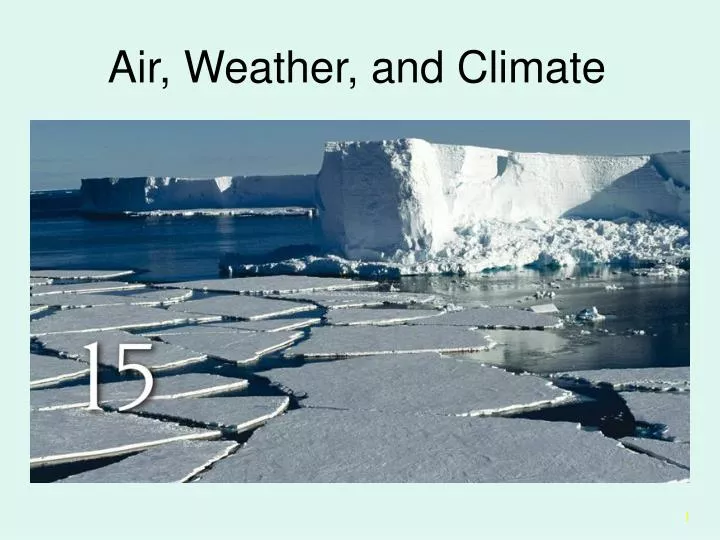
Air, Weather, and Climate. Log In!. Go to www.teachersdomain.org Create a user profile Login with your username and password Next, click on My Folders Once My Folders has loaded, use the drop down menu to go to Chp 15 Then click on Open If asked for a user number, type in 1139

E N D
Log In! • Go to www.teachersdomain.org • Create a user profile • Login with your username and password • Next, click on My Folders • Once My Folders has loaded, use the drop down menu to go to Chp 15 • Then click on Open • If asked for a user number, type in 1139 • PowerPoint slides using Teacher Domain videos and activities will have a (TD) next to the title of the slide, which corresponds to the title of the TD multimedia you will be using.
Teachers Domain When you get to the Chp 15 page in Teachers Domain, click on the TITLE, not the View button. This will take you to the webpage with the accompanying textual information questions to answer and the movie/jpeg/gif or whatever the VIEW button lets you…view! Questions can be answered informally, but remember that you want to get as much info as possible.
Outline • The Atmosphere and Climate • Greenhouse Effect • Convection Currents • Weather • Coriolis Effect • Cyclonic Storms • Climate • El Nino • Climate Change
Earth As a System (TD 27) • The Earth is a complex, living organism not too disimilar to you and I. • The Gaia theory by James Lovelock is an example of this concept. • The theory asserts that living organisms and their inorganic surroundings have evolved together as a single living system that greatly affects the chemistry and conditions of Earth’s surface. • Some scientists believe that this “Gaian system” self-regulates global temperature, atmospheric content, ocean salinity, and other factors in an “automatic” manner. • Earth's living system appears to keep conditions on our planet just right for life to persist!
Two Different Atmospheres • How does early Earth’s atmosphere differ from todays?
Global History • What techniques and materials do scientists use to confirm global history dates for geochemical phenomenon?
The Past • What four reasons have been given for past climactic changes?
Chemical Composition of the Atmosphere • 77% nitrogen, 21% oxygen, with traces of argon, carbon dioxide (340 ppm) and water vapor • Tiny amount of carbon dioxide important to the maintenance of the Earth's surface temperature via the greenhouse effect. • The greenhouse effect raises the average surface temperature about 35 degrees C above what it would otherwise be (from a frigid -21 C to a comfortable +14 C); without it the oceans would freeze and life as we know it would be impossible.
THE ATMOSPHERE AND CLIMATE • Weather - A description of physical conditions of the atmosphere. • Climate - A description of the long-term weather pattern in a particular area. • Weather and climate are primary determinants of biomes and ecosystem distribution.
Vertical Structure of the Atmosphere (TD 28) Remember to click on the different buttons AND the terms for more info!
The Atmosphere and Climate Describe the 8 parts of the atmosphere and the function of each part.
A boundary layer! • The tropopause is a region between the troposphere and the stratosphere • It is a transition boundary that limits mixing between the troposphere and the upper zones • The boundary between the troposphere and the stratosphere varying in altitude from approximately 8 kilometers (5 miles) at the poles to approximately 18 kilometers (11 miles) at the equator. • This permits the troposphere to remain relatively undisturbed.
Troubled Tropopause? • http://physicsweb.org/articles/news/7/7/18/1 • Santer and colleagues say • increased amounts of greenhouse gases warm the troposphere • reduced levels of ozone cool the stratosphere. • Both these effects increase the height of the tropopause. • The results provide independent support for troposphere warming and overturn controversial claims based on satellite measurements that showed little or no tropospheric warming over the last 20 years. • The team found that its results agreed well with other ‘fingerprint’ studies. These include • increases in Earth and sea -surface temperatures, • sea-level pressure patterns and • the melting of the polar ice caps.
Let’s hear it for the Atmosphere! • The troposphere, stratosphere, mesosphere, and thermosphere act together as a giant safety blanket. • keep the temperature on the earth's surface from dipping to extreme icy cold that would freeze everything solid, or from soaring to blazing heat that would burn up all life. • In the study of air pollution control the layers of the air that are most important are the troposphere and the stratosphere.
Convection and Atmospheric Pressure • Lighter air rises and is replaced by cooler, heavier air, resulting in vertical convection currents. • Transport energy and redistribute heat. • Much of solar energy absorbed by the earth is used to evaporate water. • Energy stored in water vapor as latent heat. • If condensation nuclei are present, or if temperatures are low enough, condensation will lead to precipitation.
Convection • Releasing latent heat causes air to rise, cool, and lose more water vapor. • Rising, expanding air creates an area of relatively high pressure at the top of the convection column. • Air flows out of high-pressure zone towards areas of low-pressure, where cool, dry air is subsiding.
Coriolis Effect • As air warms at the equator, rises, and moves northward, it sinks and rises in several intermediate bands, forming circulation cells. • Surface flows do not move straight North and South, but are deflected due to Coriolis Effect. • Go to http://www.eoascientific.com/campus/earth/multimedia/coriolis/view_interactive and play with the cannon to see how the Coriolis effect works.
Coriolis Effect • Major zones of subsidence occur at about 30o north and south latitude. • Where dry, subsiding air falls on continents, it creates broad, subtropical desert regions. • Winds directly under regions of subsiding air are often light and variable.
To understand the convection cells that distribute heat over the whole earth, let's consider a simplified, smooth earth with no land/sea interactions and a slow rotation. Under these conditions, the equator is warmed by the sun more than the poles. The warm, light air at the equator rises and spreads northward and southward, and the cool dense air at the poles sinks and spreads toward the equator. As a result, two convection cells are formed.
The slow rotation of the earth toward the east causes the air to be deflected toward the right in the northern hemisphere and toward the left in the southern hemisphere. This deflection of the wind by the earth's rotation is known as the Coriolis effect.
Convection Currents • Subsiding air is compressed as it approaches the earth’s surface where it piles up and creates an area of high pressure at the surface. • Air flows out of this region back towards low pressure, closing the cycle.
Convective Cloud Systems (TD 37) • This Quicktime movie will help you learn more about how clouds are formed! • Don’t forget to read the text and answer the questions!
Water Vapor Circulation on Earth (TD 20) • View the simulation and keep the “cannon” in mind as you watch. • Don’t forget to read the information. • Be able to answer the questions.
Wind “Belts” • Hadley Cells, Ferrell Cells and Polar Cells are distinctive forms of convection that form at different latitudes.
Hadley Cells This is the cell that is closest to the equator. It consists of winds converging and rising at the equator and then diverging north and south of the equator as it reaches the upper troposphere. The winds then sink at 30 degrees latitude as they converge with winds in the Ferrell Cell. They hit the surface and diverge back to the equator to complete the cell. This provides the equator-ward wind component of the Trade Winds.
Polar Cells • This cell has winds rising up at 60 degrees latitude and spreading out pole-ward as they reach the upper troposphere. • The winds sink down at the poles and then diverge towards the equator until they reach 60 degrees latitude where they rise up again to complete the cell. • They provide the equator-ward component of the Polar Easterlies. • The mid-latitude jet stream is found in the upper troposphere where the Ferrell and Polar cells meet.
Ferrell Cells • This cell has winds sinking at 30 degrees latitude and then traveling pole-ward as they hit the ground and diverge with winds from the Hadley Cell. • This provides the pole-ward component of the mid-latitude westerlies. • These winds travel towards the poles until they converge with winds in the polar cell at 60 degrees latitude. • These winds then rise up and spread out equator-ward to complete the cell.
Air rises in the Inter Tropical Convergence Zone (ITCZ) to the top of troposphere, then spreads polewards. Jet streams are found just below the tropopause (the interface between the troposphere and stratosphere) where the Hadley and Ferrell, or Ferrell and Polar cells converge. The regions of surface high and low pressure are shown. In the stratosphere, the air is much more stable and less well mixed than the troposphere.
Jet Streams • Jet Streams - Large-scale upper air flows. • Generally follow undulating paths where Hadley and Ferrell cells meet.
Three Jet Stream TD’s • The Jet Stream has a definite effect on weather, especially in Maryland. • Observe and read the info for the following TD sites • Giving Rise to the Jet Stream (TD 8) • Jet Stream and Horizontal Temperature Gradients (TD 11) • A Five Day View of the Jet Stream (TD 7)
Air Masses • What are the five types of air masses and their locations? • Equitorial, tropical, polar, arctic; either continental or maritime • How are they classified? • Moisture content; maritime or continental
Types of Fronts http://ww2010.atmos.uiuc.edu/(Gh)/guides/mtr/cld/prcp/zr/cond/cyc.rxml
Compare and Contrast Warm and Cold Fronts (TD 2) • See how they work at TD site named above. • Cold Front - Boundary formed when cooler air displaces warmer air. • Cold air is more dense, thus hugs ground and pushes under warm air. • Warm air cooled adiabatically. (wha? Look it up!) • Warm Front - Boundary formed when warm air displaces cooler air. • Warm air is less dense and slides over cool air, creating a long wedge-shaped band of clouds.
Cloud Types (TD 26)) • Cloud identification is not only fun, but can help you predict weather. • Go to the TD site to learn more about this fascinating information! • Quick – what type of clouds are in the sky right now? • Don’t believe it? Go to http://www.uen.org/utahlink/weather/clouds/cloud_id.html • Click on the different types of clouds • The click on the various cloud pictures to see what type of weather they “predict”.
Rating the Wind Convection currents cause wind to form. Rating the wind speed is very important. Go to http://www.boatingandmarineinfo.org/beaufort.html to learn about the Beaufort Scale. • The Beaufort Scale is used to determine wind speed and physical changes seen during that wind speed.
Observe Images of Climate Zones (TD 24) Climate and weather are intimate bedfellows. As a result, unless you have DRASTIC changes, climate doesn’t necessarily change. Go to the TD above, observe the images, read the accompanying info and answer the questions.
20 Year Map of Global Rainfall (TD 3) • There are definite patterns that can be seen when viewing the weather. • Make sure to “connect” the information to the Coriolis effect.
Ocean Temperatures and Climate Patterns (TD 19) • This animation from The New Media Studio illustrates how the atmosphere and ocean together shape wind, current, and rainfall patterns in the tropical Pacific.
Ocean Current TD’s • View the following TD sites and read the info. • Questions/notes – you know the drill! • Shipwrecks Reveal Ocean Currents (TD 22) • Examine Global Surface Currents (TD 17) • What Causes the Gulf Stream? (TD 21) • Ocean Temperatures and Climate Patterns (TD 19)
Ocean Currents • Warm and cold ocean currents strongly influence climate conditions on land. • As surface water moves, deep water wells up to replace it. • Ocean circulation also driven by differences in water density. • Gyres
Seasonal Winds and Monsoons • Monsoon - Seasonal reversal of wind patterns caused by differential heating and cooling rates of oceans and continents. • Most prevalent in tropical countries where large land area is cut off from continental air masses by mountain ranges and surrounded by a large volume of water.
The Great Flood of 1993 (TD 12) • This TD describes how an anomalous weather patterned formed and stayed in one place, causing the worst flooding ever seen in the United States.
Cyclonic Storms • When rising air is laden with water vapor, latent energy released by condensation intensifies convection currents and draws up more warm air and water vapor. • Storm cell will exist as long as temperature differential exists. • Hurricanes (Atlantic) • Typhoons (Western Pacific) • Cyclones (Indian Ocean)
How Hurricanes Form (TD 10) • Hurricanes form in the tropics where the water and air are warm and moist. There are many factors which need to be just right in order for a hurricane to form. Scientists aren't sure why all these factors are needed but know that they are important. A study found that out of 608 possible storms only 50 developed into tropical storms. • http://observe.arc.nasa.gov/nasa/earth/hurricane/intro.html
Hurricane Elana • One ingrediant is a low pressure area which forms over a large area of warm water. • The air being drawn into the central low pressure is curved due to the Coriolis Effect. • Surface friction also causes the wind around the low to spiral toward the center. • This gives the hurricane a circular rotation. The incoming air must go somewhere so it rises. • This rising air, which is saturated with water, cools and condenses to form clouds. The latent heat given off when the water condenses causes the upper air to warm and increase in pressure. • This high pressure area is the reason why weather is nice in the eye of a hurricane. • This is the start of a feedback mechanism which continues to intensify the hurricane as long as there is warm water from which to draw energy.