Download
1 / 47
470 likes | 582 Views
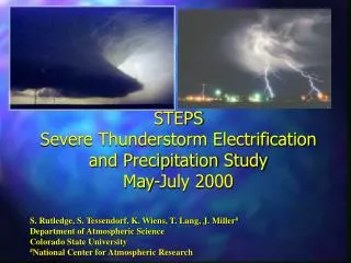
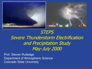
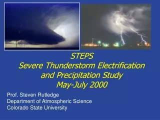
STEPS Severe Thunderstorm and Precipitation Studies May-July 2000. STEPS Objectives. To gain a better understanding of interactions between kinematics, precipitation production and electrification in severe thunderstorms over the High Plains.

E N D
STEPSSevere Thunderstorm and Precipitation StudiesMay-July 2000
STEPS Objectives To gain a better understanding of interactions between kinematics, precipitation production and electrification in severe thunderstorms over the High Plains. What are the conditions that differentiate supercell storms into high precipitation, moderate precipitation, and low precipitation events? Why do some severe storms produce anonymously large amounts of positive cloud-to-ground lightning? (e.g., greater than 50% positive) In what ways may this particular lightning signature be associated physically with the occurrence of tornadoes and large hail? Is there nowcasting potential?
Lightning Statistics from NLDN STEPS domain centered on area with high probability of severe weather. Some, but not all severe storms in this area, produce large amounts of positive cloud-to-ground lightning.
STEPS highlights Observations of 8 weak events, 7 moderate storms, and 5 severe storms. Highlights include major downburst events on 31 May and 19 June, a bow-echo MCS on 11 June, LP supercells on 31 May and 5 July, and MP/HP supercells on 22 June, 24 June and 29 June. STEPS information at http://www.mmm.ucar.edu/community/steps.html Operations journal (with text and radar summaries) at: http://www.mmm.ucar.edu/pdas/Ops-journal/ops-summary.html Support provided by NSF, NCAR, NSSL, NWS-Goodland and Colorado State University.
Network Design Surface radar network (3 Doppler radars, two having polarimetric capabilities) NMIMT GPS-based 3-D lightning mapping system NCAR mobile GPS upsonde units NOAA NSSL/OU mobile mesonet NOAA NSSL mobile balloon facility (thermodynamic and E field measurements) SDSMT T-28 armored storm intercept aircraft Goodland NWS Office (forecast and logistical support) CoCoRAHS volunteer network
CSU-CHILL Data Access Start Here
22 June severe storm Reflectivity Radial velocity/TVS