Download
1 / 61
620 likes | 828 Views
NSF and Space Weather. Presentation to the Space Weather Assessment Group July 7, 2005 Rich Behnke. The National Space Weather Program.

E N D
NSF and Space Weather Presentation to the Space Weather Assessment Group July 7, 2005 Rich Behnke
The National Space Weather Program NSWP was initiated in 1994 when community leaders approached NSF with concept of new emphasis on “space weather”
Space WeatherThe Time had Come • Space weather was ready for major scientific advances • powerful computing capabilities and techniques becoming available • new space-based and ground-based observations • Society’s vulnerability to space weather rapidly increasing • more space-based assets • sophisticated technologies more susceptible • more reliance on technology
What Exited before the National Space Weather Program • No “interagency” system • DoD, NOAA, NASA, DoE, USGS, NSF acted separately • 5-year plan through Office of Federal Coordinator for Meteorological Services & Supporting Research (OFCM) merely catalogued existing capabilities • No active coordinated process to set national priorities and focus interagency efforts
Need for a National Space Weather Program • Identify customer needs • Set priorities • Determine agency roles • Coordinate interagency activities • Ensure exchange of information and plans • Encourage and focus research • Facilitate transition of research results into operation • Help educate the next generation of space scientists
National Space Weather Program CHRONOLOGY 1993 • Fall--Community develops idea of a coordinated Space Weather Program (Siscoe, Lotko, Hildner, Lanzerotti, Killeen) • Fall -- Quantitative Magnetospheric Modeling Program developed by NASA • Fall--informal talks at NSF • AGU (Fall 93) lunch meeting (practice for NSF presentation) • Dec 20--Community presentation to Bob Corell at NSF (AD/GEO) • March 2--NSF hosts Space Weather Working Supper, for 30 leaders from academe, industry, and government agencies • June 16--NSF hosts interagency follow-up meeting for 9 agency leaders (OFCM is considered as appropriate coordination vehicle) • Aug 11--Meeting (NSF, DoD, NRC/NAS) at OFCM to discuss strategy • Sept 13--First Ad-hoc working group meeting at NSF--decisionto petition OFCM to become an official Working Group under OFCM • Ad-hoc Working Group meetings (Sep 15, 22, Oct 6, 11) • Oct 13--Presentation to OFCM--Working Group proposal accepted 1994
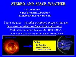
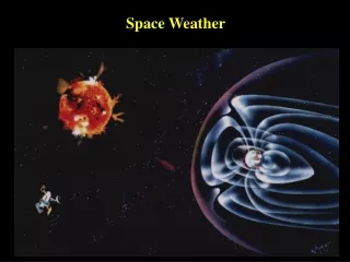
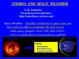
Space Weather refers to conditions on the sun and in the solar wind, magnetosphere, and ionosphere/ thermosphere that can influence the performance and reliability of space-borne and ground-based technological systems, and endanger human life. Space weather storms can cause disruption of satellites, communications, navigation, and electric power distribution grids.
National Space Weather ProgramOverall Goal and Vision • The main idea of the NSWP is to develop a system to prevent or reduce space weather disasters • The Strategic Plan calls for: “An active, synergistic, interagency, ‘single-minded’ system to achieve the goal of timely, accurate, and reliable space environment observations, specifications, and forecasts in the next 10 years US Agencies: DOD, NASA, NOAA, NSF, DOI, DOE, FAA
National Space Weather ProgramGoals • To advance • observing capabilities • fundamental understanding of processes • numerical modeling • data processing and analysis • forecasting accuracy and reliability • space weather products and services • education on space weather effects • In order to prevent • under- or over-design of technical systems • regional blackouts of power utilities • early demise of multi-million dollar satellites • disruption of communications via satellite, HF, and VHF radio • errors in navigation systems • excessive radiation doses dangerous to human health
NSWP Elements • Improve accuracy, reliability, and timeliness of forecasts and specification • Support basic research on physical processes of the coupled sun-earth system • Ensure that critical ground- and space-based observations are available • Develop end-to-end, physics-based models with predictive capabilities and user-friendly interfaces • Focus educational efforts toward forecasters, engineers, students, customers, and the general public • Ensure technology transition and integration of research and models into operation systems
Pure basic research (Bohr) Use-inspired basic research (Pasteur) Pure applied research (Edison) Relation between science and applicationsNew paradigm Quest for understanding Consideration of use
The National Space Weather ProgramAgencies Working Together Key Stakeholders NSF Commerce (NOAA) Defense NSWP Energy NASA (Living With A Star) Transportation (FAA) Interior (USGS)
Feedback Dissemination Feedback Technology Transition and Integration Models Research Observations Education National Space Weather Program Agencies Working Together Customers Communications, Satellite Operations, Power Grids, Manned Spaceflight, Navigation Forecasting and Warning Services ( NOAA, DOD) (NSF, NASA, NOAA, DOD, DOE)
The National Space Weather Program A three-dimensional approach... Sun Solar Wind Magnetosphere Ionosphere Thermosphere Earth “Mud-to-Sun” NSF NASA NOAA DoD DoI DoT DoE Research LWS CCMC RPCs Operations Customers Education Outreach Multi-agency Cross-cutting Activities
National Space Weather Program Administrative Structure Office of the Federal Coordinator for Meteorology Space Weather Program Council Committee for Space Weather Implementation Plan Update CCMC and RPCs Int’l Activities Coordination with LWS Metrics Research Competitions Space Architect Transition Plan Other
New NSWP Implementation Plan • Produced by Committee for Space Weather (cochairs: NSF, DOD and NOAA) working on regular basis • Completed July 2000
The National Space Weather ProgramExternal Review of the Implementation Plan • Presentations to AGU • Presentations to the National Academy • Review by the National Academy • Presentations to CEDAR and GEM communities
What’s in the Implementation Plan Update? • A description of the NSWP goals, program elements, strategies • A review of current Space Weather capabilities-observations and models • A description of Space Weather metrics • A summary of funded Space Weather awards • A description of future observational capabilities, both research and operational • Timelines for operational and research missions and model development • A statement of near-term NSWP priorities • A description of progress in transitioning research to operations • A description of NSWP educational activities • A description of NSWP Program Management and Agency Roles • Appendices describing research objectives, Living With a Star, and the National Security Space Architect study
Who wrote the NSWP Implementation Plan Update? Everyone! • Contains portions of the NSWP Strategic Plan written by agency reps in 1994 and 1995 • Contains portions of the NSWP Implementation Plan written by agency reps in 1996 and 1997 • Section on metrics written by NSF-appointed Metrics Working Group • Community input for descriptions of models and observations • Section on education written by Space Science Institute and SEC • Section on Living With a Star written by NASA reps • Section on Space Architect study written by DoD reps • Integration of text performed by Office of the Federal Coordinator for Meteorology in coordination with NSF, NOAA, NASA, and DoD • Research objectives written by NSF-appointed working group which met in 1995
1999 2004 2009 Ionosphere/Thermosphere Timeline Ionosphere Model (I18, I21, I23) Time-dependent Ionosphere Model (I16,I19,I20, I22) Nested and Adaptive Grid Ionosphere Thermosphere Model (I17) Coupled Magnetosphere Ionosphere/ Thermosphere Model with E-Fields ( M21) Empirical Thermosphere Model (I14) Thermosphere Ionosphere Electrodynamics Model (I15,I18) Ionospheric Conductivity Model (I26-I31) Statistical Low & Mid-Latitude E-Field Model with Storms and Substorms (I13) Physics-Based High Latitude E-Field Model (M17-M21) Research Models Assimilative Empirical High Latitude E-Field Model (I1-I12) Statistical Low & Mid-Latitude E-Field Model (I14) Data-Driven Climatolgy Scintillation Model (I25) Physics-Based Scintillation Model (I24) Global Magnetic Indices: Dst, Kp, Ae forecast Model Integration, Data Validation and Assimilation: MURI CCMC RPCs Relocatable Atmospheric Observatory • SuperDARN • Riometers • Incoherent • Scatter Radars • Ground-based • Optical • Instruments • AGOs E-Field Satellite Constellation ARGOS MSX POLAR FAST GLO ASTRID-2 SNOE ØRSTED TIMED Research Observations GEC IMAGE COSMIC LWS Ionospheric Mappers C/NOFS
NSWP Metrics • Need to establish metrics against which quantitative goals can be defined and against which progress can be measured. • What are the parameters and events to be predicted? • Where are we in terms of model and measurement capabilities? • What level of prediction accuracy, timeliness, etc. is required?
NSWP -- Metrics Panels * Initial panel membership responsible for generating first draft in Fall, 1997.
36-h 500-mb Operational Forecast over North America EMC Metrics Example
Ionosphere-Thermosphere Metric For each of the four i.s. radars determine: Where no;t(h) is the observed density at altitude h and time t and nm;t(h) is the corresponding model value. RMS error in the density measured/computed hourly at 21 altitudes, averaged over 24 hours. (Allowed inputs for the models include Ap, Kp, F10.7, and all normally available satellite data.)
National Space Weather Program NSF’s Role • Catalyst for interagency cooperation and community development • Example: AGU Space Weather journal • Support of basic research underpinnings (about half or our space physics funding) • Over 150 new focused space weather awards since 1996 • New Science and Technology Center (CISM) devoted to space weather modeling • Support to other major modeling efforts (CCMC) • New Observational platforms – Advanced Modular Incoherent Scatter Radar, the ATST, and, hopefully, DASI
Total number of awards: 398 average duration 3.3 years Total: $153,407,195
The National Space Weather ProgramSome Early NSF Activities • Basic Research Competition (with ONR and AFOSR) for 1997 • $1 M available, 63 proposals, 16 funded • Support for Grant “Matching User Needs and Space Weather Service Capabilities” • Support for Grant “Determining Space Weather Requirements for the U.S. Commercial Space Community” • Support for Workshop on Space Weather Effects on Communication and Navigation (Sept. 97) • Support for educational outreach effort • Support to National Academy (CSTR) for annual review of NSWP science plan • Informal meeting at IAGA (Uppsala) to pursue international Space Weather program
NSF Space Weather Activitiesmore recent NSF Activities • CISM • AMISR and other Ground-based Facilities • Annual Space Weather proposal competition—with AFOSR and ONR • CCMC • AGU Space Weather Journal • Metrics formulation and challenges • CSW activities: co-chair and member, tracking of progress, web site development
More Examples of NSWP Research Awards • A study of solar prominences and model calculations of the solar mag field • Development of adaptive grids for coupled models • Use of Iridium satellites to determine instantaneous auroral boundary position • Modeling ionospheric convection and thermospheric composition • End to end modeling of space weather during geomagnetic storms • CCMC computers, metrics studies • IMAX film, Space Weather Workshops, space weather educational activities • Kevin Forbes studyl • CCMC computers, metrics studies
CME Tracking using Interplanetary Scintillations (IPS) This Carrington maps (with heliographic longitude and Carrington rotation number on the horizontal, and latitude on the vertical axis) show solar wind density at the distance of the Earth from the Sun on 2001/06/05 16 UT . The values to the left of the dashed line are those forecast to arrive at Earth at the dates indicated above the map. The density at the Earth are shown as traces at the bottom of the display. The maps are derived from a corotating model of the solar wind that is fit to interplanetary scintillation (IPS) velocities and g-levels received daily from STELab, Japan. The display is updated hourly. (ref: B. Jackson, M. Kojima et al.)
Space Weather and the Real-Time Price on the California ISO Real Time Electricity Market (Sept 20-24 1999) Dst index is an indicator of geomagnetic disturbance. Magnetic storms create strongly negative index. Dollars per Mwh Dst Hour (Pacific Daylight Time)
Science – 3 Examples • Nature of Solar X-ray Sigmoids • Ionospheric ion outflow • TEC: Data and Modeling
Nature of Solar X-ray Sigmoids Observed Xray sigmoid Gibson et al, 2002 • X-ray sigmoids (S-shaped hot plasmas) are observed to be sites of solar eruptions (flares and coronal mass ejections) • MHD theory suggests that X-ray sigmoid brightenings are enhanced heating at electric current sheets forming between winding and non-winding magnetic fields • 3D MHD simulation (below) shows that an emerging twisted magnetic flux rope drives the formation of current sheets reproducing observed X-ray sigmoid morphology Simulation of emerging writhing magnetic flux rope Fan and Gibson, 2003 The simulated current sheet Fan / Gibson
Ionospheric ion outflow • During large magnetic storms large flows of ions are observed to come out of the ionosphere and enhance the ring current. • The factors that appear to determine the outflow flux are: • DC Poynting flux (field-aligned electric currents) • Alfvén Poynting flux • Precipitating electron flux Red points show dayside events, blue show nightside events, black points are averaged over the orbit of the FAST satellite (R. Strangeway, UCLA, ATM-0208498).
TEC: Data and Modeling • TEC derived indirectly from GPS attenuation or directly by incoherent scatter radar (ISR), satellite (DMSP) and ionosonde networks is being assimilated to provide the global TEC picture. A major source of Communication and Navigation Disturbances results from Total Electron Content (TEC) variations in the column between GPS transmitters and receivers Onset of the 2003 “Halloween Storm” generates a plume of ionization after sunset as detected by EISCAT and Sonde ISRs, and by DMSP. The plume does not extend to Millstone Hill. [J. Foster and J. Holt, ATM-9919598, ATM-0207748]
Center for Integrated Space Weather Modelng (CISM) An NSF Science and Technology Center Boston University and consortium
Space Weather School Center for Integrated Space Weather Modeling (CISM) • The Center for Integrated Space- Weather Modeling (CISM) conducts a summer school for 2 weeks each year to introduce graduate students to the issues and problems of space weather modeling. Participants in the Space Weather school, summer 2001 (W.J. Hughes, Boston Univ., ATM-0000950, 0120950)
NASA NOAA AFWA NSF AFOSR Community Coordinated Modeling Center (CCMC) • An interagency partnership to facilitate the development, validation, and testing of space weather models, which can eventually be transferred to Rapid Prototyping Centers to adapt for operational use • Bridges the gap between research and operations
IMAX Film -- SolarMax • Was shown at Air and Space Museum • Very well received by AGU audiences • Highly visible credit to NSF
Space Weather Science -- the bottomline “While it is true that important applications will result from the National Space Weather Program, the science that will result will be first rate... Indeed, the initiative provides a context in which much of solar-terrestrial physics can and should be done” -- Louis Lanzerotti
Space Weather Publications NSWP started
Advanced Modular Incoherent Scatter Radar (AMISR):A Global Incoherent Scatter Radar • A transportable upper atmospheric radar • PI: Dr. John Kelly, SRI International • Total construction cost: $44,000,000 over 4 years
AMISR – What is it? AMISR is: • the first state-of-the art phased array incoherent scatter radar • deployable to any geographic location on the globe • a tool to measure composition, temperature, density and motion of the Earth’s ionosphere and upper atmosphere • capable of 3-D imaging of the ionosphere via the use of multiple beams with electronic steering • completely modular: 3 faces – each face made up of 128 panels (a total of 12,288 active transmit/receive elements). • all solid state – easy maintenance • Can be operated remotely from any classroom or laboratory with a computer and the Internet
ATST – Advanced Technology Solar Telescope • Science Drivers: • Resolution – ~7X improvement • Light grasp – 10X improvement (solar physics is actually photon starved in some experiments) • Technical Specifications: • 4 m, off-axis Gregorian (all reflective), alt-az mount. • Integrated adaptive optics. • Hybrid enclosure. • 0.3-28 microns (near-UV through thermal IR). • FOV: 3 arcminutes (5 arcminute goal). • Angular resolution < 0.03 arcsecond. • Polarization accuracy < 0.01%. • Scattered Light < 1% of photosphere (sunspots); coronographic in IR. • Two rotating Coude laboratories. • Internal seeing and dust mitigation. 22 Collaborative Institutions with NSO PI. Co-PIs: HAO, NJIT, U Chicago, U Hawai’i
DASIDistributed Arrays of Small Instruments • GPS Receivers • Optical Imagers • Interferometers • Magnetometers • Passive Radar • Riometers • Neutron Monitors • Scintillation and VLF Rx • Tomography Receivers Technology: ITR, MiniaturizationEPO Opportunities