Download
1 / 51
520 likes | 783 Views
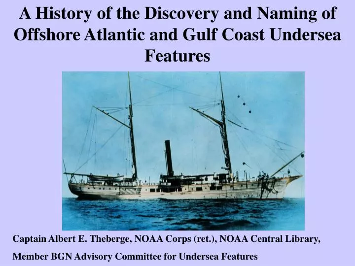
A History of the Discovery and Naming of Offshore Atlantic and Gulf Coast Undersea Features. Captain Albert E. Theberge, NOAA Corps (ret.), NOAA Central Library, Member BGN Advisory Committee for Undersea Features. Timeline of Atlantic Undersea Discovery.

E N D
A History of the Discovery and Naming of Offshore Atlantic and Gulf Coast Undersea Features Captain Albert E. Theberge, NOAA Corps (ret.), NOAA Central Library, Member BGN Advisory Committee for Undersea Features
Timeline of Atlantic Undersea Discovery • 1605 First Recorded Soundings on East Coast in Plymouth Harbor by Samuel De Champlain • Gulf of Maine -1610 St. Georges Bank Shown on English Map – Jefferys Ledge and Cashes Ledge discovered by 1675 • 1841 First Modern Deepsea Sounding by Sir James Clark Ross at 27S 17W • 1845 U.S. Coast Survey begins systematic studies of Gulf Stream resulting in discovery of continental shelf break and continental slope • 1853 Mid-Atlantic Ridge discovered by Lieutenant Otway Berryman on the USS DOLPHIN
Bathymetric Firsts Continued • 1856-57 First trans-Atlantic sounding transects by USS Arctic and HMS Cyclops • 1868 Pourtales Terrace discovered by Coast Survey off southern Florida coast – First named U.S. offshore feature not on continental shelf • 1869 Josephine Bank discovered by Swedish Research Vessel Josephine – first stand-alone seamount discovered in Atlantic
Philosophy of Naming Undersea Features • The Greater Features of the Ocean Floor Are • to Be Named from Their Geographical Situation • 2. As Far as Available Soundings Admit of the Determination of Submarine Form, Naming Is to Be Carried Out Systematically with Respect to Definite Morphological Characteristics
Philosophy of Names Continued 3. There Are Certain Important Points and Features in the Relief of the Ocean Floor Which It Is Desirable to Designate by Names. These Names Should Reflect Geographic Association or Commemorate Worthy Individuals, Vessels of Discovery, or Institutions.
East Coast, Gulf Coast and Caribbean Features Over 400 Named Undersea Features Canyons, Basins, One Rock, Swells, Escarpments, Ledges, Domes, Seamounts, Reefs, etc.
Prince Henry 1394-1460 Christopher Columbus discovers New World 1492
Battista Agnes Map of 1543 with First Mapped Depth and Possible Indication of Gulf Stream
1575 Soundings written in Pilot Book1584 Waghenaer produces first nautical charts
Matthew Fontaine Maury’s First Bathymetric Map of theAtlantic Ocean 1853
Count Louis Francoisde Pourtales’ Map of Upper Reaches of Hudson Canyon - 1870
First Physiographic Diagram of Hudson CanyonbyAdolph Lindenkohl of the Coast Survey
1845-1869 Coast Survey Maps Atlantic Offshore.1868 Pourtales Plateau (Terrace) Discovered
1873-1884 Gulf of Mexico – First Modern Bathymetric Map and 3D Imagery
Continental Shelf Delineation Arredondo 1742 Political Map Alexander Agassiz 1888 in “Three Cruises of the Blake”
Offshore Navigation 1750-1965 1886 1750 1870 1964
Acoustic Sounding Systems Begin to Unveil Details of the Seafloor - 1922 Onward German Meteor Expedition Hayes Sonic Sounder 1922
Radio Acoustic Ranging – First Offshore Non-visual Navigation
1931 Coast Survey Begins Outer Continental Shelf and Slope Surveys Value of Bathymetry to Navigation
Canyons – Among First Professional Work of Francis Shepard – The Father of Marine Geology Francis Shepard 1964 on C&GS Ship PIONEER Georges Bank Canyons Contoured by Francis Shepard 1932
Radio-Acoustic Ranging Surveys in Gulf of Mexico 1937 – Salt Domes Discovered
Salt Domes at Edge of Shelf 1937 - Properly Interpreted by Francis Shepard
Charleston Bump/ Blake Plateau -Bump First Discovered in 1853
Florida West CoastDe Soto Canyon - Florida Escarpment Florida Escarpment G. F. Jordan 1962 De Soto Canyon – H. W. Murray 1948