Download
1 / 33
330 likes | 440 Views
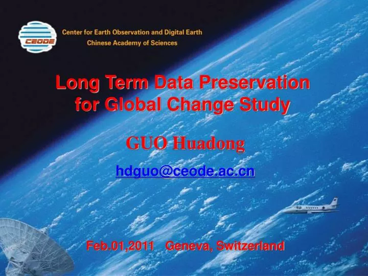
Long Term Data Preservation for Global Change Study. GUO Huadong hdguo@ceode.ac.cn Feb.01,2011 Geneva, Switzerland. Impact of Global Change. 1999. Snow reduce. Island Disappear. Glacier retreat. 天山 Glacier. Prairie degeneration. 官厅水库 , Beijing. 2009. 1994. 1962. 1994.

E N D
Long Term Data Preservation for Global Change Study GUO Huadong hdguo@ceode.ac.cn Feb.01,2011 Geneva, Switzerland
Impact of Global Change 1999 Snow reduce Island Disappear Glacier retreat 天山 Glacier Prairie degeneration 官厅水库, Beijing 2009 1994 1962 1994 lake area reduces East Juyanhai 1986/6/9 2002/5/28 甘肃省甘南藏族自治州玛曲县,09 July 2004 2
Impact of Global Change Mudrock flow nujiang dongyue river, 2010 Flood,liu zhou, guanxi,2009 Arid,2009 Snow disaster,2009,hunan Heat wave, 2009, Jun Typhoon,2010,No.3, Chanthu 3
National S&T Plan Mid-Long Term Science and Technology Development Plan (2006-2020) Earth system processes and their effect on resources,environment and disasters; Influentialmechanismand extent of human activities on the earth system; Global changes andregional responses. 4
National Research Support Recently CAS US$ 48.72 million 32.2 % MOST US$ 76.08million 50.3 % 17.5 % NSFC US$ 26.47 million Global change studies have been supported by theMinistry of Science and Technology(MOST), Chinese Academy of Sciences(CAS), and theNational Natural Science Foundation of China(NSFC). 5
Chinese Earth Observation Satellites Meteorological Satellites Polar Orbit FY-1 A, B, C, D 4 Geo-stationary FY-2A, 2B, 2C,2D,2E 3 Marine Satellite HY-1 1 Resource Satellites (CBERS, ZY, Beijing, Yaogan, Tsinghua) 7 Environmental and Disaster Monitoring Satellites 2 Communication Satellites 7 Navigation Satellites Beidou -1 3 Return Land Satellites 17 Scientific experiment Satellites 15 Spacecrafts SZ –1, 2, 3, 4, 5, 6,7 7 6
Chinese Meteorological Satellites Programs FY-1 Series: China's 1st Generation of Polar Meteorological Satellites(4 satellites) FY-2: The First Generation of Geostationary Meteorological Satellite of China FY3:Polar Meteorological Satellite (9/2008 launch) Chinese Earth Observation Satellites Meteorology Satellites of China - NSMC FY-1 FY-1 Polar Orbit FY-3, Polar Orbit, 5/2008 FY-2 Geostationary
HY-1 satelliteTo detect the marine environmental parameters of the China Seas, including chlorophyll concentration, suspended sediment concentration, dissolved organic matter, pollutants, as well as sea surface temperature. Chinese Earth Observation Satellite Ocean Satellites of China - NSOAC HY-1B, 1/4/2007 Red tide SST Suspended sediment distribution Future HY-2 HY-1 Application
The first CBERS (CBRES-1) was successfully launched on October 14, 1999 and the second one (CBERS-02) was on October 21, 2003. Chinese Earth Observation Satellite Earth Resources Satellites --CBERS CBERS
Chinese Earth Observation Satellites HJ-1 small satellite constellation The first stage: 3 satellites 2 optical satellites+ 1 SAR satellites HJ-1-A/B、HJ-1-C HJ-1-A/B HJ-1-C The second stage: 8 satellites 4 optical satellites+4 SAR satellites
CEODE, CAS CEODE ― Center for Earth Observation and Digital Earth • Belongs to Chinese Academy of Sciences. • Established on August 23, 2007 by mergingthree CAS units: • Remote Sensing Satellite Center • Airborne Remote Sensing Center • Laboratory of Digital Earth Sciences. • CEODE is committed to: operation of spaceborne and airborne earth observation system and related data services, as well as the exploration of technologies for earth observation and their application demonstrations.
CEODE-A National Research Institute Director General Satellite Remote Sensing Center Airborne Remote Sensing Center Spatial Data Center Lab. of Digital Earth Sciences Collaborative Research Unit Division for Operation of Satellite Ground Systems Division for Operation of Airborne Remote Sensing Section for Data Technology Division of Digital Earth System CAS-NRCAN Capacity Building Center Section for Data Management Ground System Engineering Division Division for the Airplane Engineering Division of Digital Land Joint Centre for Spatial Information CEODE-CRCSI Satellite Data Pre-processing Division Division for Optical System Engineering Section for Value Added Products Division of Digital Ocean and Atmosphere Joint Laboratory for Remote Sensing and Archeology The Miyun Ground Station Division for Micro-wave System Engineering Section for Customer Service Division of Optical Earth Observation Joint Lab. for Environmental RS and Data Assimilation The Sanya Ground Station Division of Microwave Earth Observation Division for Data Preprocessing Spatial Technology Application Center for International Culture and Natural Heritage The Kashi Ground Station
EO Data Acquisition & Archiving Over 2.50 million scenes of satellite data have been acquired and preserved at CEODE since 1986, providing a precious database for the earth observation .
CEODE: Airborne Remote Sensing System • Two Cessna Citation S/II Aircrafts • Two ARJ 21-700ER Aircrafts • More than 12 sensors operating • from visible-infrared to microwave • bands
EO Data Acquisition & Archiving Over 50TB data from different kinds of sensor has been acquired . Played a key role in Wenchuan earthquake (2008) and Yushu earthquake(2010) monitoring, Beijing Olympic village construction(2000~2009), as well as other scientific researches.
The value of historic data is not decreased with time passing by. Necessary for long term scientific researches and environmental monitoring applications. LTDP is a common knowledge in EO field, and the trend for LTDP increased strongly in the past years. Organizations, e.g. USGS, ESA, as well as CEODE, are making efforts to archive LTDP. Challenges existing at the points: proper preservation, safe and efficient accessing, data archiving equipment and media evolution, etc. Long Term Data Preservation
Before 1999 HDDT mainly Evolution of Data Archiving at CEODE After 2008 Massive Archiving & Management System 1999 ~ 2008 DLT / SDLT / AIT mainly
Data Massive Archiving & Management System Giving up the old mode of disperse processing system with its own tape driver. Built CEODE’s central Massive Archiving System for all the archived raw data and to be used for all processing systems. Fiber channel and SATA disk arrays, tape robot, are being used. LTO tape used as the permanent archiving media. Automatic management for data archiving, retrieving and migration. Example: Projects for LTDP LANDSAT system SPOT-5 system SPOT-5 system LANDSAT system ENVISAT system ENVISAT system RESOURCESAT system RESOURCESAT system
Projects for LTDP Data Remote Backup System • Located at Miyun Station, 100km away from CEODE headquarter. • To achieve the purpose of data double preservation. • Dual site mode of data archiving, backup, as well we being accessed from other sites. • Data retrieving from the other sites in case of local data or media problem.
Catalogue & Browse System Containing the catalogue and browse image for all the spaceborne EO data of CEODE. On-line and open to the world. Users are allowed to query and then to send their requirements. A window to make the data be accessed and used for scientific researches and remote sensing applications. Projects for LTDP
973 project - Comprehensive Experiment • There are two experimental areas: one is the roof of the world and the other an area dramatically altered by human activities. Understanding change in these two areas can help contribute to deeper understanding of humankind on global change. • These two areas in China represent specific natural and human environments where multi-scale remotely collected data (both aircraft and spacecraft) can be mutually supportive for global change research. • Develop Methods for Using Multi-scale Observations for Studying Sensitive Global Change Mechanisms . 26
Global Change Studies with EO Tibet Plateau Test Site 27
Global Change Studies with EO Bohai Bay Test Site LANDSAT RADARSAT SPOT ENVISAT 阿里站 慕士塔格站 珠峰站 纳木错站 林芝站 海洋 城市群 湿地 海岸带 草原生态
1988 1998 2007 1988 1988-1998 1998-2007 Pearl River Delta Area: Urbanization
Environment Change Studies Glacier movement by InSAR Donkemadi South Asian brown cloud to climate and Tibet Plateau glacier melting influence Glacier Movement 30
EO raw data: the recorder for the change of the Earth. The aged data has shown its importance for the global change and can support to IPCC. Necessity of LTDP increased strongly in the past years. The challenges of LTDP come from the huge volume and the evolution of archiving media. Should be doing efforts to achieve the data archiving safer and more efficient.