Download
1 / 19
190 likes | 332 Views
Using LEHD Origin-Destination Data to Measure Commuting Distance. James Palma Maryland State Data Center Maryland Department of Planning 301 West Preston Street, Suite 702 Baltimore, Maryland 20201 September 20, 2010 Presented at the 2010 APDU Conference Washington, D.C. Smart Growth.

E N D
Using LEHD Origin-Destination Data to Measure Commuting Distance James Palma Maryland State Data Center Maryland Department of Planning 301 West Preston Street, Suite 702 Baltimore, Maryland 20201 September 20, 2010 Presented at the 2010 APDU Conference Washington, D.C.
Smart Growth • “Smart growth” policies: • Desire to locate workers near their workplaces • Reducing commuting reduces greenhouse gas emissions • Compact development conserves land • Lack tools to measure policy success or failure
Priority Funding Areas (PFAs) • Maryland’s “Priority Funding Areas”: • Were created by the 1997 Priority Funding Areas Act • Direct state investment into “existing communities and places where local governments want State investment to support future growth.” • Consist of: • every municipality, as they existed in 1997; • areas inside the Washington Beltway and the Baltimore Beltway; • areas already designated as enterprise zones, neighborhood revitalization areas, heritage areas and existing industrial land; • Areas designated by local governments for future industrial, commercial, or residential growth.
Lack of Adequate Data • Few data sources allow widescale measurement of commuting distance. • Decennial Census and ACS: • Measure time, not distance • Time is affected by traffic congestion and travel mode • Travel surveys • Lack geographic specificity • Have small sample sizes • Are not updated on a regular basis
LEHD Data • Tracks origins and destinations of workers • Uses a reasonably small geography (blocks) • Separates workers into three: • Age groups • Income groups • Industry categories • Based on a large dataset with near-national coverage • Tracks commuting patterns over time, is updated frequently
LEHD Data Limitations • Suppression of small areas for origins and destinations • Synthetic data to protect confidentiality • Lack of data on non-QCEW employment and sole proprietors • Lack of federal employment data • Important for Maryland • Lack of data for Washington, D.C. • Soon to be rectified
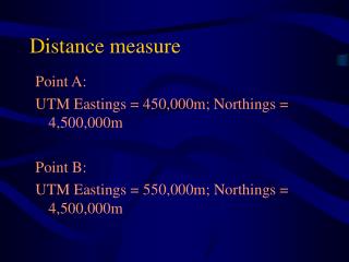
Method • Calculate geographic centroid of each block • Use coordinates of each origin and destination centroid in formula to create a “distance matrix” • Convert results to your favorite measurement system • Feed results into your favorite statistical processing program (I used R)
Spherical Law of Cosines • Simple formula: d = acos(sin(lat1)*sin(lat2)+cos(lat1) *cos(lat2)*cos(long2−long1))*R • Where: • d = distance • lat is latitude in radians • long is longitude in radians • R is the mean radius of the Earth (6,371 km) • Accurate down to one meter (with limitations) • For workers who live and work in same block: • Distance used is radius of area of block: http://www.movable-type.co.uk/scripts/latlong.html. Graphic sourced from http://en.wikipedia.org/wiki/Spherical_law_of_cosines.
Data Files Used for Analysis • All Jobs files (JA), both Main (In-state commuting) and Aux (In-commuting for out-state residents) for: • Maryland • JA Aux files only for bordering states (others ignored): • Delaware • Pennsylvania • Virginia • West Virginia • TIGER 2009 files for Census 2000 Blocks • DBF files from ESRI shapefiles imported into MS-Access • Each DBF saved as two tables (workplace and residence) for ease of processing • One file from each state above, all appended together
Data Processing Steps • Extract all Maryland origin and destination data from AUX files, append to MD Main file • Append all DBF block files together • Convert decimal degree coordinates for block centroids to radians for work and home block tables • Use block area to calculate “radius” value to use as block-internal commuting distance • Join work and home block tables to O-D files • Test for O-D in same block, apply proper formula • Distance is “radius” for O-D in same block • Spherical law of cosines formula for O-D in different blocks
Results Percentage of Workers Living and Working In and Out of PFA
LEHD Analysis Limitations • Not measuring commutes, but distance to workplace (really, payroll processing location) • Not actual distance, but centroid-to-centroid distance • Some blocks are larger than others, a problem when calculating distance matrices • Formula result is air distance only, does not take road system into account • Some commute lengths are very long, implying that workers do not actually work at their “workplace” • Though extreme commuting may be an issue, telecommuting is more likely
Usefulness of Analysis • Already used to compare commutes by workers residing inside and outside Priority Funding Areas (PFAs) • Can also be used to track transit-friendly commutes • Other data layers can be added for further analysis: • Housing price data • Demographics • Development trends and patterns • Etc. • Near-nationwide LEHD coverage allows comparisons to other areas
Next Steps • Weight centroids based on property parcel location • May create more accurate distances, esp. in larger blocks • Calculate distance on road network for sample of origins and destinations • Create a multiplier to adjust “air distance” to road distance • Experiment with different job categories: • Primary • Private • More research on extreme commuting vs. data anomalies