Download
1 / 20
200 likes | 342 Views
Glenwood Springs Overview – Resource Assessment, Uses, and Geothermal Technologies. Paul Morgan Colorado Geological Survey for the Public meeting on geothermal energy uses, technologies, and the potential for expanding uses of this clean, abundant and renewable energy resource. sponsored by

E N D
Glenwood Springs Overview –Resource Assessment, Uses, and Geothermal Technologies Paul Morgan Colorado Geological Survey for the Public meeting on geothermal energy uses, technologies, and the potential for expanding uses of this clean, abundant and renewable energy resource. sponsored by The Governors Energy Office and the Colorado Geothermal Working Group Glenwood Springs, CO, September 8, 2010
Glenwood Springs Geothermal Overview • Resource Assessment • What is a geothermal resource? • Surface manifestations, geology, hydrology, geothermal hydrogeology • Methods of assessment & current understanding of resource(s) at Glenwood Springs • Uses • Controls on uses are location, temperature, & flow • Technology • Electricity generation? • Direct Use
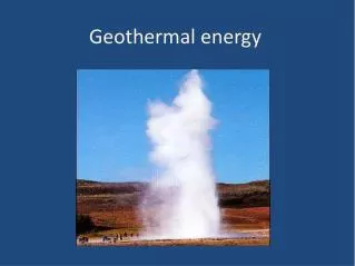
What is a Geothermal Resource? • Natural thermal energy from below the surface of the Earth that may be (legally and economically) used advantageously. • Commonly thermal energy is heat and is transferred by water; • The grade of geothermal resources varies significantly from place to place; • A common surface manifestation of geothermal resources is thermal springs.
Geological Map of Glenwood Springs Source: R M Kirkham, R K Streufert & J A Cappa, Geologic map of the Glenwood Springs Quadrangle, Garfield County, Colorado, Colorado Geological Survey MS 31, 1997
Cross-Sections From Geological Map of Glenwood Springs Source: R M Kirkham, R K Streufert & J A Cappa, Geologic map of the Glenwood Springs Quadrangle, Garfield County, Colorado, Colorado Geological Survey MS 31, 1997
Methods of Assessment • Integrate surface manifestations with geology and known hydrology • Geophysical studies of the subsurface including temperature gradient holes • Groundwater (spring water) geochemistry and isotope chemistry • Drill holes and pump (flow) tests with observations of effects on water levels and flows in other areas • Model geothermal hydrogeology rinse and repeat
Technology II Examples of Direct Use Greenhouse, CO District Heating Oregon Institute Of Technology, OR Crop Drying, NV Fish Farming, CO Images Credit: Department of Energy Geothermal Technologies Program web site
Current Understanding of Geothermal Resources at Glenwood Springs • Correlation among thermal springs, faults & Leadville Limestone – Leadville Limestone probably main geothermal aquifer • Surface spring temperatures 44-51˚C (111-124˚F) • Groundwater geochemistry reservoir temperature estimates 44-51˚C (111-124˚F)[SiO2]; Mixing model estimates 49-77˚C (120-171˚F) • Groundwater quality – poor (17,600-20,500 mg/l tds) • Discharge – low to very high (<5 - >2,200 gpm) • Source: “deep” (1-2 km; 3,280-6560 feet) circulation of meteoric water; recharge area still debated
Conclusions That May Be Made from Current Understanding • Springs and present/future wells are likely to be interconnected to some degree through Leadville Limestone (e.g., similar temperatures, similar tds) • However, significance of interconnectivity can only be determined by carefully monitored testing. • Geothermal resource is laterally extensive from east to west along the river corridor through Glenwood Springs, even where there are no surface thermal springs • Current uses of the thermal output of the natural thermal springs in Glenwood Springs are only a fraction of their capacity.
Uses – Important Factors • Location – use should be “near” source • Temperature is lost in pipes & insulated pipes are expensive • Temperature determines use • Heat-pump technology can be used to increase or decrease use temperature: primarily used in ground-source or geoexchange heat pumps. • Conventional energy sources may be used to increase temperature • Flow rate, together with temperature determines amount of energy that may be extracted.
Uses of Glenwood Springs Resource at ≤50˚C (≤122˚F) • Electricity Generation Х • Spas • Space Heating • District Heating • Low-Temperature Industrial Processes • Where Resources is Cooler • Enhanced Ground-Source Heat Pumps (Heating Cycle Only) • Ground-Source Heat Pumps Glenwood Springs Resort Pool Credit: Matt Sares
Technology – Tapping the Resource • Direct – Natural Spring Flows • Poor quality water, use heat exchangers • Drilling • Pumped wells • Poor quality water, use heat exchangers • Water appropriation? Re-inject water • Down-hole heat exchanger • Direct use • Ground-source heat pumps • CAUTION – (Senior) Water/Geothermal Appropriations
Technology I Plate Heat Exchanger Source: K D Rafferty & G Culver, Heat Exchangers, Geo-Heat Center Klamath Falls, Oregon
Technology III Down-Hole Heat Exchanger Source: Geo-Heat Center, Assessment of Down-Hole Heat Exchangers in existing wells in Puna District, Hawaii, June 2007
Technology IV Ground-Source Heat Pump Source: modified from RJS Heating Ltd.
Concluding Remarks • Large geothermal resource (probably at least partially interconnected) at ~50˚C (~122˚F) • Resource concentrated along river corridor • Current uses are well below the capacity of resource • Testing can prevent injury among users • Variety of potential uses possible