Download
1 / 27
300 likes | 546 Views
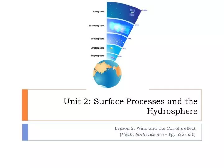
Unit 2: Surface Processes and the Hydrosphere. Lesson 2: Wind and the Coriolis effect ( Heath Earth Science – Pg. 522-536). Today’s Objectives. Explain the characteristics and significance of the atmosphere, including: Outline the complex wind circulation patterns over the Earth

E N D
Unit 2: Surface Processes and the Hydrosphere Lesson 2: Wind and the Coriolis effect (Heath Earth Science – Pg. 522-536)
Today’s Objectives • Explain the characteristics and significance of the atmosphere, including: • Outline the complex wind circulation patterns over the Earth • Describe wind deflection due to the Corioliseffect
Understanding Air Pressure • Last lesson, we noted that air pressure is simply the pressure exerted by the weight of the air above • Avg. air pressure at sea level is about 1kg/cm2 (roughly the same pressure as a column of water 10m in height) • Quick experiment – what is the pressure currently being exerted on your desk? • Answer: • Approximately 5000 kg (the weight of a 50 passenger school bus!) • Why doesn’t the desk collapse? • Air pressure is exerted in all directions! (down, up, and sideways)
Measuring Air Pressure • Meteorologists measure atmospheric pressure in millibars (mb or mbar) or kilopascals (kPa) • Standard sea level pressure is 1013.2mb or 101.325kPa • 1 mb = 100 Pa, or 0.1 kPa (1 Pa = 1kg·m/s2) • A barometer is used to measure atmospheric pressure • Bar = pressure, meter = measure) • There are several kinds of barometers, including: • Mercury barometers • Aneroid barometers
Measuring Air Pressure Mercury Barometer Aneroid Barometer
Mapping Air Pressure • An isobar is a line drawn on a map connecting places of equal sea-level pressure – the closer the isobars, the faster the air pressure is changing • Using the wind speed symbols, what do you notice about the relationship between wind speed and isobars?
What is Wind? • Wind is the horizontal movement of air from areas of higher pressure to areas of lower pressure • The greater the difference in air pressure between two locations, the greater the speed of the wind • What happens when somebody uncorks a bottle of wine? • That sound is made by air rushing into the bottle • Wind is nature’s attempt to balance inequalities in air pressure • Since unequal heating of Earth’s surface generates pressure differences, solar radiation is the ultimate energy source for most wind
Factors Affecting Wind • If the Earth didn’t rotate, and if there were no friction between moving air, and Earth’s surface, air would flow in a straight line from HL pressure • BUT, because these and other factors exist, wind is controlled by a combination of forces, including: • 1) Pressure-gradient force (PGF) • 2) Coriolis effect • 3) Friction
Factors Affecting Wind – Pressure-gradient force • Pressure differences create wind • The greater these differences, the greater the wind speed • On weather maps, places of equal pressure are connected using isobars • The spacing of isobars indicates the amount of pressure change occurring over a given distance, expressed as the pressure gradient • Similar to the slope of a hill: • A steep pressure gradient, like a steep hill, causes greater acceleration of air • A shallow pressure gradient, like a gentle hill, causes a smaller acceleration of air
Factors Affecting Wind – Pressure-gradient force • Closely spaced isobars indicate a steep pressure gradient and high winds • Widely spaced isobars indicate a weak pressure gradient and light winds • The pressure gradient is the driving force of wind, and has both magnitude and direction • Its magnitude is determined by the spacing of isobars • Its direction is always from areas of higher pressure to areas of lower pressure, and at right angles to the isobars • Once the air starts moving, the Coriolis effect and friction take effect, but only to modify the movement, not to produce it
Factors Affecting Wind – Corioliseffect • On the weather map we looked at, the wind does not cross the isobars at right angles as the pressure gradient force directs it • This is a result of Earth’s rotation and has been named the Coriolis effect, after the French scientist who first described it • All free-moving objects or fluids, including wind, are deflected to the right of their path of motion in the Northern Hemisphere and to the left in the Southern Hemisphere (video) GustaveCoriolis
Factors Affecting Wind – Coriolis effect • We attribute the apparent shift in wind direction to the Coriolis effect. This direction is: • 1) Always directed at right angles to the direction of air flow • 2) affects only wind direction, not wind speed • 3) is affected by wind speed (the stronger the wind, the greater the deflection) • 4) is strongest at the poles and weakens toward the equator where it is non existent
Factors Affecting Wind - Friction • The effect of friction on wind is only important within a few kilometers of Earth’s surface • Friction acts to slow the movement of air • As a result, wind direction is also effected (see diagram) • Coriolis effect is stronger with increasing wind speed; because friction slows wind, the Coriolis effect is weakened and wind direction changes • The result is movement of air at an angle across the isobars towards the area of lower pressure
Geostrophic Wind • When the Coriolis effect balances with the PGF, the wind will blow parallel to the isobars • Upper-air winds generally take this path and are called geostrophic winds • Due to lack of friction, geostrophic winds travel at higher speeds than surface winds
Highs and Lows • Among the most common features on any weather map are areas called pressure centers: • Lows, or cyclones • Highs, or anticyclones • In a low, the pressure decreases from the outer isobars toward the center of the low and air rises • In a high, the pressure increases from the outer isobars toward the center of high and air sinks • Due to the PGF and Coriolis effect, winds blow outward and to the right from a high – called an anticyclone, or anticyclonic flow • Winds blow inward and to the left into a low – called a cyclone, or cyclonic flow
Global Wind Patterns • As noted, the primary cause of wind is unequal heating of Earth’s surface • In tropical regions, more solar radiation is received than is radiated back to space • In polar regions, less solar energy is received than is radiated back to space • Attempting to balance these differences, the atmosphere acts as a giant heat-transfer system, moving warm air towards the poles, and cool air toward the equator • This system is very complex, but we can develop an understanding by first considering how air would circulate on a non-rotating Earth with a uniform surface
What if Earth didn’t Rotate? • Two large thermally produced cells would form: • Heated equatorial air would rise up into the troposphere, and be forced towards the poles • The air would cool, sink, and begin moving back towards the equator • This hypothetical circulation would include upper-level air moving poleward, and surface air flowing equatorward
Idealized Global Circulation • If we add the effect of rotation, this simple convection system will break down into smaller cells • The Coriolis effect would deflect the air’s poleward or equatorward motion, causing it to rise or sink earlier • This would create three pairs of latitude wind circulation cells on each side of the equator, that are divided by zones called pressure belts Pressure Belts Wind Circulation Cells
Idealized Global Circulation – Equatorial Low • Rising air at the equator is associated with a pressure belt known as the Equatorial low or the Doldrums • Since surface air arrives here from both the northern and southern hemispheres, this region is also called the intertropical convergence zone (ITCZ) • This region is associated with abundant precipitation, and weak winds
Idealized Global Circulation – Hadley Cell • Warm air rising from the equator begins moving poleward • However, soon the air is turned by the Coriolis effect • By the time it reaches 30 degrees latitude, the air is cooled and sinks into a zone of relatively high pressure at the surface – known as a Subtropical high, or the Horse Latitudes • This cell of air circulation is called the Hadley cell, and the winds are the trade winds
Idealized Global Circulation – Polar Highs • Surface high-pressure areas lie at both poles – Polar highs • Cold air flows toward the equator at the surface, turned westward by the Coriolis effect, called the easterlies • At higher levels above the poles, the air that comes from lower latitudes sinks to replace this air • Rising air at about 60 degrees latitude completes the circulation – Subpolar lows • This air is forced to rise because the cold air from the poles collides with warmer air coming from lower latitudes
Idealized Global Circulation – Polar Fronts • Where cold surface air from the poles meets warmer surface air from lower latitudes at about 60 degrees latitude*, is the Polar Front • *Average latitude • Circulation between 30 and 60 degrees latitude is harder to find • Surface air in this cell flows toward the poles from the subtropical high are called the westerlies
Summary of Idealized Global Circulation • Wind Circulation Cells: • 0-30 degrees = Trade Winds (Hadley Cell) • 30-60 degrees = Westerlies • 60-90 degrees = Polar Easterlies • Pressure Belts: • 0 degrees = Equatorial low (Doldrums, ITCZ) • 30 degrees = Subtropical high (Horse Latitudes) • 60 degrees = Subpolar low (Polar front) • 90 degrees = Polar high
Influence of Continents • One final thing to consider when looking at global circulation patterns is the effect of continents • 1) Land heats more in summer and cools more in winter compared to the oceans • This causes unequal heating of the surface • Hottest points on Earth not always at the equator • 2) Generally greater friction above land than above water • Friction affects the speed and direction of air, thus changing global wind patterns