Download
1 / 45
450 likes | 543 Views
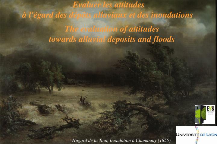
Evaluer les attitudes à l'égard des dépôts alluviaux et des inondations. The evaluation of attitudes towards alluvial deposits and floods. Hugard de la Tour, Inondation à Chamouny (1855). L’Isère (Cliché : Philippe Belleudy ).

E N D
Evaluer les attitudes à l'égard des dépôts alluviaux et des inondations The evaluation of attitudes towards alluvial deposits and floods Hugard de la Tour, Inondation à Chamouny (1855)
L’Isère (Cliché : Philippe Belleudy) « (…) des plages de sable, des archipels de galets bordent son lit principal, pareil à quelque grand miroir qui magnifie ce qui vient s’y refléter ». Bergounioux « Flot, requiers pour ta marche un galet au sol terne Qu’à vernir en ta source au premier pas tu perdes ». F. Ponge, Le parti-pris des choses.
Content 1. The attitudes towards riverscapes 2. Perception of braided river landscapes 3. Floods in local newspapers
Plan 1. The attitudes towards riverscapes 2. Perception of braided river landscapes 3. Floods in local newspapers
Due to the present degree of environmental alteration along the Magra River, • the need for sustainable sediment management is urgent. It is therefore important: • to understand how local stakeholders • perceive a river channel that is rich • in gravels, • to better evaluate whether or not they • will support proposed braided channel • restoration projects .
Postulat: The visualfeatures of riverscapes have an influence on the evaluation and behaviour of observors. • Ten photographs of the river were shown to each participant depicting: • different proportions of water, vegetation, and mineral bar, • and different sizes of gravels.
Five distinct groups of participants (total n=127) • Students attending college near the Magra River, • Students attending college far-away from the river, • People with a scientific understanding of river ecosystem function, • Local river managers working for the government watershed authority, • - and other Magra River users.
Three quantitative variables: Aestheticquality Beneficial uses of the river Need for active river management Visual analogic scale (VAS) Unpleasant Pleasant 0 10 The evaluation of riverscape characteristics
Two categorical variables: • the categories of uses to which the riverscape shown would be most suited • 1 – no activity; • 2 – fishing; • 3 – swimming; • 4 – navigation, • 5 – relaxation, • 6 – gravel mining, • 7 – hydroelectric generation, • 8 – domestic/agricultural water withdrawal, • 9 – nature conservation) • la caractérisation de l’intervention envisagée The evaluation of riverscape characteristics
Two categorical variables: • the categories of uses to which the riverscape shown would be most suited; • the appropriate types of management activities for each riverscape: • 1 – no management, • 2 – improved landscaping, • 3 – wildlife protection, • 4 – bank stabilization, • 5 – channel cleaning, • 6 – engineered structures The evaluation of riverscape characteristics
Surface area of each photograph (A through J) occupied by water, vegetation, and sediments, and the visually-assessed grain size classes of the sediment shown (0 - no sediment, 1 - gravel, 2 - pebbles, and 3 - large boulders)
Correlation Matrix (calculated with average Bravais-Pearson coefficients) for the survey response variables (aesthetic value, beneficial uses, and needs for management action) and the landscape components (area occupied by water, vegetation, and mineral bar). Significant values with p < 0.05 are in bold type
Introduce infrastructures • List of infrastructures • Flooding / variable • Type of damages expected • Normal / flooded flows • Historical photos, substantial gravel or not • Chosing photos / drive perception • Show real risky versus no risk situations • Very nice pictures • Small numbers of photos contrasted level of gravels in natural riverscapesand then photos with impliedgravel associated risk and then a second set of photos like the first (hyp. effect of phot order) • Very much related to the time since flow events (memory effect). • Two different places one with a recent big flood, one without. • Use expert jugement as a ref. • Risk? Riverscape with eroding banks (natural, with a house), vulnerable infrastrcuture (culver), bridge (public interest), house (private interest). Identification / risks • Triplate photos / braided rivers with fine sediment implicting aggradation, gravel bar (implication of potential instability), cobble / paved channels. • How people perceive risk through sediment process (torrential fans – may think house at risk far from the site) • Questions • Distance to the closest river • If this house is sell, will you buy it? Will you be safe in this house? • Would you like to live there? • Divergence of the managers? Do you simply survey citizens? Other groups? • Natural or man-influenced? • More information that you want and real questions. • 3 questions? Safe/dangerous, • Aerial photos. Where would you built your house. Where would it be risky to live? Oblique photos + gravel bars / far
Intra-group variability of the scores attributed to each of the survey response variables
Categorization of beneficial uses recommended by survey respondents for each photograph
Categorization of management actions recommended for each riverscape photograph
Elements of discussion • In terms of riverscape perception: • The influence of water on landscapeevaluation • Whatisnaturalis not alwaysaesthetics • The preference for maintained nature (ratherthanwild and regulated nature) • The role of familiarity • A differencebetween local/expert knowledges • In terms of restorationproject: • Consider the archetypesthat influence public as well as decisionmakers • Promotecampaigns of environmentaleducation to explain the objectives
Content 1. The attitudes towards riverscapes 2. Perception of braided river landscapes 3. Floods in local newspapers
140 articles : • 68 in Le Crestois • 72 in Le JDD
Presentation of each article Statisticswith R Textual data analysis : ALCESTE and TXM GIS : places quoted (communes, rivers, catchment)
Stakeholders form a system characterized by different uses • stakeholders quoted • 40% users • 31% politicians • 21% riverside people • uses of the river • 51% production • 42% protection
Stakeholders form a system characterized by different uses • production • quoted : farmers and riverside people • natural condition brutality and damages • protection • quoted : quarrymen • prevention acts • leisure activities • anglers
1994, 2003 et 2005 • Crisis and memory • Hydrological extremes and article distribution • 4 years without articles • A mean of 5 articles per year • the role of floods and the maximum of articles • What is the influence of the season? • autumn and spring • winter and summer • crisis and management
The crisis and its temporal management • 2 groups : the crisis and its immediate management (physical and temporal management) / the resilience of the system (to prevent a new crisis from happening)
The mostquoted - dams, dikes … and othersworks of civil engineering - restoration and maintenance A spatial variability A temporal variability
A spatial variability • Eachsubcatchementfocuses on itssubcatchment • Twodifferentcommunities in a same basin • Whichintegrated management isthen possible ?
The water territory (Ghiotti) and the risk territory • Identify the risk places • An archipelagicgeography • Somediscontinuities
The Drôme as a management model Versus the floods as a crisis… • The time of management and politicaldecisions (PPRi) • Twosubcatchment (upstream and downstream) because of • differentplayors • different uses of the river • a politicalchoice but some local adaptations… • Different places • the alea is not the sameeverywhere • the urban communes are more quoted but … • a specific place the Ramières…
A diachronicapproach • The repetition of alea and the more quoted places • An environmental disruption • the difficulty of fixing the flood causes • somestakeholderswithdifferentaims • a system resilience : which management of the crisis? • memory : exemplaryfloods, memory lapses, places which are forgotten
La presse locale, une bonne source d'information ? A) Des biais importants : une échelle territoriale restreinte et parfois peu significative(Caron et Torre, 2005) la diversité du métier de journalistes(Bucher et Strauss, 1961 ; Neveu, 2004 ; Ruellan, 2005) l'incomplétude de l'information(Vicardet al., 2005)et la partialité du choix des événements(Caron et Torre, 2005) les filtres culturel et idéologique, ainsi que la ligne éditoriale(Grawitz, 2001; Allard, 2005) B) Les atouts : une diffusion considérable et la quasi-exclusivité de l'information locale(Torre et al., 2005) le reflet des attentes du public(Bourdieu, 1966 ; Grawitz, 2001) un support pour les débats et une source pour l'étude des conflits(Caron et Torre, 2005 ; Torre et al., 2005) des archives propices à l'analyse d'événements(Sautter, 1994 ; SPOTTER, 2005), mais aussi à l'étude diachronique des inondations et des représentations et politiques publiques associées(Allard, 2005)
Perspectives • A) Floods in newspapers (Isère basin) • Drome catchment: 100 articles in local newspapers(Emeline Comby) • IserecatchmentthroughLe Petit Dauphinois and Le Dauphiné Libéré from 1880 to 2010 (Silvia Flaminio, Master 1) • B) 20/30 entretiens semi-directifs sur l’Isère (risque inondation) • experts, managers, practitioners, local decision-makers • C) The perception of gravel bars by public and expert • Which variables in the set of photographs? • Whichevaluativefeatures? • Which questions about floods to betterunderstand • the spatial and temporal framework of riverine • landowners? Le Crestois, 1984