Download
1 / 31
310 likes | 416 Views
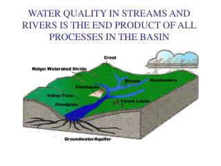
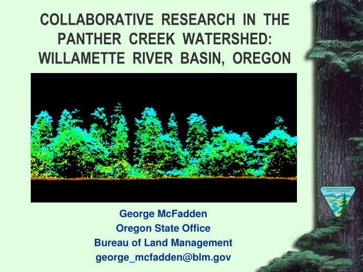
COLLABORATIVE RESEARCH IN THE PANTHER CREEK WATERSHED: WILLAMETTE RIVER BASIN, OREGON. George McFadden Oregon State Office Bureau of Land Management george_mcfadden@blm.gov. PANTHER CREEK WATERSHED. Ball Bearing Mountain 2265 ft. Carlton City Reservoir 575 ft.

E N D
COLLABORATIVE RESEARCH IN THE PANTHER CREEK WATERSHED: WILLAMETTE RIVER BASIN, OREGON George McFadden Oregon State Office Bureau of Land Management george_mcfadden@blm.gov
PANTHER CREEK WATERSHED Ball Bearing Mountain 2265 ft. Carlton City Reservoir 575 ft.
COLLABORATIVE RESEARCH PARTNERS • Bureau of Land Management * • Environmental Protection Agency * • Natural Resource Conservation Service * • Weyerhaeuser Company * • U.S. Forest Service, PNW Research Station * • Oregon Department of Geology and Mineral Industries * • City of Carlton • McMinnville Water and Light
COLLABORATIVE RESEARCH PARTNERS • Forest Capitol Partners • Oregon State University * • Portland State University • Seattle Biometrics * • Watershed Sciences * • Hampton Affiliates • Yamhill Basin Council * Core Research Organizations
PANTHER CREEK RESEARCH OBJECTIVES • Develop LiDAR stand level inventory methods • Conduct a systematic soil sample • Develop methods to predict distribution of soil carbon • Characterize Panther Creek slope stability • Characterize Panther Creek soil chemistry • Assess effects of forest / land use management on carbon storage
PANTHER CREEK COLLABORATION TENANTS • All data is part of the public record • Research in landowner blind • Each collaborator funds the research where they have interest • Data sharing and external analysis is encouraged
DISCRETE RETURN LIDAR COLLECTION SCHEDULE • Leaf on 2007 Complete • Leaf off 2007 Complete • Leaf off 2008 (2009) Complete • Leaf off 2009 (2010) Complete • Leaf on 2010 Scheduled • Leaf off 2010 (2011) Planned • Leaf off 2011 (2012) Planned
DISCRETE RETURN LIDAR EFFECTIVENESS Source: Watershed Sciences Report 1/22/2010
2010 LEAF ON FLIGHT REQUIREMENTS • Discrete return LiDAR at 8 pulses per square meter • Hyperspectral digital imagery at up to 256 bands, probably 24 to 30 bands • Wavelength return LiDAR • Imagery co-registration with products from 2010 leaf on flight
VEGETATION SAMPLE PLOTS • 42 1/5 acre circular plots • Grid cells stratified into 3 by 3 block based upon tree height and canopy cover • 9 plots randomly located, 1 per block • 1 plot randomly located in mixed hardwood / conifer strata • 3 additional plots randomly located in each “stand” where a random plot is located • 2 additional plots randomly located in riparian stands
VEGETATION PLOT VARIABLES • Species • Status (live or dead) • DBH • Total height • Height-to-live-crown • Lean percent (> 10%) • Dead top • Location (x,y) coordinates
SOIL PIT PLOTS • Three soil pits will be randomly selected in each of the 10 to 12 dominant kinds of soils in Panther Creek • 1/5 acre plot established at each of the 36 soil pit locations selected in Panther Creek • 36 total plots / Only 35 associated with soil pits as one pit location is on a skid road and was not installed but the vegetation plot was installed • Measurements the same as vegetation plots
SOIL VARIABLES SAMPLED • Acid oxalate extractable Fe, Al & Si • Active soil carbon (AC) • Aggregate stability • Bulk density • Calcium carbonate equivalent • Cation exchange capacity (CEC) • Clay mineralogy via x-ray diffraction • Dithionite-citrate extractable Fe, Al & Si • Effervescence in 1N HCl • Extractable acidity (BaCl2-TEA)
SOIL VARIABLES SAMPLED (CONT) • Exchangeable cations (Na, K, Ca, Mg) • KCl extractable NH4+ & NO3- • Micromorphology – thin section • Mineral content • New Zealand phosphorus retention • Optical analysis – glass count • Particulate organic matter (POM) • p-Nitrophenol, β-Glucosidase • pH in NaF • pH in water & CaCl2
SOIL VARIABLES SAMPLED (CONT) • Particle size analysis (sand, silt and clay) • Total N, C & S • Water retention (0.06 Bar) • Water retention (0.1 Bar) • Water retention (0.33 Bar) • Water retention (1 Bar) • Water retention (2 Bar) • Water retention (5 Bar) • Water retention (15 Bar)
WEATHER INSTRUMENTS • RAWS Station Installed Spring 2010 • Soil Pits (36) Installed Spring 2010 • Air Temperature • Relative Humidity • Soil Moisture • Soil Temperature
LANDSLIDE ANALYSIS Landslide inventory mapping is greatly improved using high resolution (~8pts/m2) LiDAR data collected during leaf-on and/or leaf-off conditions In Panther Creek identified landslides went from 7 to 93 Great care is needed when using differential LiDAR DEMs to map, quantify, and interpret elevation change caused by landslides In Panther Creek 90 % of high confidence sites were active landslides but only 10 % of low confidence sites were active landslides Source: Burns, W.J., Coe, J.A., Kaya Sener, K, Ma, L., 2009. Analysis of Elevation Changes Detected from Multi-Temporal LiDAR Surveys in Forested Landslide Terrain in Western Oregon. Geological Society of America Abstracts with Programs, Vol. 41, No. 7, p. 379
DATA SHARING METHODOLOGY Seattle Biometrics maintains a password protected website where core researchers upload raw data sets for storage and archiving Oregon State University is developing a public website with project descriptions, sample designs, list of publications and a selected sample of raw data Bureau of Land Management will distribute the archived raw data upon request and submission of a portable hard drive for data transfer