Download
1 / 105
1.05k likes | 1.17k Views
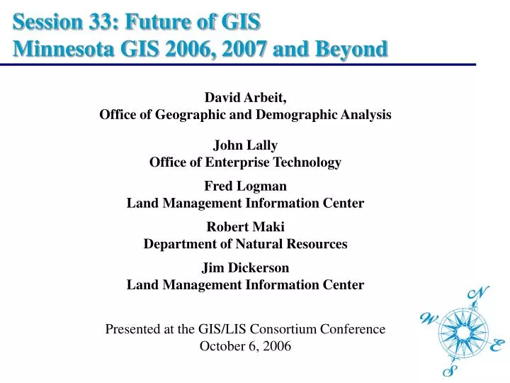
Session 33: Future of GIS Minnesota GIS 2006, 2007 and Beyond. David Arbeit, Office of Geographic and Demographic Analysis John Lally Office of Enterprise Technology Fred Logman Land Management Information Center Robert Maki Department of Natural Resources

E N D
Session 33: Future of GIS Minnesota GIS 2006, 2007 and Beyond David Arbeit, Office of Geographic and Demographic Analysis John LallyOffice of Enterprise Technology Fred LogmanLand Management Information Center Robert MakiDepartment of Natural Resources Jim DickersonLand Management Information Center Presented at the GIS/LIS Consortium Conference October 6, 2006
On Common Ground: Towards a Statewide Geospatial Infrastructure David Arbeit, Office of Geographic and Demographic Analysis John LallyOffice of Enterprise Technology Fred LogmanLand Management Information Center Robert MakiDepartment of Natural Resources Jim DickersonLand Management Information Center Presented at the GIS/LIS Consortium Conference October 6, 2006
On Common Ground: Shared Geospatial Services Inventory Session Overview • State enterprise technology vision and strategy • Strategic planning for geospatial technology • The geospatial technology architecture concept • New! Shared services survey and catalog • Available Now! WMS Image Shared Service
On Common Ground: Towards a Statewide Geospatial Infrastructure The Minnesota EnterpriseInformation ManagementMaster Plan John Lally Director of Strategic Planning Office of Enterprise Technology
The Role of OET • Enterprise-level planning and leadership • Business, Information and Technical Architecture • Portfolio Management – assets, applications, projects • Oversight • Policy, practices and standards • Enterprise services • Security • EGS foundations 5
Who is “the enterprise” • State agencies, boards and commissions, of course but also . . . • Local government (counties, cities & towns, STDs) • Higher education • K-12 education • Business partners and vendors 6
What defines “the enterprise” Responsibilities, authority and relationships differ, but we all share • Public purpose • Public funding • Common customers and stakeholders • Commitment to serving the best interests of our citizens 7
Change Drivers • Our customers and their expectations • Demand for on-line services • Inefficient workflow and outdated business processes • Economic considerations • Δ in information infrastructure and technology • Our workforce • Cyber security considerations 8
Guiding principles of enterprise IM • An enterprise view • Future orientation • Federated model • Collaboration • Shared responsibility for stewardship of public resources – budget, data, technology • A commitment to customer service • An enterprise architecture • Business case discipline • Learning from others 9
Our Blueprint: The Federated Governance Model Agency-specific Services Shared Services Utility Services The federated enterprise model balances three ways of managing IT business for the state 10
Purpose of master planning • To guide policy and investments through: • Coordination • Cooperation • Convergence • Lay the foundation for effective management of information – data, technology, resources • Provide the context for transformation of state government programs • Improve performance of IT-supported business activities 11
Strategy Study Teams 1: Business Process Redesign 2: Shared Services & Agency centers of excellence* 3: Consolidation of utility functions* 4: Electronic Government Services 5: Funding Mechanisms 6: IT Portfolio Management* 7: Integration of financial, payroll and purchasing 8: Information Security 9: Comprehensive Telecommunication Planning 11: Workforce 12: Data Practices *LMIC involvement 12
Applications and services of a highly specialized nature for which there are no opportunities to add value through central management. Agency- Specific Services Services and applications required by more than one enterprise partner, and managed by one entity to improve service and efficiency. Shared Service Services and applications common to all enterprise partners, and managed by one entity for all agencies and jurisdictions to improve service and/or reduce costs. Utility Services Service Types 13
Why is OET interested in GIS? • Investment in data and applications is significant and growing • Opportunities for sharing data and applications are obvious • Value to citizens and government has been demonstrated in many areas of interest – economic development and analysis, land use, public safety, environment, services distribution, tax administration, benefit management and many more • Need for standards is apparent 14
Agency COE Utility How might Shared Services work for GIS? • Infrastructure (and hosting?) at OET • Specialized applications and thematic data at individual agencies • Common applications and tools • Baseline map info, standards and general data 15
On Common Ground: Towards a Statewide Geospatial Infrastructure Strategic Planning for Geospatial Technology Fred Logman Strategic Planning Project Coordinator Land Management Information Center
Strategic Planning for Geospatial Technology Building on decades of informal collaboration, Minnesota’s GIS community now needs to collaborate on a strategy that will bring the benefits of GIS to the entire state. • Governor’s Council on Geographic Information Strategic Plan (2004) • National States Geographic Information Council and Federal Geographic Data Committee 50 States Initiative(2006) • A new strategic plan to build common ground
Governor’s Council on Geographic Information Mission To provide leadership and direction in the development, management and use of geographic information in Minnesota. • Strategic Plan: A Foundation for Coordinated GIS(2004) • Conceptual Architecture for Enterprise GIS (2005) • Second Generation Strategic Plan (2006/2007) www.gis.state.mn.us
A Foundation for Coordinated GISMinnesota’s Spatial Data Infrastructure Supports the National Spatial Data Infrastructure
A Foundation for Coordinated GISMinnesota’s Spatial Data Infrastructure Initially focused on foundation data
Local Governments State Agencies Regional Agencies Federal Agencies Tribal Governments Academic Institutions Non-Profit Organizations Private Businesses A Foundation for Coordinated GISMinnesota’s Spatial Data Infrastructure Inclusive of whole Minnesota geospatial community
A Foundation for Coordinated GISMinnesota’s Spatial Data Infrastructure Organizational Issues • Explicit authority and responsibility for overseeing the development and implementation of the MSDI should be assigned to a state cabinet level agency • Adequate resources should be provided to support the sustained development and implementation of the MSDI, including necessary funding to sustain the coordination effort • GIS implementation by state agencies should be coordinated within guidelines established for the state’s IT architecture framework and consistent with policies of the state’s Office of Technology and Department of Finance
A Foundation for Coordinated GISMinnesota’s Spatial Data Infrastructure Organizational Issues • GIS implementation by state, local and regional agencies should be coordinated with similar efforts by state and federal agencies as they relate to the MSDI • Emphasis should be placed on identifying emerging opportunities for effectively using GIS, identifying opportunities for joint projects and leveraging private and federal resources not otherwise available to Minnesota • The continued development of the MN Geographic Data Clearinghouse should be supported emphasizing e-government solutions for distributing geospatial data
Working Towards a Nationwide Infrastructure Federal agencies and state coordinators continue to work towards developing a common National Spatial Data Infrastructure. • FGDC Future Directions – 50 States Initiative • Program emphasizing strategic and business planning • Target implementation grants • Minnesota among 11 states to receive planning grant • National States Geographic Information Council • Worked with FGDC to promote 50 States Initiative • Identified criteria, characteristics and activities for success
National States Geographic Information CouncilCoordination Criteria www.nsgic.org A 2005 study revealed that Minnesota had recently regressed and was lacking some important criteria for success!
A full-time, paid coordinator position is designated and has authority to implement the state’s business and strategic plans26 of 48 states – Not Minnesota A clearly defined authority exists for statewide coordination of geospatial information technologies and data production20 of 48 states – Not Minnesota 3. The statewide coordination office has a formal relationship with the State’s CIO28 of 48 states – Not Minnesota National States Geographic Information Council9 Coordination Criteria
National States Geographic Information Council9 Coordination Criteria • A Champion (political or executive decision maker) is aware and involved in the process of coordination16 of 48 states – Not Minnesota • Responsibilities for developing the NSDI and State Clearinghouse are assigned29 of 48 states – Includes Minnesota • The ability exists to work and coordinate with local governments, academia, and the private sector41 of 48 states – Includes Minnesota
National States Geographic Information Council9 Coordination Criteria • Sustainable funding sources exist to meet projected needs12 of 48 states – Not Minnesota • Coordinators have the authority to enter into contracts and become capable of receiving and expending funds20 of 48 states – Includes Minnesota • The Federal government works through the statewide coordinating authority27 of 48 states – Includes Minnesota
Current Strategic Planning Project • Will produce a second generation strategic plan • Focuses on State agencies while recognizing the larger Minnesota geospatial community • Mainly looking at organizational and operational issues • Working toward a Web based shared services environment • Geospatial center(s) of excellence • Conceptual Architecture • Shared Services Survey • Implementing shared services • Recognizes the need to optimize available resources while increasing productivity and availability
Strategic Planning Project Process • Governor’s Council on Geographic Information Strategic Planning Committee serves as steering committee • State agency staff interviews help focus effort • Research coordination strategies in other states • Facilitate strategic planning workshop with stakeholders • Early adopters • Late adopters • Emerging users • Strategic planning workshop will identify: • Issues faced by agencies • Existing and anticipated needs • Areas for collaboration • Key recommendations
Strategic Planning Project Products • Strategic Plan • Organizational recommendations • Governance components • Resource optimization opportunities • Relationship to traditional IT • Components of Web based shared services environment • On-going Shared Services Catalog • Business Plan • Organizational and fiscal recommendations – Legislature • Completed no later than March 2007
On Common Ground: Towards a Statewide Geospatial Infrastructure Minnesota State GIS Enterprise Architecture Robert Maki Chief Information Officer Department of Natural Resources Governor’s Council on Geographic Information Geospatial Architecture Committee
Government Entity 2 Government Entity 1 Government Business Application C Government Entity 3 Government Business Application B Hosted Services Hosted Services Hosted Services Commercial Service Provider Government Business Application A Service Provider Shared Services Concept
Services and Consumers GIS Desktop User Government Business Application User Public Web Application User Result Consumer Service Provider Request Any internet-based service capable of accepting a request and delivering a result in an agreed upon format
Name Projection Service Image Geocoding Lake Buffer Floodplain Test Coordinate Location Lake ID Buffer Distance GIS data file Input Projection Output Projection Area of Interest Request Description Street Address Area feature (in GML format) Coordinate Location 0 – Not in Floodplain 1 – In Floodplain Reprojected data file Image file suitable for viewing Result Example Services
Consumer Result Service Provider Request Application-Data Services App-Data Service 1 • Succinct • Atomic • Non-dependent • Focused • Hosted by business entities (including private entities) • Conformant to enterprise communication protocol and data format (results) standards App-Data Service 2 App-Data Service 3 App-Data Service N
Service providers work with the Coordinating Organization to ensure proper functioning of the enterprise Service Provider Coordinating Organization Service Broker Services Suite Consumers learn about services through a broker catalog Enterprise Overview Consumer applications interact directly with Service Providers Access Application Consumer • GIS Software • Business Apps • Public Access Apps
Coordinating Organization Broker Services Suite Coordinating Organization (Enterprise Broker) Role • Provide services that facilitate data discovery and describe fitness for use • Provide services that supply server connection information • Provide some role in authentication process (security) • Host a source-services catalog (a registry database) • Ensure compliance with enterprise standards • Monitor services access-reliability • Provide support to application developers seeking to work within the system, including documentation type validation services • Host application objects that connect the broker to client applications
Minnesota State GIS Enterprise Example Case Hypothetically… Department of Transportation planning staff are considering a new transportation corridor alignment And they require the following information: • the latest information on: impaired waters and sites of known environmental contamination from Pollution Control Agency (PCA); • protected wetland locations and conservation easements from Board of Soil and Water Resources (BWSR); • protected lakes and watercourses, trout streams, endangered species occurrence, recreation easements, and state-managed natural resource lands from Department of Natural Resources (DNR); • known cultural resource locations from the State Archaeologist Office How would this work be currently performed?
Begin Evaluation Process PCA DNR Preliminary Assessment BWSR SAO Minnesota State GIS Enterprise This approach enables access to the most up to date resources available and reduces the amount of data that the client needs to handle How does a next generation architecture address this circumstance? MnDOT Corridor Assessment Application
On Common Ground: Towards a Statewide Geospatial Infrastructure Identifying Shared Opportunities: The MN Shared Geospatial Services Inventory David Arbeit Director Office of Geographic & Demographic Analysis Department of Administration
Identifying Shared Opportunities:The MN Shared Geospatial Services Inventory By building on a shared service architecture, organizations can more productively develop a GIS applications that serve their business needs, at greatly reduced cost. • Illustrate shared service and broker concept • Describe value of service inventory • Show examples of shared geospatial services • Walk through MN Geospatial Resources Inventory • Invite community to document their stuff
Enterprise Geospatial Services Architecture Service providers identify & document services Broker Organization Service Provider Catalog Service Service Support Services Consumer applications interact directly with Service Providers Query forService Access Service Consumers learn about services through a broker catalog service Consumer Consumer