Download
1 / 16
160 likes | 715 Views
Understanding Lake-Effect Snow Storms in the Finger Lakes & Great Lakes Regions Neil F. Laird Assistant Professor Department of Geoscience Hobart & William Smith Colleges.

E N D
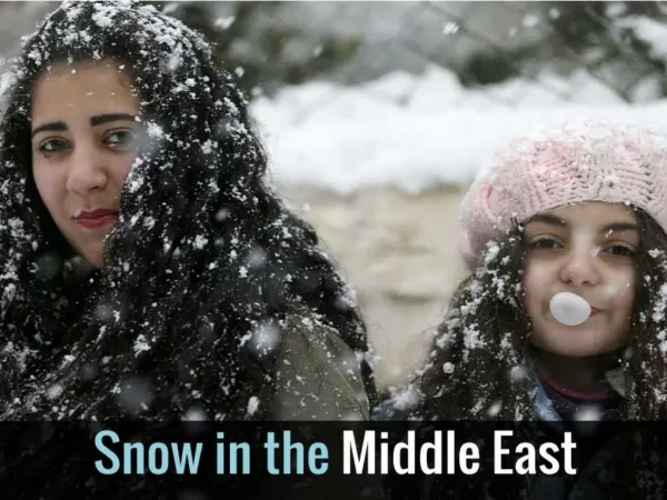
Understanding Lake-Effect Snow Storms in the Finger Lakes & Great Lakes Regions Neil F. Laird Assistant Professor Department of Geoscience Hobart & William Smith Colleges Lake-effect storms can often produce significant snow accumulations within very short time periods that can negatively impact transportation systems, limit or enhance business operations, cause significant property damage, and result in injuries and deaths due to accidents and exertion. As an example, some of the recent lake-effect storms last winter had snowfalls totaling 5 to 7 feet over periods of 2-3 days. The difficulty in predicting the development of lake-effect storms rests with the numerous parameters that influence the lake-atmosphere system and the complex atmospheric circulations that exist and interact across various spatial and temporal scales.
Lake-Effect Snowstorms Winter Precipitation from Great Lakes & Finger Lakes (liquid equivalent, mm) NYS Finger Lakes Snow Belt 1 inch = 25 mm common snow:liquid ratio (10:1 to 20:1)
Lake-Effect Snowstorms Snowfall & Impacts
(atmospheric stability) N CBL (latent heat flux) HL (wind speed) U (sensible heat flux) HS (air temperature) Ta Tw(water temperature) L (fetch distance) Lake-Effect Snowstorms Formation & Contributing Parameters
Lake-Effect Snowstorms Formation Across the Lake Upwind Shore Mid-Lake Downwind Shore
Lake-Effect Snowstorms Seasonal Forcing (Lake & Atmosphere)
Lake-Effect Snowstorms Influence of Topography
Lake-Effect Snowstorms Influence of Ice Cover on the Lake (GLICAF Project – February 2004)
1 3 2 Lake-Effect Snowstorms Morphology 1 Widespread Coverage Shoreline Band Mesoscale Vortex 2 3
Lake-Effect Snowstorms Morphology 1 Widespread Coverage 3 Mesoscale Vortex 2 Shoreline Band
Lake-Effect Snowstorms NYS Finger Lakes Snow Bands
Lake-Effect Snowstorms Idealized Model Simulations • Regional Scale Computer Model • 10 km grids, 20 levels, 36-hr duration; 56 simulations • Wind Speed • Lake-Air Temperature Difference • Fetch (lake size, lake shape, wind direction) • Atmospheric Stability
Wind Speed, U = 5 m s-1 Lake-Effect Snowstorms Idealized Model Simulations U = 10 m s-1 U = 15 m s-1 T = 15 °C (27 °F) d/dz = 3 °C km-1 Lake = Axis Ratio 4:1 (320:80 km) Area 31,416 km2 Lake Superior: 2:1 (82,200 km2) Lake Huron: 1:1 (59,600 km2) Lake Michigan: 3:1 (57,800 km2) Lake Erie: 4:1 (25,700 km2) Lake Ontario: 4:1 (19,000 km2)
Lake-Effect Snowstorms Results from Idealized Model Simulations • U/L a proxy for LE morphology • Continuous transition zones • T independence ( T > 5 C) • U/L correlated with LE intensity
Lake-Effect Snowstorms U/L Comparison with Observations Shading: U/L prediction Symbol: Observed event
Lake-Effect Snowstorms • Lake Effect Snowstorm Development • Cold air moves over Warm lake water • Warmth and Moisture from lake to air • Air becomes unstable over lake • Clouds and snow develop over lake • Convergence at shoreline adds lift • Heaviest snowfall near convergence at shore • Where & How much snow falls? • Snow belts extend 10 – 50 miles inland • Wind direction • Wind speed • Temperature of lake • Temperature of air crossing lake • Topography downwind of lake • Extent of ice cover