Download
1 / 45
450 likes | 640 Views
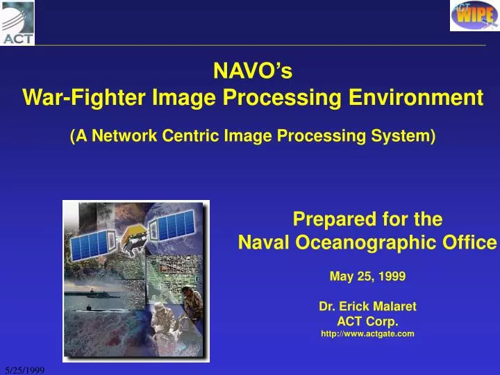
NAVO’s War-Fighter Image Processing Environment (A Network Centric Image Processing System). Prepared for the Naval Oceanographic Office May 25, 1999 Dr. Erick Malaret ACT Corp. http://www.actgate.com. OUTLINE. NAVO’s WIPE System Overview WIPE’s Building Blocks Examples with WIPE

E N D
NAVO’s War-Fighter Image Processing Environment (A Network Centric Image Processing System) Prepared for the Naval Oceanographic Office May 25, 1999 Dr. Erick Malaret ACT Corp. http://www.actgate.com
OUTLINE • NAVO’s WIPE System Overview • WIPE’s Building Blocks • Examples with WIPE • Real-Time WIPE DEMO • Concluding Remarks
War-fighter Image Processing Environment • WIPE is a network centric system For Geo-Spatial Data: Assimilation, Processing, and Distribution • WIPE provides Flexible WWW Access to all Data in an Interactive Manner ==> Products and Virtual Products
NAVO/WIPE System • A WIPE (classified) server has been implemented at NAVO to host the following data sets over the SIPRNET • Acoustic Imagery • Bathymetry • Satellite Imagery • Surface Sediments • Bottom Roughness • Mine-Like Contacts • Ship Location • 3d Grid of Ocean Temperatures • 3d Grid of Ocean Salinity • Wrecks and Obstructions
WIPE LEVERAGES IN ACT’s SOFTWARE • MSHELL - Image Processing Interpreter Language developed by ACT. The language has a high level syntax similar to Matlab and IDL. • ProVIEW - Professional Windows Environment for Windows (ProVIEW). ProVIEW has extensive capabilities in image processing, analysis, and map generation. • WIPE - War-fighter Image Processing Environment. Data Assimilation, Processing, and distribution system with WWW interactive capabilities. MSHELL provides the computational engine used by ProVIEW & WIPE ProVIEW provides many of the graphical capabilities used under WIPE
Mission Critical Support Experience WIPE and its building blocks (MSHELL and ProVIEW) have been extensively used in many mission critical operations
T I M E WIPE’s KEY USERS • O96 (REA) • SACLANT CENTER - (REA) • NRL’s Naval Center for Space Technology • NEMO • NAVO • NOAA • NRL Stennis & SPAWAR (DEI Project)
WIPE’s Data Types, and Models • WIPE supports multiple data types: • Point Data • Vector Data • Gridded Data • Non-gridded Data • Volumetric Data • N-Dimensional Data • WIPE supports key industry data standards: • SQL Relational Data Bases • Vector Product Format • Shapefile (ArcInfo,ArcVIEW) • NetCDF • CEOS (Radarsat, …) • ASCII Tables • PDS (NASA) and FITS • ...
WIPE’s Output • WIPE supports multiple data output options for both raw data and meta-data • textual output • interactive access to data values • 2-D plots and 3-D plots for selected regions • image view of data • JPEG,GIF • float files, and NetCDF files (good for further analysis)
Network Centric High-Level Architecture Non-WIPE Server • Data Provider #1 • Satellite Imagery: SAR, LANDSAT, SPOT, AVHRR, ... • mine locations • ... • WIPE • Server #1 • Client #1 • WEB Browserwith swingjar java classes support FTP HTTP/CGI . . . . . . . . . . . . • WIPE • Server #2 . . . • Data Provider #N • 3D Model Data • virtual products from WIPE • in-situ bathymetry • ... • Clien #K • WEB Browserwith swingjar java classes • ProVIEW CORBA CORBA • WIPE • Server #M Sample Data Providers Transfer Method(s) to a WIPE server Network of WIPE Servers Hosting Geo-Spatial Data Interactive Midleware Protocol(s) Interactive Clients requesting and receving virtual products
HIGH Level WIPE Functional Architecture (for a single WIPE System) • Data Provider, e.g. • SAR Satellite • HyperSpectral Satellite • Data From Other Sources • Updates to Digital Terrain Elevation • Updates to Known Bathymetry • Other Tape Loading or FTP transfer or ... WIPE Sensor Data Assimilation Engine (Windows/NT or UNIX machine) • Client Using Web Browser • Can Access all Sensor Data in an interactive manner • With ProVIEW on Client Side: • Accepts data files with embedded code,e.g PDS and NetCDF • Allows further data analysis Queries WIPE Data Server/Processing Engine (Windows/NT or UNIX machine) Results (Note: Multiple WIPE servers can collaborate in a transparent manner)
Single WIPE Server Architecture Assimilation Engine Server Engine PROCESSED Data and/or SOURCE DATA (file system) • Sample Data Sources: • satellite images • gridded data • non-gridded data • ASCII files • Vector data • volumetric data • ArcInfo files • Other Inputs: • METADATA • ALGORITHMS • Model output • WIPE output product • METADATA w/ LINKS TO REPOSITORY! • Flexible Readers • extracts & re-samples • as needed ROI Data Packers and Data Visualization Assimilation Engines/Code META DATA (SQL Data base) • To Other • WIPE LANs • DEI Sites • OTHER HTTP Servers Staging Incoming Directory (security) • High Level Data Finder • Queries Meta Data • Requests Actual data and output format . . . Configuration Tables (SQL Dbase) • Interactive Users • or applications • access to selected: • source data • products • virtual products • visualization tools • ProVIEW WEB AGENT • MSHELL (IMAGE PROCESSING INTERPRETER LANGUAGE) • Large Collection of Multi-Dimensional Image Processing Algorithms • User Provided Algorithms: static and dynamic • Midleware Interfaces: based on CGI ( CORBA in the near future) • SCHEDULER • checks for new data • garbage collection • --------------------------- • Invokes ProVIEW scripts Proposed Enhancement with “METCAST + DEI/DOI” Subscribed Users or Subscribed Apps WIPE server can consist of a single Windows/NT machine (200MHz and above)
EXAMPLE SCREENS ON THE FOLLOWING PAGES SHOW • NAVO (Un-classified Examples) • REA 96 data • REA 98 data
High Level Search Browser • High Level Search Browser is used for finding data as a function of: • Time • Sensor • Location REA 96-98 data availability
High Level Search Browser (cont.) • Security is built on top of Windows/NT • Password and Login • IP Address of Client • Access restrictions are done on each data-source, e.g. user x can access Bathymetry data but not satellite data
High Level Search Browser (cont.) Use the Navigation to step back to a previous display Use the zoom button to move in and out of an area
High Level Search Browser (cont.) User can zoom in into any area of interest
High Level Search Browser (cont.) Color assignment to meta-data can be under WIPE administrator control
Interactive Raw Data Browser Bathymetry Contours are generated on the fly.
Interactive Raw Data Browser Using the: ‘Select Action|NetCDF’ option The user can generate a custom data cube to be downloaded into his machine for further usage (AESS or user apps) For example, the generated cube can consist of SAR at different times, bathymetry, DTED, ...
WIPE USER PROFILES A session can be saved for future access When a session is created it can be shared with other users
High Level Search Browser (cont.) META-DATA QUERY RESULTS
Interactive Raw Data Browser WWW Geo-referencing of satellite data against known coastal features is easily done Before After
Interactive Raw Data Browser In WIPE the User has direct Access to the DATA! Line Profile View View4d
Interactive Raw Data Browser Internally WIPE creates multiple resolutions for imagery data Given a user requested resolution, WIPE uses the best internal image match
Interactive Raw Data Browser An Analyst Using WIPE can Perform Ambient Noise measurements: -ship size/type -ship density estimation -heading -...
SAMPLE WIPE SCREENS WITH ACOUSTIC DATA METADATA ACTUAL DATA
Possible Future Developments at NAVO • Incorporate Additional Sensor Modalities or Data Sets on • the Existing WIPE Server • Incorporate Display Options Suggested by NAVO, e.g. Map Projections • Use of Additional WIPE Servers, E.G. Ingest Acoustic Imagery and Related Data Aboard a Ship for Rapid Access • Interface to NAVO’ Data-Warehouse • Investigate use of WIPE to support generation of Dynamic STOICs • Interface NAVO Applications With WIPE Server • Install Proview Workstations That Interface With WIPE for More Complex Processing on the Client Side • Interface NAVO/WIPE Server(s) With Other WIPE Servers at SACLANTC, NOAA, ...
CONCLUDING REMARKS ACT Is Interested in Working With NAVO in Demonstrating How The WIPE Architecture Can Assist NAVO’s WSC
NETWORK CENTRIC Access to REA Data Time Window of Interest • Sample Sets: • Acoustic • Bathymetry • Roughness • Salinity • Sediment • Temperature • Mine Contacts • Ship Wrecks • . • . • . • Satellite Imagery Access to Other User Session Profiles
Sample Region of Interest Selected • Location of Acoustic Data Collection Sites and Mines Selected Region to Zoom (see next VG)
Interactive Access to Acoustic Data • Scroll Window Capability
Sample Region of Interest Selected • Bathymetry • Mine Locations
Interactive Raw Data Browser Image Below depicts: Sediment Classes (SHAPE file Format) Mine Locations
Ability to Zoom Into Any Region of Interest • Data Sets are automatically Re-sampled • Overlays can be enable or disabled • Can access any layer in volumetric data sets
ROI over Spatial and Temporal Selections • Temperature Cube (NetCDF format) and Mine Locations Immediate Access to any Layer in NAVO Temperature Datasets
NETWORK CENTRIC Access to REA Data Time Window of Interest • Sample Sets: • Acoustic • Bathymetry • Roughness • Salinity • Sediment • Temperature • Mine Contacts • Ship Wrecks • . • . • . • Satellite Imagery Access to Other User Session Profiles