Download
1 / 13
130 likes | 224 Views
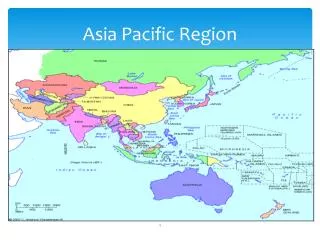
Pacific Region NCEP Model Review. Ken Waters Pacific Region Headquarters Honolulu, Hawaii Dec. 10, 2003. Pacific Region. Two forecast offices (Honolulu and Guam) Five Micronesia WSO’s One WSO in American Samoa. Pacific Region’s Challenge for 2004. Implementing IFPS in the region

E N D
Pacific RegionNCEP Model Review Ken Waters Pacific Region Headquarters Honolulu, Hawaii Dec. 10, 2003
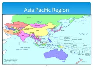
Pacific Region • Two forecast offices (Honolulu and Guam) • Five Micronesia WSO’s • One WSO in American Samoa
Pacific Region’s Challenge for 2004 • Implementing IFPS in the region • Last region to go operational • Initial Operational Capability (IOC) date is Oct 15, 2004 (CONUS was Oct 1, 2003) • Different challenges for PR due to island-based geography • Most forecast grid points fall over water • Lack of high-resolution model output, particularly for West Pacific • Big concern is the tropical cyclone wind field; recent experience has not gone well for CONUS coastal offices having to deal with this difficult problem
Models in the Pacific • Few options for West Pacific: • GFS (80 km run by EMC) • UKMET • NOGAPS • Global Wavewatch • Used extensively by both offices for marine and surf • In addition, for Hawaii: • RSM (10 km run by EMC) • Used to initialize winds in IFPS • MSM (As low as 2.5 km, run by Univ Hawaii) • Currently not available in AWIPS or N-AWIPS; only Web • Eta (8 km run by EMC)
WFO Honolulu • Hurricane Jimena • Early Sept. 2003 • Poor initialization on GFS • For several days, GFS kept focusing on a trough southwest of the actual center of the hurricane • Note the wind max located well north of the GFS storm center location Actual Location GFS Location
Honolulu – Hurricane Jimena • MSLP also showed center too far south • Eta also showed similar tendency to not initialize on the hurricane • Negative effect on WWIII output making it more difficult to forecast high surf conditions
Honolulu - Jimena • Even QuikSCAT showed limitations due to heavy convection around the small center of the hurricane that made analysis difficult
Honolulu – Jimena • What was useful was satellite imagery such as this TRMM pass which correctly identified the center
Honolulu Comments • GFS MOS (MAV) difficulties • When developing the equations, the only stations available were Honolulu and Hilo • Hilo has much higher precipitation (~150” vs. 25”) • Result is high POPs for Kona, which is at the same latitude as Hilo, but is normally much dryer than Hilo due to orography effects • Therefore, this product is not very useful for the forecast office
WFO Guam • Problem noted with GFS creating secondary “TC’s” behind actual developing “TC’s” • Reference correspondence on this between Bill Ward and Hua-Lu Pan • This effect tends to diminish the features in the actual storm • A major impact if GFS is used to initialize IFPS grids
WFO Guam • GFS performed very well for Typhoon Parma; this storm lingered across the central Pacific doing loops near Wake Island • Also, good performance for Typhoon Lupit • Office is experimenting now with using GFS to initialize IFPS • First looks indicate problems with weather and sky parameters • Frequently over-forecasts coverage of rain and isolated TS
PR Wish List • To run a “local” model for the West Pacific • Possibly either MM5 or WRF, run at PRH by DaNa Carlis, from the NOAA Educational Partnership Program / Graduate Scientist program • Need higher resolution model output for initialization of IFPS (currently using 80 km GFS to initialize grids at 5 km resolution!) • Looking forward to receiving MOS for the Pacific; sometime in 2004 • Improvements in the MAV GFS MOS product for Honolulu • Tropical Cyclone initialization for the GFS
Summary • Great job overall on the GFS • Need better model guidance for West Pacific • IFPS issues our primary concerns • Tropical Cyclone winds expected to be problem #1!