Download
1 / 34
340 likes | 442 Views
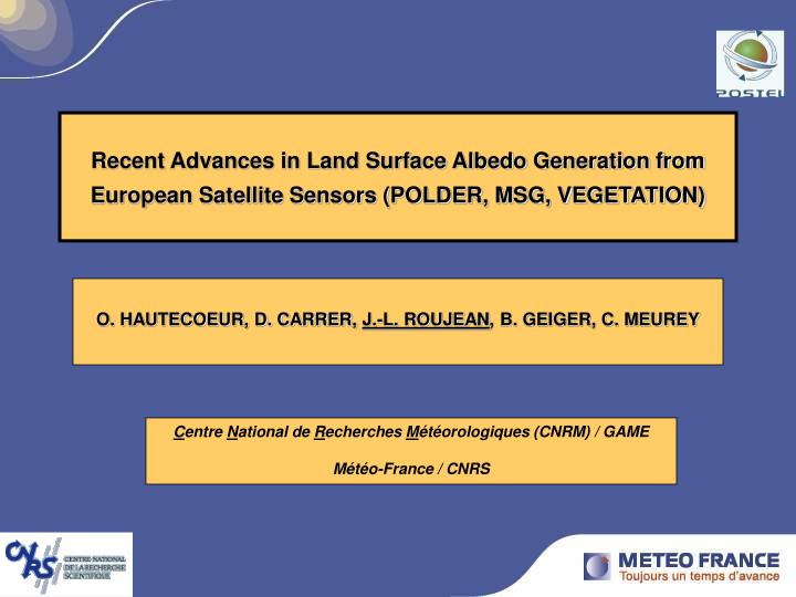
Recent Advances in Land Surface Albedo Generation from European Satellite Sensors (POLDER, MSG, VEGETATION). O. HAUTECOEUR, D. CARRER, J.-L. ROUJEAN , B. GEIGER, C. MEUREY. C entre N ational de R echerches M étéorologiques (CNRM) / GAME Météo-France / CNRS. Validation plan - Overview.

E N D
Recent Advances in Land Surface Albedo Generation from European Satellite Sensors (POLDER, MSG, VEGETATION) O. HAUTECOEUR, D. CARRER, J.-L. ROUJEAN, B. GEIGER, C. MEUREY Centre National de Recherches Météorologiques (CNRM) / GAME Météo-France / CNRS
Validation plan - Overview • A global analysis • Comparison with other land surface albedos according following criteria: global, routinely disseminated, free access. • 2 classes of products are analysed: • Albedos issued from radiation transfer codes and GCMs • (ISCCP, ECMWF, ARPEGE) • b) Albedos issued from a Ground Segment of remote sensing dataprocessing • (MISR, MODIS, MSA) • A local analysis • Comparison with ground-based pyranometers: • BSRN, ARM, SURFRAD, CarboEurope, AsiaFlux Objective criteria: seasonal trend, spatial coherence, gap filling, % of erroneous data, quality assessment, attempt of error explanation by other means.
Albedo MSG AVHRR-3 Spectral response functions
BRDF algorithm Kernel-driven BRDF models Isotropic geomeric volumetric + …+ BRD F Geo Iso 1 pixel Vol
Centre de Production POLDER (CPP) CPP distributes 2 products: • Directional Parameters products : spectral BRDF model coefficients. • Albedo : spectral Directional Hemispherical Reflectance (DHR) for median solar zenith angle (to be changed for solar noon for PARASOL/POLDER-3) • Synthesis period : 30 jours • Composite period : 10 jours • [enhanced weight is given to the data near central date] • DQX (Data Quality indeX) : includes ‘level of noise’ and quality of BRDF model inversion.
[ISCCP - POLDER] - range of variations [-0.25 ; 0.25 ] 15 April 2003 15 June 2003 ISCCP ISCCP POLDER POLDER -0.25 0.25 -0.25 0.25
Characteristics of GCMs albedo products ARPEGE (forecast product) ECMWF (forecast product) • solar product (0.4 - 3.0 µm) • global • monthly (snow-free) • tri-hourly (snow) • 1° degree (spatial resolution) • diffuse / direct albedos • ( ECOCLIMAP) • 0.5 ° degree (spatial resolution) • climatology ISLSCP Initiative II updated with soil reflectance, biophysical parameters [Los et al., 2000]. • vegetation albedo = 0.07 • snow albedo exposed = [ 0.5 , 0.85 ] • snow albedo shaded = 0.2 • diffuse / direct albedos
[ARPEGE - POLDER] - range of variations [-0.25 ; 0.25 ] 15 April 2003 15 October 2003 ARPEGE ARPEGE POLDER POLDER -0.25 0.25 -0.25 0.25
[ECMWF - POLDER] - range of variations [-0.25 ; 0.25 ] 15 Avril 2003 15 Octobre 2003 ECMWF ECMWF POLDER POLDER -0.25 0.25 -0.25 0.25
[MSA - POLDER] - range of variations [-0.25 ; 0.25 ] 15 April 2003 15 June 2003 MODIS MSA MSA POLDER POLDER -0.25 0.25 -0.25 0.25 Meteosat Surface Albedo < JRC + EUMETSAT -0.25 0.25 -0.25 0.25
[MISR - POLDER] - range of variations [-0.25 ; 0.25 ] 15 April 2003 15 June 2003 MODIS MISR MISR POLDER POLDER -0.25 0.25 -0.25 0.25 -0.25 0.25
[MODIS - POLDER] - range of variations [-0.25 ; 0.25 ] 15 April 2003 15 June 2003 MODIS MODIS MODIS POLDER POLDER -0.25 0.25 -0.25 0.25 -0.25 0.25 -0.25 0.25
SURFRAD POLDER MODIS
CarboEurope & AsiaFlux PAR albedo POLDER MODIS Shortwave albedo PAR albedo Shortwave albedo
SAF on Land Surface Analysis The main purpose of the Land SAF is to increase the benefits from MSG/SEVIRI and EPS/AVHRR-3 data related to land, land-atmosphere interactions and biophysical applications, namely by developing techniques, that will allow a more effective use of data from the two planned EUMETSAT satellites (MSG and EPS)
Data processing chain SAF NowCasting ECMWF (H20, 03, aerosols ?)
MSG vs MODIS MODIS MSG Bias of VIS = 0.015 (due to aerosols ?) Standard deviation : 0.015 (VIS) 0.030 (NIR) period August 13 – 28, 2006
[ MSG – MODIS ] Broadband - DHR Broadband - BHR Visible - DHR Near Infrared - DHR Europe June 1rst, 2005 October 1rst, 2006
MSG vs MODIS vs ECMWF Short-wave broadband albedo November 17 - December 2, 2005
BSRN station – TORAVERE (Estonia) BHR MSG BSRN DHR
AMMA sites – Agoufou (Mali) & Niamey (Niger) CESBIO station Ground measurement (orange). Land SAF albedo (black). Daily AOT from AERONET at 440nm (blue). [values on y-axis need to be multiplied by 10 ] Rainfall estimates from TRMM (in mm) (green). ARM station
Comparison of DSSF products Network RADOME of Météo-France
Ground-based validation of DSSF EUROPE AFRICA
VEGETATION / SPOT – 1 km blue red SWIR NIR
11/14 Assimilation – Kalman filter ECOCLIMAP-II land cover map (305 classes) K0 K1 CATCH zone (West Africa) K2 (Samain, Roujean and Geiger, RSE, 2007)
Overview of Land surface albedo - Essential climate variable to assess energy budget (via net absorbed radiation) in Numerical Weather Prediction (NWP) and climate modeling • Specifications required by end-users community for a snow-free albedo product is assessed around 0.03 (absolute units) • Validation is the process of determination by which a model provides a representation of the truth. Typically, it yields an analysis of the spatial variability ( i.e. the representation of the gradients at the continental scale ), plus the temporal evolution, typically over an annual cycle.