Download
1 / 51
550 likes | 890 Views
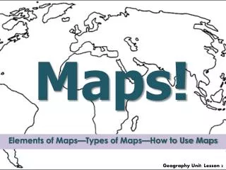
Maps Maps & More. What is a map?. http://www.brainpopjr.com/socialstudies/geography/readingmaps. Physical Map. Definition: A map that shows the location of physical features, such as landforms, bodies of water, or resources. Sentence: A climate zone map is a type of physical map.

E N D
What is a map? • http://www.brainpopjr.com/socialstudies/geography/readingmaps
Physical Map Definition: A map that shows the location of physical features, such as landforms, bodies of water, or resources.
Physical Feature Definition: The landforms, bodies of water, climate, natural vegetation, and soil of the earth that are created by nature and make a place unique.
Sentence: A few physical features of Georgia are the Atlantic Coastal Plain and the Chattahoochee River.
Landform Definition: A feature on the surface of the earth. http://www.brainpopjr.com/socialstudies/geography/landforms
Sentence: Examples of landforms are mountains, valleys, plateaus, deserts, plains, islands, and peninsulas.
Elevation Definition: Elevation is the altitude or height of the land above sea level. Green indicates lowest elevations. Brown indicates highest elevations.
Sentence: Mt. McKinley, Alaska is the highest elevation in the U.S. and Death Valley is the lowest elevation.
Great Plains Definition: In geography, a plain is land with relatively low relief (elevation), that is flat or gently rolling. Prairies and steppes are types of plains. The Great Plainsis a vast region of North America which lies west of the Mississippi River and east of the Rocky Mountains .
Sentence: The Great Plains is an important region for agriculture.
Great Lakes Definition: Five freshwater lakes between the United States and Canada.
Sentence: The five Great Lakes are Lake Superior, Lake Michigan, Lake Huron, Lake Erie, and Lake Ontario.
Continental Divide Definition: An imaginary line that sits atop a continuous ridge of mountain summits that divide the continent into two main drainage areas.
Sentence: The Continental Divide runs along the crest of the Rocky Mountains.
Great Basin Definition: A basin is a large or small depression in the surface of the land or in the ocean floor. The Great Basin is an area in the western United States (mostly in Nevada and part of California, Oregon, Idaho, and Utah) where rivers and lakes have no outlet to the ocean.
Death Valley Definition: Death Valleyis a desertvalley located in Eastern California. Situated within the Mojave Desert, it features the lowest, driest, and hottest locations in North America.
http://abcnews.go.com/GMA/video/death-valley-land-extremes-10343980http://abcnews.go.com/GMA/video/death-valley-land-extremes-10343980 Sentence: Table salt is a natural resource in Death Valley.
St. Lawrence River Definition: Links the Great Lakes to the Atlantic Ocean (490 N, 670 W)
http://vimeo.com/2399288 Sentence: Jacques Cartier was the first European to explore the St. Lawrence River.
Atlantic Coastal Plain Definition: A coastal plain is a flat, level area of land near an ocean. The Atlantic Coastal Plain is the area of the southern and southeastern U.S extends to the continental shelf and is generally characterized by level (flat) land with assorted mixed forests. The coastal areas include bayous, deltas, marshes, mud flats and swamps.
Sentence: The Atlantic Coastal Plain is a habitat for many sea birds.
Gulf of Mexico Definition: A gulf is a portion of an ocean or sea partly that is enclosed by land. The Gulf of Mexico is part of the Atlantic Ocean that is bordered by the southeast coast of the United States and the east coast of Mexico.
Sentence: The oil spill in the Gulf of Mexico caused major damage to the environment.
Political Map Definition: A map that shows boundaries of cities, states, and countries.
Sentence: The political map of the United States changed as new states were admitted.
Map Symbol Definition: A map symbol is something used to represent something else.
Sentence: A black dot is a symbol that usually represents a city.
Map Legend or Map Key Definition: A part of the map that explains any symbols or colors on a map. A map legend may also be referred to as a map key. http://player.discoveryeducation.com/index.cfm?guidAssetId=F0EDBDD3-91B9-4782-B4D7-EECC315114AD&blnFromSearch=1&productcode=US
Sentence: A map legend is like a dictionary; it tells what the map symbols mean.
Compass Rose Definition: A part of the map that shows the cardinal (N, S, E, W) and intermediate (NE, SE, SW, NW) directions. http://player.discoveryeducation.com/index.cfm?guidAssetId=F0EDBDD3-91B9-4782-B4D7-EECC315114AD&blnFromSearch=1&productcode=US
Location Definition: A word used to identify a point or an area on the earth’s surface or elsewhere. A synonym for location is place.
Sentence: The location of Sope Creek Elementary school is on Paper Mill Road in Marietta, GA.
Locations are found on a map by using a grid system made up of lines of latitude and longitude. http://www.brainpop.com/socialstudies/geography/latitudeandlongitude/
Latitude Definition: An imaginary horizontal line that measures the distance, north or south, in degrees from the equator (00). These lines are often referred to as parallels. .
Equator Definition: The imaginary line around the middle of the earth. It is 00 latitude.
Sentence: The equator divides the earth in half making two “equal” parts.
Longitude Definition: An imaginary vertical line that measures the distance, east or west, in degrees from the Prime Meridian (00). These lines are often referred to as meridians. .
Prime Meridian Definition: The line of longitude located at zero degrees (00).
Sentence: The Prime Meridian runs through Greenwich, England.
Map Scale Definition: A part of a map that compares distance on a map to distance in the real world.
Map & Globe Skills Review Physical features give each part of the country its special character. Examples of physical features are landforms, bodies of water, climate, natural vegetation, and soil. A landform is a feature on the surface of the land, such as The Atlantic Coastal Plain, The Great Plains, Continental Divide, The Great Basin, Death Valley, Gulf of Mexico, St. Lawrence River, and The Great Lakes. If you traveled across the United States from the Pacific to the Atlantic coast, you would see these unique physical features.
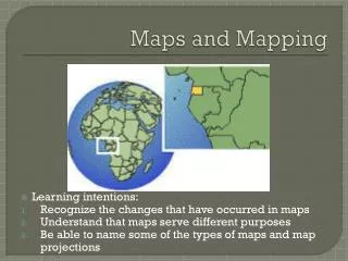
Geographers create maps that are visual representations of a portion of the earth. The features of a map help us understand the information presented. These special features on a map include: a map key, legend, symbol(s), compass rose, scale, and a grid system to help easily describe a location through latitude and longitude lines. There are two special lines on a world globe that are important to remember, the Prime Meridian (longitude) and the Equator (latitude).
There are many types of maps, but we will focus on two. A physical map is a map that shows location of physical features, such as landforms, bodies of water, or resources. A political map is a map that shows cities, states, and countries.