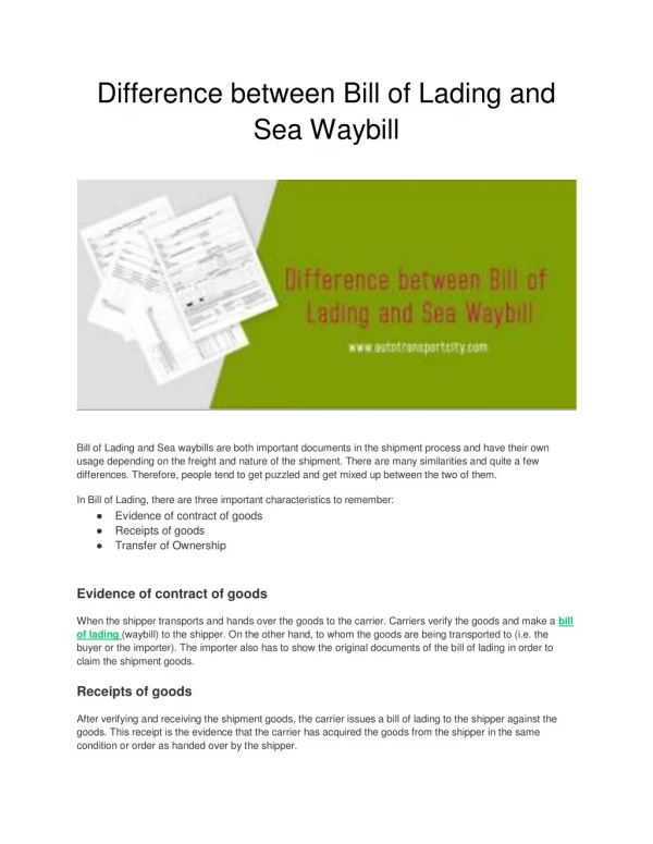
Download
1 / 28
280 likes | 405 Views
SHAPE between coast and sea. Olga Sedioli Directorate General for Environment, Soil and Coast Protection of Emilia-Romagna Region (IT). Introduction. S haping an H olistic A pproach to P rotect the Adriatic E nvironment: between coast and sea.

E N D
SHAPEbetween coast and sea Olga Sedioli Directorate General for Environment, Soil and Coast Protection of Emilia-Romagna Region (IT)
Introduction Shapingan Holistic Approachto Protectthe AdriaticEnvironment: between coast and sea SHAPEproject is co-funded within AdriaticIPA Cross-Border Cooperation Programme
General Information SHAPE was the only projectapproved within 1st Call for Ordinary projects of Adriatic IPA under Measure 2.1 “Marine & coastal environment protection and enhancement”. SHAPE has the second amongconsiderable budgets Start: March 2011 Duration: 36 months Budget: 4,1 Mln € Area : all the Adriatic Countries Lead partner: Emilia-Romagna Region
What is SHAPE? • a cross-border cooperation project that aims at sustainable developmentof the Adriatic maritime region • it enhances a rational and efficient use of the sea and its assets & resources through integrated approach • general objective: create amulti-level & cross-sector governanceto manage conflicting uses and users • focus: implement the existingIntegrated Coastal Zone Management& Maritime Spatial Planning tools in Adriatic area
Albania Env Centre for Admin & Tech, Tirana Montenegro Public Enterprise for CZM Bosnia-Herzegovina Ministry Civ Eng & Phys Planning HNC Croatia Instit. of Phys. Planning, Istria Region PAP/RAC Split Slovenia Regional Development Centre Koper Italia Regione Emilia-Romagna Regione Veneto ARPA Friuli Venezia Giulia Regione Marche ARPA Molise Regione Abruzzo Regione Puglia The partnership
Associate Partners Croatia City of Pula Ministry for Environment Region of Istria Slovenia Ministry of Environment and Spatial Planning Municipality of Piran Italy Ministry of Environment, Land & Sea Protection
Why an Adriatic project on ICZM and MSP? Extraordinary value of Adriatic Seaamong world inland seas, fundamental for the wellbeing and the strategic for prosperity of Adriatic Countries: a great environmental, cultural, economic value. Increasing pressures: human activities in coastal and marine areas develop conflicting claims on space and resources that threat some of most sensitive and precious habitats & assets. Added value ofcross-border cooperation: many issues cross regional and national borders. Sharing a common approach to manage coastal and marine space in the same sea basin can allow a better facing of global challenges (e.g. climate change).
Framework references for ICZM and MSP policies ICZM: the Protocol entered into force 24th March 2011 MSP: Roadmapfor Maritime Spatial Planning indicating 10 key principles COM(2008)791
SHAPE structure WP1&WP2 coordinated by Emilia-Romagna Region WP3coordinated by PAP/RAC in Split WP4coordinated by Veneto Region WP5coordinated by Slovenia
General objectives (1) • makehumanactivities moresustainablein maritime & coastal areas • manage & solveconflicts among different uses & usersand support the decision-making processes • strengthen therole of ICZMto the Adriatic region scaleand build the basis for national and local strategies • enhance Maritime Spatial Planning (MSP) in the Adriatic area basing on EU key principles • reach a good level of coherence between spatial planning of land and sea, in order to create a link between ICZM & MSP
General objectives (2) • improve theinstitutional structure, involving stakeholders and arising public awareness • share data & experiences as a common basis of knowledge to allow acoherent & aware governancefor the maritime and coastal environment • develop acoherent frameworkof Adriatic Sea, contribute to EMODNET & objectives of Marine Framework Strategy • coordinateactivities in Adriatic Sea with other experiences in the European framework • create anAdriatic Networkto enhance and developsynergiesamong different projects
WP2 Coordinator: Emilia-Romagna Region (Italy) Communication &Dissemination Objective: develop atransnational cross-border coordinated approachunder both strategic and operational point of view developsynergieswith other similar project in the EU context Results: • creation of SHAPE web portal including theAdriatic Regional Forumon coastal Sustainability • social networks: follow SHAPE on Facebook and Twitter! • International Conferences: (Bari, Venice) in cooperation with Partners • Two Coast Day celebrations organized (2012 in Split, 2013 in Rimini)
TEPproject Developing synergies:the FACECOAST clusterFace the challenge of climate change in the med coastal zones Aim: gather & capitalize contributions of EU projects concerning coastal defense against natural & anthropogenic risks in the frame of adaptation to climate change & sustainable development policies. Target: promote an exchanging spaceon Med coastal defense against erosion, flooding hazards and consequent risks, taking into account ICZM approach and extra-Med experiences. Therefore coastal defense is open towards other interdisciplinary & multi-sectoral contributions (projects) as link units through which exchange with other interlaced issues. SHAPE joined FACECOAST cluster in March 2012
WP3 Integrated Coastal Zone Management • Coordinator: • PAP/Regional Activity Centre • in Split (Croatia) Objective: develop anintegrated approachto manage the multiple, interwoven, overlapping interests of coastal areas in a coordinated & rational way, harnessingcoastal resourcesfor optimum social & economic benefit for present & future generations, maintaining agood environmental status. ICZMis a continuous process of achieving such goals & objectivesof sustainable developmentin coastal areas. PAP/RACprovides its expertise and know-how inimplementing the ICZM Protocol.
WP3 Results… 3.1 Analysis of current national legislation and comparison with ICZM Protocol: PAP/RAC prepared a common outline for Partners to elaborate reports on national/local ICZM Practice in comparison with Protocol provisions the PAP/RAC outline were used for MAREMED - Pilot Action A 3.2 Definition of the setback zone PAP/RAC prepared an explanatory report on ProtocolArt. 8 as a term of reference for Partners to elaborate pilot actionsaiming to test the implementation and applicability of these Protocol provisions the PAP/RAC report & the Emilia-Romagna setback line definition approach were used for MAREMED - Pilot Action B
WP3 …Results 3.3 Outline for the ICZM National Strategies for the Adriatic Countries: PAP/RAC elaborated a draft proposal for the elaboration of National ICZM Strategies as defined in Art. 18 of the Protocol 3.4 Institutional coordination PAP/RAC prepared an explanatory report on ProtocolArt. 7 provisions in order to draft the proposal for setting up a common general governance framework for ICZM 3.5 Capacity building for effective implementation of ICZM Protocol PAP/RAC helped to organizeone training course in Abruzzo(June 2013)and is currently implementing the MedOpen virtual training course
Shipping towards Maritime Spatial Planning WP4 Coordinator: Progetto Venezia Department Veneto Region (Italy) Objective: manageconflictsamong different uses & users on marine space & resources, mitigate impacts by carrying out anholistic analysis of maritime spaceto support the development of coherent pictures and the elaboration of spatial plans, integrating existing policy tools. evaluate how tointegrate environmental aspects in MSP, alsoaccording toWFDand Marine Strategyimplementation. WP4 aims to create amethodology ad hoc for planning in maritime areasin the Adriatic Region and to test MSP at local scale by common data processing and mapping.
WP4 Results: 4.1 integrated analysis of legal framework, policies & planning instruments:coordinator gathered Partners reportsaiming to develop an holistic approach to a common and legally binding planning. 4.2 an ecosystem approach to MSP:WP coordinator prepared a table compliant with Marine Strategy requirements to gather information on environmental status and describe the ecosystem characteristics of the Adriatic marine sub-region 4.3 analysis of criticalities for MSP and creation of thematic maps: coordinator provided a questionnaire for partners & stakeholders aimed to define relevant topics to develop and issues\sectors to work on
4.4 integration between MSP&ICZM: coordinator supports Partners to implement pilot projects aimed to test such integration Location of pilot projects. 4.5 developing a common methodology for MSP: the action aims at defining guidelines for the implementation of different steps and principles of MSP
WP5 Within land and sea Coordinator: Regional Development Centre Koper (Slovenia) Objective: promote theintegration between ICZM & MSPin the Adriatic area, reach coherence between terrestrial and marine spatial planning. develop a demonstrativeGIS Atlasfor Adriatic basin as acommon & exhaustive knowledge base, able to integrate coastal & marine databases at different scales, a tool to support decision making processes. The goal is to define themost relevant common topicsto be considered at regional scale for integrating ICZM & MSP, not only legal basis but also who thepotential usersare, which functionalities they need or expect GIS to have and thepurpose(processes, actors, input elements, output elements).
WP5 Results: 5.1 definition of most relevant topics & contents: collection & analysis of relevant topics/legislative frameworks using top-down method (from UN, EU, regional, national to local level), in coordination with results of WP3 & WP4, considering existing relevant GIS applications and similar relevant projects 5.1 analysis of users demands: coordinator elaborated a specific questionnaire and semi-structured interviews to potential GIS users (government, regional, provincial & local administrations, international organizations, scientific community & public) in order to define their purposes, data requirements, classify and describe information and their relationships, etc.
5.2 developing the structure: coordinator & Lead Partner gathered data and metadata at basin scale with contributions from all Partners, building the GIS structure and the catalogue; the structure gives the possibility to develop the GIS also at local level • 5.3 building the GIS Adriatic Atlas : Lead Partner and Coordinator are implementing the database and the structure of the geographic information system so that it can be an integrated tool able to support the implementation of ICZM and MSP • 5.4 creating the database of legislative & planningtools: coordinator is building a specific database of georeferenced documents related to and concerning ICZM and MSP (gathering results from WP3 & WP4).
Thank you for your attention! http://www.shape-ipaproject.eu/