Download
1 / 40
400 likes | 560 Views
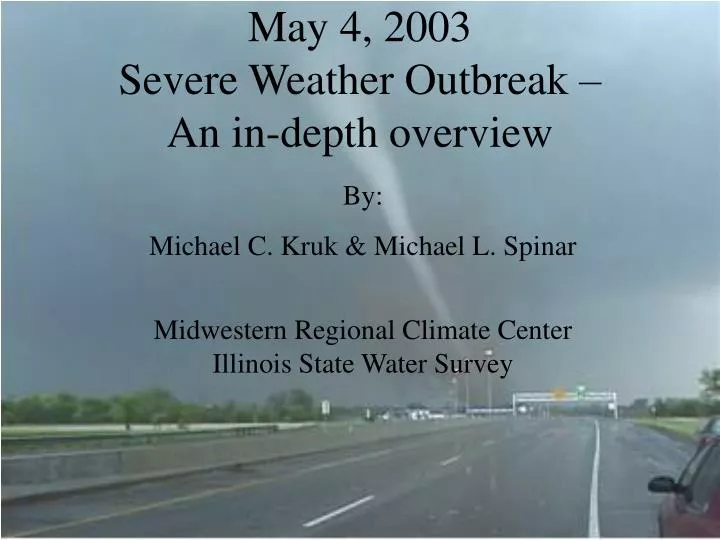
May 4, 2003 Severe Weather Outbreak – An in-depth overview. By: Michael C. Kruk & Michael L. Spinar Midwestern Regional Climate Center Illinois State Water Survey. May 4, 2003 Severe Weather Outbreak – An in-depth overview. Synoptic Setup ETA Model Forecasts

E N D
May 4, 2003Severe Weather Outbreak – An in-depth overview By: Michael C. Kruk & Michael L. Spinar Midwestern Regional Climate Center Illinois State Water Survey
May 4, 2003Severe Weather Outbreak – An in-depth overview • Synoptic Setup • ETA Model Forecasts • Radar Analysis and Storm Development • Summary of Impacts
The Outlook • Issued by the Storm Prediction Center at 8am CDT on Sunday, May 4 • High risk means: • Major severe weather outbreak anticipated • At least 20 tornadoes, 2 of which are rated F3+ • Widespread wind damage (50+ reports) • Wind gusts in excess of 80 mph
The Outlook – 13Z Probabilities Hail Tornado Wind Courtesy of SPC Day 1 Outlook 13Z 05/04/03
The Outlook - Text SIGNIFICANT SEVERE TSTM EVENT LIKELY...WITH OUTBREAK OF TORNADOES...LARGE HAIL AND DAMAGING WIND ANTICIPATED TODAY FROM MUCH OF ERN KS/ERN OK AND MO SWWD AT LEAST AS FAR AS SE OK/NE TX...SHIFTING EWD WITH TIME ACROSS MO/AR/WRN IL. POTENTIAL EXISTS FOR LONG-TRACK AND VIOLENT TORNADOES WITH A FEW SUPERCELLS IN HIGH RISK AREA...AND SEVERAL CYCLIC/MULTIPLE TORNADO PRODUCING STORMS SHOULD OCCUR. NUMEROUS EVENTS OF DAMAGING GUSTS/HAIL ARE POSSIBLE WITH THESE STORMS...AS WELL AS WIND DAMAGE FROM LATER BOWS/LEWPS THAT MAY EVOLVE FROM EARLY SUPERCELLS. Text courtesy of SPC Day 1 Outlook 13Z 05/04/03
12Z Synoptic Overview – Why a HIGH Risk? 250mb Divergence from Jet Streak Left Exit Region + Developing Short Wave Trough Polar Jet 90 kt 110 kt 130 kt Subtropical Jet Map courtesy of University of Wyoming
12Z Synoptic Overview – Why a HIGH Risk? 500mb Impressive Diffluence* 50 kts 50 kts Jetstreaks *Diffluence is often used as a proxy for divergence and shear aloft. However, one must be careful that there is no speed convergence when it is used. Map courtesy of University of Wyoming
12Z Synoptic Overview – Why a HIGH Risk? 850mb Impressive Height Falls Edge of capping inversion Deep moisture 18 C 20 C 50 kts! LLJ 30 kts Map courtesy of University of Wyoming
12Z Synoptic Overview – Why a HIGH Risk? Intensifying surface low Strong Temp. Contrast Strong fronts & dryline Deep Moisture Map courtesy of University of Wyoming
Synoptic Overview – Why a HIGH Risk? Shortwave troughs Strong Jet
Elevated convection Dry wedge
Synoptic Overview – Why a HIGH Risk? Notice the VGP exceeds the tornado threshold of 0.35. VGP is the Vorticity Generation Parameter, and takes into account both the amount of shear and the instability available. More shear will increase the horizontal spin, and more instability will lead to a stronger updraft that will better tilt this spin into a mesocyclone. Also, there is evidence of some mid-level drying, and a very small cap. Sounding courtesy of UCAR
Synoptic Overview – Why a HIGH Risk? Notice the extremely favorable veering of the winds and increasing speed with height. But also notice the large mid-level capping inversion. Sounding courtesy of UCAR
Synoptic Overview – Why a HIGH Risk? 18Z Analysis Summary • Based on what we’ve seen so far, Topeka, KS and points further southwest look more favorable than does Springfield, MO at 18Z. • Topeka sounding at 18Z is significantly more unstable and has virtually no cap. • Springfield sounding shows convective cloud debris left over from morning convection at 18Z – insolation not yet taking place. • We know there is enough speed and directional shear with height, but specifically, will supercells develop in the high risk area? • Will the large cap over SGF erode in conjunction with all the necessary atmospheric parameters to produce severe weather that specifically warrants a HIGH risk?
Wait! Has the cap really eroded in just two hours?? Really dry… Really juicy…
Elevated convection north Line of supercells south
Synoptic Overview – Why a HIGH Risk? 20Z Analysis • 20Z analysis indicates atmosphere is primed for explosive development. A kick to one parcel seems to be enough… • Both TOP and SGF have an excellent PBL profile for tornadoes (quite moist and lots of low-level wind shear). • 20Z outlook from SPC suggests threat remains high across most of Missouri, including the Springfield area. 20Z SGF sounding supports this notion. • What eroded the significant cap at SGF in just 2 hours? • Given the amount of wind shear and low-level directional turning, supercells seem quite likely if convection can develop. What about the threat for violent, destructive tornadoes? What forcing mechanism exists, if any, to tap into this instability? • Let’s take a look at the ETA model output to see what is forecast to happen during the late afternoon and evening hours.
ETA Cross-Section from Dodge City KS, to Indianapolis, IN @ 12Z May 4 Screaming Jet Rising motion ahead of the front Plentiful low-level moisture FRONTAL ZONE Data courtesy of UNIDATA using GARP interface.
Strong mid-level jet moving into the High Risk area Forecast map courtesy of UCAR
Double-lobed low height center Short-wave troughs Forecast map courtesy of UCAR
Trough has moved across the high risk area Forecast map courtesy of UCAR
The Storm Development Phase Overshooting tops Satellite image courtesy of SPC
The Storm Development Phase Winds/Pressure Winds/Moisture Convergence Large values of moisture convergence near the surface low and associated fronts Deep May low & strong pressure gradient => Strong winds Analysis maps courtesy of the Department of Atmospheric Sciences, University of Illinois
The Storm Development Phase Warm front Dry! Dryline Funnel Cloud! WINDY! Unseasonably moist Surface map courtesy of UCAR
The Storm Development Phase PDS Watches!!
The Storms Explode on Radar Discrete supercells anyone?
Radar from EAX Are these really all hook echoes? YES!
Radar from EAX – Storm Relative VelocityHow many mesocyclones can you find? Hint: Look for inbound (red & yellow) next to outbound (blue) velocities.
Radar from SGF – Storm Relative VelocityKeep counting those mesocyclones!
Radar from SGF Classic Supercell Radar Signature
Radar from SGF – Storm Relative Velocity The “BIG ONE” Kansas Interstate 44 OKLAHOMA MISSOURI Miami Newton County Outbound Radial velocities Neosho Ottawa County Inbound radial velocities McDonald County Mesocyclone
Ground TruthThe “BIG ONE” Rain-wrapped tornado
Line with supercellular elements More severe storms firing east in TN/KY
Summary of Impacts REDEFINED: Map courtesy of the Storm Prediction Center Courtesy of the Storm Prediction Center
8 states affected Potential for a dangerous situation seen as early as 48 hours prior to start of event 35 miles SW of Springfield – more than 10 fatalities Tornado was on the ground for half an hour and leveled a fire station in Battlefield, MO, and destroyed an electrical substation in Carl Junction, MO. First tornado report of the day made at 1:40pm CDT. Occurred 2-3 miles north of Pauline, in Adams County of south-central Nebraska 3:55pm – tornado hits Leavenworth County Kansas and stays on the ground for 90 minutes. 1 death near Kansas City intersection of I-70 and I-435. 400 homes damaged in Green County, MO alone Summary of Impacts
According to the NWS in Pleasant Hill, MO, two of the tornadoes received a maximum intensity rating of F4, with two others at F2, and one tornado as an F1. The F4 rating is the highest rating that the Metropolitan area has seen since 1977. A total of 25 tornado warnings were issued on Sunday from the Pleasant Hill Office Warnings were issued by the NWSFO with an average lead time of 15 minutes prior to tornado touchdown Summary of Impacts (con’t)
Devastating Damage Tornado families Map provided by NWS EAX