Download
1 / 1
10 likes | 136 Views
AdcircLite -NC Rapid computation of storm surge and waves for NC coastal waters Jesse Bikman 1 , Brian Blanton 2 , Alexander Taflandis 3 , Andrew Kennedy 3

E N D
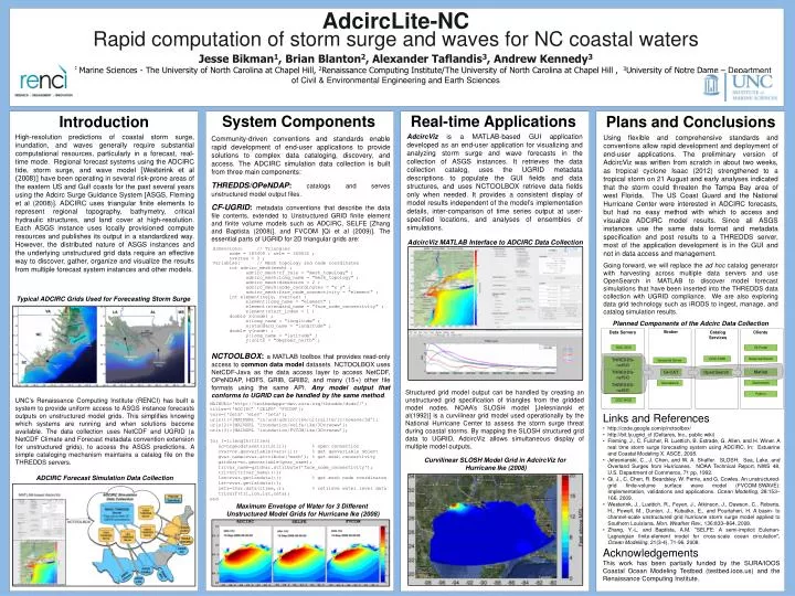
AdcircLite-NCRapid computation of storm surge and waves for NC coastal waters Jesse Bikman1, Brian Blanton2, Alexander Taflandis3, Andrew Kennedy3 1Department of Marine Sciences - The University of North Carolina at Chapel Hill, 2Renaissance Computing Institute/The University of North Carolina at Chapel Hill , 3University of Notre Dame – Department of Civil & Environmental Engineering and Earth Sciences Real-time Applications System Components Introduction Plans and Conclusions AdcircViz is a MATLAB-based GUI application developed as an end-user application for visualizing and analyzing storm surge and wave forecasts in the collection of ASGS instances. It retrieves the data collection catalog, uses the UGRID metadata descriptions to populate the GUI fields and data structures, and uses NCTOOLBOX retrieve data fields only when needed. It provides a consistent display of model results independent of the model’s implementation details, inter-comparison of time series output at user-specified locations, and analyses of ensembles of simulations. High-resolution predictions of coastal storm surge, inundation, and waves generally require substantial computational resources, particularly in a forecast, real-time mode. Regional forecast systems using the ADCIRC tide, storm surge, and wave model [Westerink et al (2008)] have been operating in several risk-prone areas of the eastern US and Gulf coasts for the past several years using the Adcirc Surge Guidance System [ASGS, Fleming et al (2008)]. ADCIRC uses triangular finite elements to represent regional topography, bathymetry, critical hydraulic structures, and land cover at high-resolution. Each ASGS instance uses locally provisioned compute resources and publishes its output in a standardized way. However, the distributed nature of ASGS instances and the underlying unstructured grid data require an effective way to discover, gather, organize and visualize the results from multiple forecast system instances and other models. Using flexible and comprehensive standards and conventions allow rapid development and deployment of end-user applications. The preliminary version of AdcircViz was written from scratch in about two weeks, as tropical cyclone Isaac (2012) strengthened to a tropical storm on 21 August and early analyses indicated that the storm could threaten the Tampa Bay area of west Florida. The US Coast Guard and the National Hurricane Center were interested in ADCIRC forecasts, but had no easy method with which to access and visualize ADCIRC model results. Since all ASGS instances use the same data format and metadata specification and post results to a THREDDS server, most of the application development is in the GUI and not in data access and management. Going forward, we will replace the ad hoc catalog generator with harvesting across multiple data servers and use OpenSearch in MATLAB to discover model forecast simulations that have been inserted into the THREDDS data collection with UGRID compliance. We are also exploring data grid technology such as iRODS to ingest, manage, and catalog simulation results. Community-driven conventions and standards enable rapid development of end-user applications to provide solutions to complex data cataloging, discovery, and access. The ADCIRC simulation data collection is built from three main components: THREDDS/OPeNDAP:catalogs and serves unstructured model output files. CF-UGRID: metadata conventions that describe the data file contents, extended to Unstructured GRID finite element and finite volume models such as ADCIRC, SELFE [Zhang and Baptista (2008)], and FVCOM [Qi et al (2009)]. The essential parts of UGRID for 2D triangular grids are: AdcircViz MATLAB Interface to ADCIRC Data Collection dimensions: // Triangles node = 185409 ; nele = 369032 ; nvertex = 3 ; Variables: // Meshtopology and nodecoordinates intadcirc_mesh(mesh) ; adcirc_mesh:cf_role = "mesh_topology" ; adcirc_mesh:long_name = "mesh_topology" ; adcirc_mesh:dimension = 2 ; adcirc_mesh:node_coordinates = "x y" ; adcirc_mesh:face_node_connectivity = "element" ; intelement(nele, nvertex) ; element:long_name = "element" ; element:standard_name = "face_node_connectivity" ; element:start_index = 1 ; double x(node) ; x:long_name = "longitude" ; x:standard_name = "longitude" ; double y(node) ; y:long_name = "latitude" ; y:units = "degrees_north" ; Broker Data Servers Catalog Services Clients Typical ADCIRC Grids Used for Forecasting Storm Surge OGC-SOS GI-Portal Geoportal Server OGC-CSW THREDDS-ncISO Geoportal Server Planned Components of the Adcirc Data Collection Matlab OpenSearch THREDDS-ncISO GI-CAT Geonetwork Geonetwork THREDDS-ncISO Python OGC-WCS NCTOOLBOX: a MATLAB toolbox that provides read-only access to common data model datasets. NCTOOLBOX uses NetCDF-Java as the data access layer to access NetCDF, OPeNDAP, HDF5, GRIB, GRIB2, and many (15+) other file formats using the same API. Any model output that conforms to UGRID can be handled by the same method. Structured grid model output can be handled by creating an unstructured grid specification of triangles from the gridded model nodes. NOAA’s SLOSH model [Jelesnianski et al(1992)] is a curvilinear grid model used operationally by the National Hurricane Center to assess the storm surge threat during coastal storms. By mapping the SLOSH structured grid data to UGRID, AdcircViz allows simultaneous display of multiple model outputs. UNC’s Renaissance Computing Institute (RENCI) has built a system to provide uniform access to ASGS instance forecasts outputs on unstructured model grids. This simplifies knowing which systems are running and when solutions become available. The data collection uses NetCDF and UGRID (a NetCDF Climate and Forecast metadata convention extension for unstructured grids), to access the ASGS predictions. A simple cataloging mechanism maintains a catalog file on the THREDDS servers. MAINURL=‘http://testbedapps-dev.sura.org/thredds/dodsC/’; titles={'ADCIRC’ 'SELFE’ ‘FVCOM’}; vars={'zeta’ ‘elev’ ‘zeta’}; uris{1}=[MAINURL ‘in/und/adcirc/ike/ultralite/lr/nowave/3d’]; uris{2}=[MAINURL ‘inundation/selfe/ike/3Dvrwoww’]; uris{3}=[MAINURL ‘inundation/FVCOM/ike/3Dvrwoww’]; for 1=1:length(titles) nc=ncgeodataset(uris{i}); % open connection zvar=nc.geovariable(vars{i}); % get geovariable object gvar_name=zvar.attribute('mesh'); % get mesh connectivity gridvar=nc.geovariable(gvar_name); trivar_name=gridvar.attribute('face_node_connectivity'); tri=nc{trivar_name}(:); lon=zvar.getlondata(:); % get mesh node coordinates lat=zvar.getlatdata(:); zeta=zvar.data(itime,:); % retrieve water level data trisurf(tri,lon,lat,zeta); end • Links and References • http://code.google.com/p/nctoolbox/ • http://bit.ly.ugrid_cf (Deltares, Inc., public wiki) • Fleming, J., C. Fulcher, R. Luettich, B. Estrade, G. Allen, and H. Winer. A real time storm surge forecasting system using ADCIRC. In: Estuarine and Coastal Modeling X. ASCE, 2008. • Jelesnianski, C., J. Chen, and W. A. Shaffer. SLOSH: Sea, Lake, and Overland Surges from Hurricanes. NOAA Technical Report, NWS 48, U.S. Department of Commerce, 71 pp, 1992. • Qi, J., C. Chen, R. Beardsley, W. Perrie, and G. Cowles. An unstructured-grid finite-volume surface wave model (FVCOM-SWAVE): Implementation, validations and applications. Ocean Modelling, 28:153–166, 2009. • Westerink, J., Luettich, R., Feyen, J., Atkinson, J., Dawson, C., Roberts, H., Powell, M., Dunion, J., Kubatko, E., and Pourtaheri, H. A basin- to channel-scale unstructured grid hurricane storm surge model applied to Southern Louisiana. Mon. Weather Rev., 136:833–864, 2008. • Zhang, Y.-L. and Baptista, A.M. "SELFE: A semi-implicit Eulerian-Lagrangian finite-element model for cross-scale ocean circulation", Ocean Modelling, 21(3-4), 71-96, 2008. • Acknowledgements • This work has been partially funded by the SURA/IOOS Coastal Ocean Modeling Testbed (testbed.ioos.us) and the Renaissance Computing Institute. Curvilinear SLOSH Model Grid in AdcircVizfor Hurricane Ike (2008) ADCIRC Forecast Simulation Data Collection Maximum Envelope of Water for 3 Different Unstructured Model Grids for Hurricane Ike (2008)