Download
1 / 27
290 likes | 593 Views
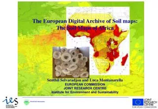
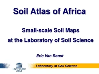
Soil Atlas of Africa. Small-scale Soil Maps at the Laboratory of Soil Science. Eric Van Ranst. Laboratory of Soil Science. Overview. image files (scans). vector maps. Laboratory of Soil Science. Central African Soil Database : Regional. 1) Soil map of the Belgian Congo & Ruanda-Urundi.

E N D
Soil Atlas of Africa Small-scale Soil Maps at the Laboratory of Soil Science Eric Van Ranst Laboratory of Soil Science
Overview image files (scans) vector maps Laboratory of Soil Science
Central African Soil Database : Regional 1) Soil map of the Belgian Congo & Ruanda-Urundi vectorised * 1:5 M * 1958-1959 (C. Sys) * INEAC classification ~ Soil Taxonomy Laboratory of Soil Science
Carte des Sols du Congo Belge et du Ruanda-Urundi
Central African Soil Database : Regional 2) Soil association map of Rwanda & Burundi * 1:1 M image * 1957 – 1961 (A. Van Wambeke) * INEAC classification Laboratory of Soil Science
Carte des Sols du Rwanda et du Burundi
Central African Soil Database : Regional 3) SOTER Central Africa (2007) vectorised * 1:2 M for DR Congo * 1:1 M for Rwanda, Burundi * WRB classification
Central African Soil Database : Rwanda 1) Soil map of Rwanda vectorised * 1:250,000 * 1992 * legend ~ parent material, development, texture, depth, drainage Laboratory of Soil Science
Central African Soil Database : Rwanda A . C 6 3 dominant: I.A3 secundary: G.K5.z tertiary: I.C4.gr association Laboratory of Soil Science
Central African Soil Database : Rwanda 2) Soil map of Rwanda * 1:50,000 * 2000 * 43 sheets * legend ~ parent material, development, texture, depth, drainage * soil profile classification ~ INEAC, USDA, FAO vectorised Laboratory of Soil Science
Central African Soil Database : Burundi 1) Soil map of Burundi * 1:250,000 vectorised * 1988 * soil classification ~ INEAC, USDA (1975), FAO (1975) Laboratory of Soil Science
Central African Soil Database : Burundi 2) Soil map of Burundi * 1:50,000 image * 2000 * 42 sheets * soil classification : great group & subgroup of the ISABU classification Laboratory of Soil Science
Central African Soil Database : DR Congo Soil maps realised between 1945 – 1960 by INEAC Soil maps realised after 1960 by Ghent University Coverage of about 15% vectorised image • digitalisation project is ongoing collaboration with UNIKIN and UNILU Laboratory of Soil Science
Central African Soil Database : DR Congo 1) Soil map of the Lower Congo and Kinshasa * 1:200,000 * 1991 * 8 sheets * cartographic legend ~ parent material profile development texture soil depth * soil profiles : INEAC, USDA (1975), FAO (1988) Laboratory of Soil Science
Central African Soil Database : DR Congo 2) Reconnaissance soil map of the Kwango * 1:1,000,000 * 1955 * 1 sheet, associations or complexes, INEAC 3) Reconnaisance soil map of the Kasai * 1:200,000 * 1958 * 2 sheets, associations of soil series ~ parent material & soil profile development Laboratory of Soil Science
Central African Soil Database : DR Congo 4) Soil map of the Upper Lulua * 1:1,000,000 * 1959 - 1960 * great groups ~ INEAC classification 5) Soil association map of the Upper Lulua – Dilolo * 1:200,000 * 1959 - 1960 * associations reporting parent material, development & texture Laboratory of Soil Science
Central African Soil Database : DR Congo 6) Reconnaissance soil map of Maniema * 1:250,000 * 1960 * 1 sheet, complexes, INEAC classification 7) Soil maps of the Kivu * 1:50,000 – 1:500,000 * 1950 - 1970 * 3 sheets Laboratory of Soil Science
Central African Soil Database : DR Congo 8) Soil maps of the Eastern Province * 1:40,000 – 1:200,000 * 1952 - 1959 * 8 sheets 9) Soil maps of the Equator * 1:50,000 – 1:100,000 * 1956 - 1968 * 8 sheets Laboratory of Soil Science
Other Soil Maps (image files) 1) Soil map of Cameroon image * 1:500,000 – 11 sheets (not published) * 1982 – 1990 (E. Van Ranst & J. Debaveye) * great group level (Soil Taxonomy) 2) Soil map of the Republic of Botswana image * 1:1M – 2 sheets * 1990 * soil group & 1 subgroup ~ FAO legend Laboratory of Soil Science
Other Soil Maps (image files) 3) Soils and physiography of Tanzania * 1:2M image * 1983 * FAO legend 4) Provisional soil map of Zimbabwe - Rhodesia * 1:1M image * 1979 - 2nd Edition Laboratory of Soil Science
Other Soil Maps (image files) 5) Soil map of the Republic of Zambia image * 1:500,000 * 1967 * legend ~ soil map Africa ‘63 6) Soil mapof theRepublic of Zambia image * 1:3M * 1983 * FAO legend Laboratory of Soil Science
Other Soil Maps (image files) 7) Soil map of Tunesia image * 1:1M 8) Soil map of Algeria image * 1:500,000 – 7 sheets 9) Soil map of the Arabic countries : North Morocco * 1:1M image Laboratory of Soil Science