Download
1 / 55
550 likes | 643 Views
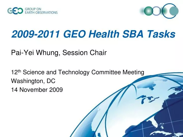
2009-2011 GEO Health SBA Tasks. Pai-Yei Whung, Session Chair 12 th Science and Technology Committee Meeting Washington, DC 14 November 2009. GEO Health Social Benefit Area. GEO is working with the health community to improve the flow of user-friendly environmental data.

E N D
2009-2011 GEO Health SBA Tasks Pai-Yei Whung, Session Chair 12th Science and Technology Committee Meeting Washington, DC 14 November 2009
GEO Health Social Benefit Area GEO is working with the health community to improve the flow of user-friendly environmental data. Comprehensive data sets support prevention, early warning, research, health-care planning and delivery, and timely public alerts.
GEO Health Tasks • HE-09-01: Information Systems for Health • HE-09-02: Monitoring and Prediction Systems for Health • HE-09-02a: Monitoring and Prediction of Aerosol Impacts on Health and Environment • HE-09-02b: Air Quality Observations, Forecasting and Public Information • HE-09-02c: Global Monitoring Plan for Persistent Organic Pollutants • HE-09-02d: Global Monitoring Plan for Atmospheric Mercury • HE-09-03: End-to-End Projects for Health • HE-09-03a: Implementation of Meningitis Decision-Support Tool • HE-09-03b: Implementation of a Malaria Early Warning System • HE-09-03c: Ecosystems, Biodiversity and Health: Decision Support Tools and Research
HE-09-01: Information Systems for HealthEmily Firth Background To improve predictive and decision support tools for human diseases with environmental drivers (e.g., malaria, meningitis, heat-related illness), more extensive, validated observation and epidemiological data are needed.
HE-09-01: Information Systems for Health Goals Improve in-situ environmental and health data collection for the utilization and validation of remotely sensed data. Explore how GEOSS will support the collection and distribution of information and meet the diverse needs of the health community. Support further development of a global public health information network database to improve health decision-making at the international, regional, country, and district levels. Interface WHO’s Global Health Observatory with other health and environmental systems and the GEO GEOSS Common Infrastructure (GCI).
HE-09-01: Information Systems for Health Science and Technology • WHO is developing the Global Health Observatory to help health practitioners, scientists, and others find models, risk factors, and research outputs for specific diseases. • “Health and Environment” module provides access to data from WHO and other organizations on diseases with environmental risk factors. • Goal is to assess and validate decision support tools assess and validate those being developed, working toward standardized assessment tools.
HE-09-02: Monitoring and Prediction Systems for Health Goals Support the development of operational health-related applications. Connect established and emerging cross-cutting Earth-observation systems to health monitoring and prediction systems.
HE-09-02a. Monitoring and Prediction of Aerosol Impacts on Health and EnvironmentLeonard Barrie NASA image by Jeff Schmaltz, MODIS Rapid Response Team, Goddard Space Flight Center.
HE-09-02a. Monitoring and Prediction of Aerosol Impacts on Health and Environment Background Sand and dust aerosols can travel hundreds or thousands of miles, carrying fine particles, spores, bacteria, viruses, and persistent organic pollutants. Health impacts can include respiratory and cardiovascular illness, eye infections, and in some regions, diseases such as meningitis and valley fever. An estimated 300,000 premature deaths worldwide may result from long-range transport of PM2.5 in sand and dust aerosols (Mauzerall, 2008).
HE-09-02a. Monitoring and Prediction of Aerosol Impacts on Health and Environment Goals Improve sand and dust storm forecasting and observation technology through coordinated international research and assessment. Integrate satellite and surface-based observations of aerosols, through a partnership of environmental agencies, meteorological services, satellite agencies, and others. Develop a community of forecast centers to forecast sand and dust storms on a regional basis, delivering standardized products to the health community and the public.
HE-09-02a. Monitoring and Prediction of Aerosol Impacts on Health and Environment Science and Technology WMO has established the Sand and Dust Storm Warning Advisory and Alert System (SDS-WAS), an international partnership of research and operational experts and users to help countries forecast and predict sand and dust storms and deliver information to users. Web-based portal (www.wmo.int/sdswas) for user access to regional research and forecast activities and services. Regional node for Asia and North Africa/Europe/ Middle East.
HE-09-02a. Monitoring and Prediction of Aerosol Impacts on Health and Environment Future Directions/Resource Needs Funding support needed to bring together researchers and users for regular scientific exchange, demonstration, and training. Crucial for developing and implementing effective, realistic modeling and forecasting tools.
HE-09-02b. Air Quality Observations, Forecasting, and Public InformationPhil Dickerson
HE-09-02b. Air Quality Observations, Forecasting, and Public Information Goals Enable worldwide sharing of air quality observations and forecasts to help researchers and decision-makers. Provide the public with near real-time information and forecasts about air quality.
HE-09-02b. Air Quality Observations, Forecasting, and Public Information Science and Technology • U.S. AIRNow system • Provides local air quality conditions and forecasts, based on an index of five air pollutants. • 300 cities provide air quality forecasts. • 4,000 monitors provide real-time data. • Redesigned as AIRNow-International • Multiple language support and worldwide mapping capability. • Uses open components that can be adopted by any state, country, or province. • AIRNow International pilot partnership between the U.S. EPA and Shanghai currently under way.
Data Files* Data Files Maps* Image layers* = file = web service = module = data/info transfer AIRNow-International Data Inputs Processing, QA, Reporting Outputs Administration of the System AIRNow Information Service AIRNow Data Management System (DMS) AIRNow Mapper Web Services* Web Service AIRNow Database *Outputs will conform to standards to promote sharing and interoperability
HE-09-02b. Air Quality Observations, Forecasting, and Public Information AIRNow and GEOSS AIRNow will useGEOSS observations and models Current: Partners produce forecasts Future: need for operationally useful satellite AQ data Air pollution does not respect political boundaries AIRNow will provide GEOSS with observations AIRNow-International will be designed to make data available to other providers, compliant with GEOSS standards
HE-09-02b. Air Quality Observations, Forecasting, and Public Information Future Directions/Resource Needs Integrate satellite data (NASA, NOAA) with ground observations Develop AIRNow for Central America (better monitoring infrastructure required). Develop exceptional event services (for fires, etc.—real-time particulate counts).
HE-09-02c. Global Monitoring Plan for Persistent Organic Pollutants (POPs)Fatoumata Keita Ouane and Katarina Magulova
HE-09-02c. Global Monitoring Plan for Persistent Organic Pollutants (POPs) Background Stockholm Convention on Persistent Organic Pollutants adopted baseline levels of POPs in ambient air and human milk (May 2009). Global monitoring plan needed to evaluate treaty’s effectiveness. Identify changes in levels over time Provide information on regional and global environmental transport.
HE-09-02c. Global Monitoring Plan for Persistent Organic Pollutants (POPs) Goals Implement global monitoring plan to track changes in POPs levels in humans and the environment. Interlink existing and emerging systems for monitoring air, water, ice caps, and human health.
HE-09-02c. Global Monitoring Plan for Persistent Organic Pollutants (POPs) Science and Technology Investigation of sampling and analytical methods for perfluorooctane sulfonic acid (PFOS) and its salts (newly listed by the Stockholm Convention). Analytical methodology for PFOS in human breast milk Sampling and analysis method for air Five regional monitoring reports for 12 POPs in ambient air and human milk or blood, 1998-2008, available at www.pops.int
HE-09-02c. Global Monitoring Plan for Persistent Organic Pollutants Future Directions/Resource Needs Building database of information from disparate sources Need to solve problem of data compatibility
HE-09-02d. Global Monitoring Plan for Atmospheric MercuryNicola Pirrone
HE-09-02d. Global Monitoring Plan for Atmospheric Mercury Goals Develop global observation system by harmonizing SOPs for monitoring mercury. Share data to better understand temporal and spatial patterns of mercury transport and deposition. Validate regional and global atmospheric mercury models for use in evaluating policy options.
HE-09-02d. Global Monitoring Plan for Atmospheric Mercury Science and Technology Global Atmospheric Mercury Monitoring Programme (GAMMP) anticipated to begin in late 2010. 25 to 40 mercury monitoring sites around the world. Interoperable system to allow sharing of information: core of a forecasting and alert system for health professionals. Data from the GAMMP will be used to validate regional and global atmospheric mercury models.
HE-09-02d. Global Monitoring Plan for Atmospheric Mercury Future Directions/Resource Needs Additional support with monitoring data needed (e.g., Mauna Loa, Hawaii)
HE-09-03a: End-to-End Projects for Health Goals Advance the application of observation, monitoring, and forecasting systems to health decision-making processes.
HE-09-03a. Implementation of a Meningitis Decision-Support SystemDavid Rogers and Masami Onoda http://www.cdc.gov/ncidod/eid/vol9no10/03-0182.htm
HE-09-03a. Implementation of a Meningitis Decision-Support Tool Background About 350 million people at risk in sub-Saharan Africa Devastating health, social, and economic consequences. Dry, dusty conditions important contributing factor, though not well understood. Meningitis Environmental Risk Information Technologies (MERIT) project coordinates ~30 organizations involved in research and solutions development.
HE-09-03a. Implementation of a Meningitis Decision-Support Tool Goals • Improve forecasts of dust and other relevant environmental conditions. • Help decision-makers identify districts where meningitis risk is high • Help target new vaccine to those most at risk. • Improve the understanding of the environmental factors in disease outbreaks. • Build a model that takes into consideration all of the factors that influence meningitis risk.
HE-09-03a. Implementation of a Meningitis Decision-Support Tool Science and Technology Currently testing a decision-support tool in Niger. A modeling framework based on data from January-April 2009 meningitis season will be tested during 2010.
HE-09-03a. Implementation of a Meningitis Decision-Support Tool Future Directions/Resource Needs Integrate environmental information (e.g., space surveillance of dust) into the model. Create a test bed to demonstrate new decision-support tool.
HE-09-03b. Implementation of a Malaria Early Warning SystemGeorge Jungbluth Coordinating the use of satellite and climate observations in vector disease forecasting with local treatment, mitigation, and response
HE-09-03b. Implementation of a Malaria Early Warning System Background • Malaria is a leading public health problem • 40% of world’s population lives in malaria-prone areas • Worldwide prevalence 250-350mln cases/year • 1 mln deaths per year, with large majority in Africa, among young people in rural areas. • Satellite observations of climate, moisture content, and other variables are now being used to predict where and when malaria outbreaks are likely to occur.
HE-09-03b. Implementation of a Malaria Early Warning System Goals • Further develop country-specific techniques to use satellite data for early malaria detection and monitoring, paired with in situ observations and validation. • Integrate vector risk products with local mitigation and prevention efforts. • Integrate best practices in using satellite and other observations for malaria risk prediction, develop pilot projects using these practices paired with training and capacity building.
HE-09-03b. Implementation of a Malaria Early Warning System Science and Technology • NOAA STAR – Malaria Risk Map Derived from VHI • Using Vegetation Health Index (VHI) indices from NOAA POES AVHRR instrument. • Produces weekly malaria risk maps of African continent. • Some estimates validated in parts of Africa, India, Bangladesh, South America.
http://www.star.nesdis.noaa.gov/smcd/emb/vci/VH/vh_currentImage.phphttp://www.star.nesdis.noaa.gov/smcd/emb/vci/VH/vh_currentImage.php
HE-09-03b. Implementation of a Malaria Early Warning System Science and Technology • CNES Malaria Rural and Urban Risk Mapping • Location: Senegal, Burkina Faso, Paraguay, Argentina. • Goal: understanding mechanism for malaria vector outbreak, identifying contributing factors, and early detection of triggering environmental conditions. • Develop zone-dynamic vector risk maps. • Using SPOT5 images (10m and 2.5m res), TRMM data, ZPOM for malaria vectors.
HE-09-03b. Implementation of a Malaria Early Warning System Science and Technology • GISTDA Malaria Risk on Thailand Frontier • Location: Tak Province, Thai-Myanmar border. • Goal: use satellite imagery, spatial analysis and time series analysis to determine malaria distribution patterns. • Measurements: NDVI, temperature, relative humidity, rainfall, land cover, using LANDSAT 5TM data. • 2004-08 data predicted malaria morbidity rate and distribution through 2009 season.
HE-09-03b. Implementation of a Malaria Early Warning System Connections with Other Activities • GEO Community of Health • Coordination of best practices, pilot projects • WHO • Information portal and dissemination • Standards for use of EO and climate data in disease vector prediction
HE-09-03c. Ecosystems, Biodiversity and Health: Decision-Support Tools and ResearchGary Foley
This Sub-task uses a Unique Approach : Interdisciplinary “Community of Practice” • Implement research activities that foster the development and application of tools (e.g. indicators, models) to inform decision-making and help reduce the emergence & spread of infectious and zoonotic diseases. • Through an interdisciplinary team approach which also includes end-users (e.g. decision-makers), characterize the dynamics and mechanisms underlying the relationship between social stressors, changes in biodiversity and ecosystem composition, and disease transmission to animal hosts and to humans.
An Interdisciplinary Approach to Biodiversity & Human Health The Public & Public Officials
Research & Technical Developments? • Greece-Laboratory of Clinical Bacteriology, Parasitology, Zoonoses and Geographical Medicine, University of Crete • Italy-ISPRA • Portugal-CIGPT, University of the Azores - Research Centre on Geographical Information and Land Planning • US-EPA/CDC/Smithsonian
Greece: Regional, geographical and epidemiological study for the detection and monitoring of zoonoses with the use of GIS. Italy-ISPRA: In order to improve the life quality and health of cities inhabitants, it is important to create the basis over which to make urban planning. To contribute to the Ecosystems, Biodiversity and Health sub-task, research activity on urban green mapping (by neural network classifier applied to high resolution imagery) is conduced for a new approach on urban cover. The study involves the Italian cities having more than 150,000 inhabitants. Portugal: CIGPT wishes to contribute with its know-how on Environmental Planning and Small Islands issues to support USA on the interdisciplinarity development and implementation of this sub-task, focusing its action in Small Islands' Ecosystems, Biodiversity and Health.
US Research & Technical Highlights • EO & Field Data >> Lyme Disease Model >> Map and Predict Risks • Host/vector dynamics for Lyme Disease • Risk Management for Lyme Disease • Land Use Planning/Integrated Pest Mgmt • Effectiveness of Repellents/Pesticides • Green Infrastructure • West Nile Virus, Wetlands & Human Attitudes • Local CoP for Lyme Disease in NE USA
US Research & Technical Highlights • EO & Field Data >> Lyme Disease Model >> Map and Predict Risks • Host/vector dynamics for Lyme Disease • Risk Management for Lyme Disease • Land Use Planning/Integrated Pest Mgmt • Effectiveness of Repellents/Pesticides • Green Infrastructure • West Nile Virus, Wetlands & Human Attitudes • Local CoP for Lyme Disease in NE USA