Download
1 / 21
210 likes | 524 Views
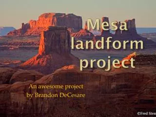
Landform Definitions. V. Martinez. Butte. butte A butte is a flat-topped rock or hill formation with steep sides. . Butte http://en.wikipedia.org/wiki/Butte.

E N D
Landform Definitions V. Martinez
Butte • butteA butte is a flat-topped rock or hill formation with steep sides.
Buttehttp://en.wikipedia.org/wiki/Butte • Buttes are prevalent in the western United States and on the Hawaiian Islands, especially around Honolulu. The word "butte" comes from a French word meaning "small hill". • Buttes are formed by erosion when a cap of hard rock, usually of volcanic origin, covers a layer of softer rock that is easily worn away. This hard rock avoids erosion while the rock around it wears down. One example of a noted butte is Chimney Rock.
Canyon • canyonA canyon is a deep valley with very steep sides - often carved from the Earth by a river.
Grand Canyon in Arizonahttp://en.wikipedia.org/wiki/Gorge • http://library.thinkquest.org/CR0210629/Stephen%20C's%20Page.htm • “The Grand Canyon is located in Arizona and stretches to Colorado. The Grand Canyon is a national park and has become a national landmark. People from all over the world travel to see the Grand Canyon.” It was formed by the Colorado River running through and eroding the land.
Cape • capeA cape is a pointed piece of land that sticks out into a sea, ocean, lake, or river.
Delta • deltaA delta is a low, watery land formed at the mouth of a river. • It is formed from the silt, sand and small rocks that flow downstream in the river and are deposited in the delta. • A delta is often (but not always) shaped like a triangle (hence its name, delta, a Greek letter that is shaped like a triangle).
Deserthttp://www.enchantedlearning.com/coloring/desert.shtml • desertA desert is a very dry area. http://student.britannica.com/eb/art/print?id=55846&articleTypeId=0
Geyser • geyserA geyser is a natural hot • spring that occasionally sprays water and steam above the ground. • Old Faithful is a famous geyser located in Yellowstone National Park in Wyoming, Montana, and Idaho . • http://www.nps.gov/archive/yell/oldfaithfulcam.htm • http://www.nps.gov/archive/yell/tours/oldfaithful/index.htm
Mountain • A mountain is a very tall high, natural place on Earth - higher than a hill. The tallest mountain on Earth is • Mt. Everest.
Plainshttp://www.edu.pe.ca/southernkings/plainmr.htm • plainPlains are flat lands that have only small changes in elevation.
Plant life on plains-Why are plains usually well populated?http://www.edu.pe.ca/southernkings/plainmr.htm • “Plant life on plains is controlled by the climate. Thick forests usually thrive on plains in humid climates, grasslands cover fairly dry plains such as the Great Plains in the United States. Plains are usually well populated because the soil and terrain are good for farming, and roads and railways are easily built between rural towns and cities.”
Coatal Plains • A coastal plain is a stretch of lowland along a seacoast which slopes toward the sea. • Atlantic Coastal Plain is a good example of a fertile and well populated coastal plain.
Plateau • plateauA plateau is a large, flat area of land that is higher than the surrounding land.
Prairiehttp://www.enchantedlearning.com/biomes/grassland/prairie.shtmlPrairiehttp://www.enchantedlearning.com/biomes/grassland/prairie.shtml • A prairie is a wide, relatively flat area of land that has grasses and only a few trees. • A prairie is a temperate grassland, plains of grass that get hot in the summer and cold in the winter. Most of the interior of North America was a prairie.
Tundrahttp://www.enchantedlearning.com/biomes/tundra/tundra.shtmlTundrahttp://www.enchantedlearning.com/biomes/tundra/tundra.shtml • A tundra is a cold, treeless area; it is the coldest biome. • “Arctic tundras are frozen, windy, desert-like plains in the Arcticthat are dotted with bogs and ponds. Permafrost (a layer of frozen subsoil) covers the ground, so there is very little drainage of water. The short growing season lasts for only 50 to 60 days. Arctic tundras are located in the far north of Greenland, Alaska, Canada, Europe, and Russia.”
Tundra • “Alpine tundras are located high in mountains worldwide, above the tree line. The growing season is about 180 days, and nighttime temperatures are usually below freezing. The soil is well-drained (unlike the Arctic tundra).”
Volcano • A volcano is a mountainous vent in the Earth's crust. When a volcano erupts, it spews out lava, ashes, and hot gases from deep inside the Earth.