Download
1 / 9
100 likes | 189 Views
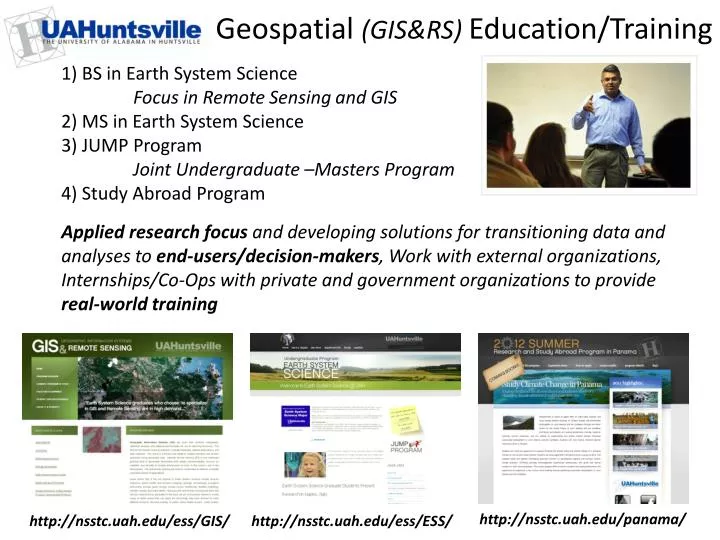
1) BS in Earth System Science Focus in Remote Sensing and GIS 2) MS in Earth System Science 3) JUMP Program Joint Undergraduate –Masters Program 4) Study Abroad Program. Geospatial (GIS&RS) Education/Training.

E N D
1) BS in Earth System Science Focus in Remote Sensing and GIS 2) MS in Earth System Science 3) JUMP Program Joint Undergraduate –Masters Program 4) Study Abroad Program Geospatial (GIS&RS) Education/Training Applied research focus and developing solutions for transitioning data and analyses to end-users/decision-makers, Work with external organizations, Internships/Co-Ops with private and government organizations to provide real-world training http://nsstc.uah.edu/panama/ http://nsstc.uah.edu/ess/GIS/ http://nsstc.uah.edu/ess/ESS/
GIS & Remote Sensing in Earth System Science (BS/MS) 1) Atmospheric Science 2) Atmospheric Chemistry 3) GIS & Remote Sensing 4) Earth Ecosystems 5) Hydrology 6) Human Dimensions/Impacts Declared ESS Majors (UG) 2013: 90+ ESS MS Students 2013: 7 ESS 499 ESS 413 ESS 411 ESS 370 ESS 414 ESS 415 JUMP ESS 418 2008 2009 2010 2011 2012 2013 ATS 670 ESS 514 ESS 513 ESS 590 ESS 610 • Current Geospatial Courses: • ESS 370: Introduction to Satellite Remote Sensing • ESS 411: Introduction to GIS (CE) • ESS 413/513: GIS and Image Processing • ESS 414/514: Geospatial Applications • ESS 415/515: Advanced GIS • ESS 499: Undergraduate Research Capstone • ATS 670: Satellite Remote Sensing I • ATS 680: Numerical Modeling Applications for ESS ESS 515 ESS 612 • Future (2013) Course Additions: • ESS 418: People and Pixels: Linking Remote Sensing and Social Science • ESS 610: Land Use Applications and Sustainability • ESS 612: Advanced GIS for Earth Atmosphere Problems
GIS/RS Research Computing Facilities @ NSSTC available UG/GR student facilities to conduct research, interact with peers and mentors, and “own” their research NSSTC (Bud Cramer Hall @ UAHuntsville Campus) 29 Dell Optiplex workstations ArcInfo 10.1 (Spatial, 3D, Network, Geostatistical) ENVI 5.0 +IDL Mobile ESS Lab (Dell ATG semi-rugged laptops, full GIS/IP software, Garmin handheld GPS) used in the field in Mexico, Panama, Guatemala, Atlanta, Tennessee, Alabama GIS & Remote Sensing Lab (NSSTC 4085)
Study Abroad Research Opportunities: Panama Climate Change & Sustainability in Latin American and the Caribbean 2010 2011 2012 • Spanish instruction at Florida State, Panama & Cultural immersion in home stays in Panama • Technology (GIS/Image Processing) & Policy and Science (climate change/sustainability) instruction • CATHALAC and UAHuntsville scientists and faculty
Study Abroad Research: Panama 2011/2012 Research Projects Evaluation of Precipitation, Temperature, and Soil Condition effects on Sugar Production at Ingenio Santa Rosa, Panama using Remote Sensing Data (Kirsten Cooksey, David McConnell, Joshua Smith) • Projections on Potential Impacts of Changing Precipitation and Land Cover on Sedimentation in the Panama Canal Watershed (Tiffany Keeton, Cory Manberg, Josh Myrick) • Developing the Hydrological Problematique of Taboga Island (Amanda Bosserman, Jason Pounders) • Nitrogen fixing Fabaceous plants and their benefits to agriculture (Joseph Wayman) • Los Emberá y sus Recursos: la Vulnerabilidad de los Recursos Naturales al Cambio Climático (Claire Herdy, Emma Norton, Nancy Pospelov) • Comparison of MM5 and WRF Forecast Models, CMORPH and Hydro Estimator Satellite Estimates to Ground-Based Rain Gauge Data (Nicole Dsouza, Melanie Phillips)
Community and high school outreach via directed STEM teaching by MS graduate students in Earth System Science (ESS 490ST) and Civil Engineering. • GIS as a tool for water resources/pollution issues at home and abroad • The many applications of GIS and remote sensing • Putting hydrology concepts into practice with geospatial data • Integrated GIS (field & lab) tie directly into APES learning goals and labs • Hands-on introduction to GIS using ArcGIS Explorer • Mark water quality testing sites using Garmin GPS • Advanced junior and senior level high school students Geographic Information Systems in Advanced Placement Environmental Science (GIS in APES) Eric R. Anderson M.S. Candidate, Earth System Science UAHuntsville Ben Johnston AP Envi. Sci., Bob Jones HS, Madison
NASA-DEVELOP Research Internships (available every semester) DEVELOP is a training and development internshipenabling students and young professionals to learn about Earth science and develop prototype applications. DEVELOP addresses needs for long-term capabilities within the workforce to use Earth science results in decision making. Advisors from NASA and partner organizations assist students in using NASA data in fields such as: Agriculture, Climate, Disasters, Ecological Forecasting, Energy, Health & Air Quality, Oceans, Water Resources, Weather. MSFC-DEVELOP Team, SERVIR Student Research Lab Steve Padgett-Vasquez, Center Lead University of Georgia (FNR) Claire Herdy, Co-Lead University of Alabama in Huntsville (ESS) Jeff Luvall, NASA-MSFC Science Advisor Rob Griffin,UAH-ESS Project Advisor Marshall Space Flight Center Alabama NSSTC-UAH http://develop.larc.nasa.gov/
NASA-DEVELOP Research Internships 2011/2012 MSFC Projects Highlights • Leveraging NASA EOS to explore the environmental and economic impact of the April 27 Tornado outbreak in Alabama • Mobile Bay Oyster Reef Habitat Analysis, Development of a Habitat Suitability Model for Mobile Bay Oyster Reefs Based on Hydrologic Models • Using NASA EOS to Identify and Monitor Pathogenic Dust in the Middle East • Colombia Fire Forecasting: Utilizing NASA EOS data for fire management in el Departamento del Valle del Cauca,Colombia • Nepal-Food Security: Utilizing NASA’s EOS data to research the potential effects of climate change on food security in Nepal • Middle East Public Health & Air Quality: • Using NASA EOS to Identify and Monitor Pathogenic Dust in the Middle East • Southeast Ecological Forecasting: Using NASA Earth Observation (EOS) satellites for large-scale mapping of the longleaf pine (Pinuspalustris) forest ecosystem.
Student Research/Training Involvement & Successes Student Research Presentations DEVELOP Internship Final Results Presentations (Kevin Cowart, Brad Barrick) Conferences Student Participation & Outreach IAC 2012, ESRI 2012/2013 Student-Led Training Events Hyperspectral Image Analysis Workshop (Africa Flores)