Download
1 / 63
640 likes | 862 Views
Dynamic Earth. This unit will cover: layers of the earth, plate tectonics, volcanoes, earthquakes. 1. Crust: Continental crust Oceanic crust 2. Mantle Largest section Includes the asthenosphere toward the top Solid part and semi-liquid parts to it 3. Core Inner core (Solid—Iron)

E N D
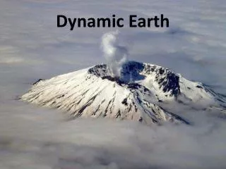
Dynamic Earth This unit will cover: layers of the earth, plate tectonics, volcanoes, earthquakes
1. Crust: • Continental crust • Oceanic crust 2. Mantle • Largest section • Includes the asthenosphere toward the top • Solid part and semi-liquid parts to it 3. Core • Inner core (Solid—Iron) • Outer Core (Liquid) Earth’s Internal Structure: Compositional Layers
Internal Structure of Earth Upper Mantle Crust Lower Mantle Outer Core Inner Core “Asthenosphere”
Early observations of the world • Alfred Wegener proposed an idea for CONTINENTAL DRIFT. • Continental Drift= proposed that the world’s continents were stuck together • He called his super continent PANGEA.
Pangea Alfred Wegener
Rejected….. • Alfred Wegener idea of Pangea was rejected after his death in 1930. • The use of Seafloor spreading was a new idea that was promoted.
Technology used in Seafloor Spreading • Sonar—uses sound waves to measure the depth of the bottom of the ocean • Magnetometer—is a device to measure the changes in magnetic fields. Antarctic- using magnetometer Sonar
Results… • Map Generated Topographical Maps that showed the deep sea trenches and ocean ridges. Picture of California’s Coast Blue—water Green, brown--land
Theory of Plate Tectonics • Which states that the Earth’s crust and rigid upper mantle is broken into plates • The plates move in different directions and different rates over time.
Different Plates Around the World Ring of Fire
Plate Boundaries • Divergent Boundaries • Places where plates are coming apart • Convergent Boundaries • Places where plates crash or crunch together • Transform Boundaries • Places where plates slide past each other
Divergent Boundary • Places where plates are coming apart
Convergent Boundary With Subduction Plate Plates crash into each other
Transform Boundary • Places where plates slide past each other
PlateMotions • Assume plates are rigid (no internal deformation: bending or flexing) • Obtain plate motion: • Directions • Rates of movement
Convection Cell— that regulates the flow of magma. There are also convection cells in the atmosphere for our weather.
What do plate tectonics form? • Earthquakes • Hotspots • Volcanoes
Earthquakes Most destructive forces on Earth. But it is buildings and other human structures that cause injury and death, not the earthquake itself 1988 - Soviet Armenia: magnitude 6.9, 25,000 people died 1985 - Mexico City: magnitude 8.1, 9500 people 1989 - Loma Prieta, CA: magnitude7.1,40 peopledied 1995 - Kobe, Japan: magnitude 7, ~6000 people died
Where do earthquakes occur? • They occur when plates are diverging, sliding past each other, colliding or going underneath each other. • There are three types of faults • Strike-Slip Fault • Normal Fault • Reverse Fault • Thrust Fault
Strike Slip Fault • Occurs horizontally when two plates slide past each other • San Andres Fault in California • Causes Rail roads to bend
Normal Fault • Occur vertically and when the plates are diverging • Happen where the lithosphere is being pulled apart
Reverse Fault • Occurs vertical, the plates collide together pushing the rock upward • Example—thrust • In the ocean causes tsunami
PARTS OF EARTHQUAKES • HYPOCENTER—LOCATIONS OF EARTHQUAKE UNDERNEATH THE GROUND. • EPICENTER—LOCATION OF EARTHQUAKE ON THE SURFACE
epicenter hypocenter Transform fault
Body Waves P waves: • Pressure or compressional waves. Vibrate parallel to direction of wave travel like a slinky. • Fast travel: 4-7 km/sec (15,000 mph) • P is primary, or first wave to arrive at recording station S waves: • Shear waves. Vibrates perpendicular to direction of wave travel. Like snapping a rope • Slower than P wave: 2-5 km/sec (11,000 mph) • So S is secondary, or second wave to arrive at recording station
Locating the Epicenter of an Earthquake • P, S and surface waves all start out at same time. • The further you are away from the quake, the longer the time span between arrival of P and S wave. • The distance of the seismometer to the earthquake can be determined by the time between the arrival of P wave and arrival of S waves. • Can tell the distance, but not the direction. • Therefore, multiple sites must be used to find epicenter.
Kodiak, AL 1964 Tsunami Damage
Richter Scale • Measures the magnitude of an earthquake from 1-10
RICHTER SCALE MEASURES MAGNITUDE FROM 0-10
Hot Spots • Islands associated with hot spots (island chains, mid-ocean ridges, triple junctions). • Iceland (mid-ocean ridge). • Galapagos Islands (triple junction). • Island of Hawaii (mid-plate volcanic chain; hot spot trace). • Linear island chains form as plate moves over hot spot. • Hawaiian islands get older in direction of plate movement (older away from mid-ocean ridge).
VOLCANOES http://georoc.mpch-mainz.gwdg.de/volcano.gif
Volcanoes • Basic parts of a volcano • Crater (depression at the summit of a volcano, connected by a vent or pipe to the magma chamber below) • Caldera (crater more than 1 km in diameter, formed at the summit of a volcano when lava is drained from an underground magma chamber, causing the summit of the volcano to be unsupported, and to collapse)
Example of Caldera • Crater Lake in Oregon. This volcano was so violent that the top of the mountain was blown off. Now all is left is a beautiful lake.
Pit crater (collapse features on the flanks or summit of a volcano that are smaller than the main caldera at the summit of a volcano) • Vent (pipe-like conduit from the magma chamber to the surface) • Fumaroles (secondary vents on the flank of a volcano which emit steam and other gases)
http://volcano.und.nodak.edu/vwdocs/vw_hyperexchange/parts.htmlhttp://volcano.und.nodak.edu/vwdocs/vw_hyperexchange/parts.html