Download
1 / 15
150 likes | 157 Views
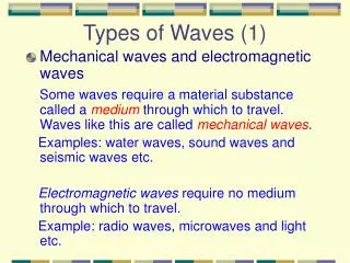
Eumetcal NWP course, Dec 2009 Sevim Müller. Mountain waves in Norway A case study (4. Nov. 2009 ) . Motivation. Characteristics of Norway: Mountains (up to ca. 2500m) Fjords Neighbouring the N-Atlantic Weather is very sensitive to local effects Mountain waves are a serious thread.

E N D
Eumetcal NWP course, Dec 2009 Sevim Müller Mountain waves in Norway A case study (4. Nov. 2009 )
Motivation • Characteristics of Norway: • Mountains (up to ca. 2500m) • Fjords • Neighbouring the N-Atlantic Weather is very sensitive to local effects Mountain waves are a serious thread X Helsinki
Mountain waves – ”Ingredients” • - stable atmosphere • lee-side amplifying: • wind is decreasing and/or stability increases from mountain top heights and upover • - strong turbulence: 50 kt in 850 hPa (be aware: 40 kt in 925 hPa)
Turbulentareas Rotor with weak wind and/or wind of the opposite direction Strong leewind / downslope wind Mountain waves Courtesy of Eirik Samuelsen
Available data / Methods Observations Mainy Synop and Metar, (satellites) Models ECMWF, HIRLAM 12KM + 8 KM + 4 KM, UM 4KM +1KM, SIMRA (250 M) Other tools Vertical cross sections and vertical soundings
4. November 2009 – 12 UTC Mainy Synop and Metar, (satellites)
4. November 2009 – 18 UTC Mainy Synop and Metar, (satellites)
4. November 2009 – Metar Sandnessjøen and Brønnøysund ENST 040950Z 06007KT 030V150 CAVOK 07/M03 Q1004= ENST 041050Z 07011KT 360V160 9999 FEW025 BKN100 08/M03 Q1004= ENST 041150Z 03007KT 330V150 CAVOK 08/M03 Q1004= ENST 041250Z 06010G20KT 030V180 CAVOK 08/M03 Q1004= ENST 041350Z 04006KT 300V110 CAVOK 08/M04 Q1004= ENST 041450Z VRB08G16KT 9999 FEW050 SCT080 08/M02 Q1005= ENST 041550Z VRB07G18KT CAVOK 07/M02 Q1006= ENBN 040950Z 14017G30KT 110V190 CAVOK 07/M03 Q1003= ENBN 041050Z 13017G32KT 100V160 CAVOK 07/M02 Q1003 RMK/RWY22 14028G44KT= ENBN 041220Z 14024G50KT 100V200 CAVOK 07/M02 Q1003= ENBN 041250Z 14022G37KT 100V170 9999 FEW045 SCT120 07/01 Q1002 RMK/RWY22 13035G52KT 100V160= ENBN 041320Z 13036G54KT 100V170 9999 FEW045 BKN120 0/M01 Q1002 RMK/RWY22 14045G66KT= ENBN 041350Z 14037G58KT 100V160 9999 FEW035 SCT120 07/M01 Q1001= ENBN 041450Z VRB06KT 9999 FEW035 SCT120 07/M02 Q1005= ENBN 041550Z 12021G49KT 090V160 9999 FEW035 SCT100 07/M01 Q1005=
4. November 2009 – Metar Sandnessjøen and Brønnøysund ENST 040950Z 06007KT 030V150 CAVOK 07/M03 Q1004= ENST 041050Z 07011KT 360V160 9999 FEW025 BKN100 08/M03 Q1004= ENST 041150Z 03007KT 330V150 CAVOK 08/M03 Q1004= ENST 041250Z 06010G20KT 030V180 CAVOK 08/M03 Q1004= ENST 041350Z 04006KT 300V110 CAVOK 08/M04 Q1004= ENST 041450Z VRB08G16KT 9999 FEW050 SCT080 08/M02 Q1005= ENST 041550Z VRB07G18KT CAVOK 07/M02 Q1006= ENBN 040950Z 14017G30KT 110V190 CAVOK 07/M03 Q1003= ENBN 041050Z 13017G32KT 100V160 CAVOK 07/M02 Q1003 RMK/RWY22 14028G44KT= ENBN 041220Z 14024G50KT 100V200 CAVOK 07/M02 Q1003= ENBN 041250Z 14022G37KT 100V170 9999 FEW045 SCT120 07/01 Q1002 RMK/RWY22 13035G52KT 100V160= ENBN 041320Z 13036G54KT 100V170 9999 FEW045 BKN120 0/M01 Q1002 RMK/RWY22 14045G66KT= ENBN 041350Z 14037G58KT 100V160 9999 FEW035 SCT120 07/M01 Q1001= ENBN 041450Z VRB06KT 9999 FEW035 SCT120 07/M02 Q1005= ENBN 041550Z 12021G49KT 090V160 9999 FEW035 SCT100 07/M01 Q1005= modfl
Forecast for 4. nov. 2009 Land forecast issued 3. nov. 2009, 11 UTC: Southeast breeze, gale force 8 at exposed places, possibly brief periods with severe gale force 9. Land forecast issued 4. nov. 2009, 11 UTC: Southeast near gale force 7 at exposed places, in periods gale force 8, in south severe gale force 9. Brønnøysund TAF: ENBN 040500Z 0406/0415 13015KT CAVOK TEMPO 0406/0415 13030G50KT= ENBN 040500Z 0406/0415 13015KT CAVOK TEMPO 0406/0415 13030G50KT= ENBN 040800Z 0409/0418 13015KT CAVOK TEMPO 0409/0418 13030G50KT= AMD ENBN 041100Z 0412/0421 13025G35KT CAVOK TEMPO 0412/0421 13045G60KT= ENBN 041100Z 0412/0421 13025G35KT CAVOK TEMPO 0412/0421 13045G60KT= ENBN 041400Z 0415/0423 13025G35KT CAVOK TEMPO 0415/0423 13045G60KT= ENBN 041700Z 0418/0423 13020G35KT CAVOK TEMPO 0418/0423 13040G55KT= ENBN 042000Z 0421/0423 14020G35KT 9999 FEW030 SCT100 TEMPO 0421/0423 13040G55KT=
4. Nov. 2009 – Synoptic situation Mainy Synop and Metar, (satellites)
4. Nov. 2009 – Synoptic situation Mainy Synop and Metar, (satellites)
Vertical cross section - 06z UM 4km – 20091104 06z – Theta-field (white lines), wind arrows, wind strength (coloured)
Vertical cross section - 12z UM 4km – 20091104 12z – Theta-field (white lines), wind arrows, wind strength (coloured)
Conclusion Models are quite good understanding the general situation but did not forecast this strong gusts. Human forecasters forecast stronger winds and mountain waves, but not enough and not exact timing. To forecast strong turbulence / gusting use (amongst others): vertical cross sections. Forecast more wind.