Download
1 / 42
420 likes | 576 Views
Overview of Navy’s System for Global Modeling of Sulfate, Smoke & Dust. Douglas Westphal Anthony Bucholtz Piotr Flatau Arunas Kuciauskas Ming Liu Betsy Reid Jeffrey Reid Kim Richardson Annette Walker Aerosol and Radiation Modeling Section Marine Meteorology Division

E N D
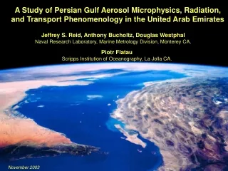
Overview of Navy’s System for Global Modeling of Sulfate, Smoke & Dust Douglas Westphal Anthony Bucholtz Piotr Flatau Arunas Kuciauskas Ming Liu Betsy Reid Jeffrey Reid Kim Richardson Annette Walker Aerosol and Radiation Modeling Section Marine Meteorology Division Naval Research Laboratory Monterey CA 93943 www.nrlmry.navy.mil/aerosol
Why?Aerosol Impacts on Navy Activities • Conventional Navy view: • Marine aerosol (salt, sulfate) in marine boundary layer • Locally produced • EO propagation, TAWS, slant range visibility • But there are other aerosols and impacts: • Dust, smoke, pollution • Long-range transport • Operational constraints • mission planning • hazard avoidance • navigation • Numerical weather prediction • direct effect • indirect effect • Satellite analyses • SST retrievals
Impact of Aerosols on Navy Activities Mediterranean, 15 April, 2000 Southwest Asia, 12 October, 2001 Southwest Asia, 10 October, 2001
Pollution and Smoke over the Atlantic June 28, 2001 SeaWiFS
Impact of Aerosols on Navy Activities:Volcanic Ash in the Mediterranean October 28, 2002 SeaWiFS
Impact of Dust on Navy Activities “… helicopters encountered … several large layers of suspended dust about 190 nm long. Like flying in a milk bowl … pilots unable to see the surface from as low as 75 feet.” NDU staff report on Iran Hostage Rescue Mission “After sunrise the visibility reduced to less than 1 nautical mile in blowing dust, prompting all squadrons to immediately begin preserving topside aircraft. … the harbor pilot was told that visibility was down to less than ¼ mile at the harbor and that no traffic would be moved until the visibility improved.” USS Carl Vinson, U.A.E, February 1999 “The ability to have DAMPS generate a dust forecast out to 48 hrs would provide us with an ability to reschedule flight operations or move ships to other locations. In the eleven months I’ve been out here, dust has had the biggest impact on limiting and/or canceling operations that have taken place in this AOR.” CO NAVCENTMETOCCEN, Bahrain, July 2000 At Roosevelt Roads/Vieques, Puerto Rico, drone operations over practice ranges were cancelled by conditions of reduced visibility due to Saharan dust; interfered with gunnery training schedules (couldn’t visually certify range was clear)
Impact of Aerosol on Navy Activities Aerosol climatology required for selection of High Energy Lasers Focused on marine boundary layer (for ship defense)
KOREA Impact of Aerosols on NWP: Example of Visible Direct Effect • SEAWIFS Visible wavelength imagery for March 17, 2002 • Plume of aerosol leaving Asia composed of dust, pollution and other aerosols • Direct effects are obvious • Indirect effects are possible as aerosol is entrained into synoptic weather system
Impact of Aerosols on NWP:Example of Infrared Direct Effect ACE-Asia Experiment, April 2001 • Shipboard deployment • Sea of Japan (subject to dust storms from China) • Main result: increased downward infrared flux due to dust in atmosphere Infrared perturbation (W/m**2)
Impact of Aerosols on NWP: Example of Indirect Effect AVHRR Near-IR imagery for May 14, 1994, from MAST “Ship tracks” are variations in cloud albedo due to aerosol-induced changes in cloud properties Large-scale changes in cloud albedo likely due to polluted vs. clean air Ship Tracks Large-Scale Albedo Change
Impact of Aerosols on NWP:Indirect Effect on Hurricane Felix?
Impact of Aerosols on NWP:Aerosol Contamination of SST Retrieval Cummings/FNMOC (El Niño) Dust Contamination Smoke Effect
Why Global?Long-Range Transport • Often assumed that aerosol is locally produced and can be modeled based on local variables, ignoring long-range transport • However, • Intercontinental aerosol transport occurs frequently • Regional aerosols can be significantly impacted by non-local sources • Other reasons for global modeling: • Regional aerosol simulations require initial and boundary conditions • Validation data are scarce; validate model wherever data are available
Intercontinental Transport Background: Composite of Several Retrievals of TOMS Absorbing Aerosol Index
Intercontinental Transport Dust: Red Arrows, Smoke: Blue Arrows Background: Composite of several TOMS retrievals of Aerosol Index
Aerosol Research at NRL/MRY • Objectives: • Forecast global and regional distribution of aerosols • Measure and model the optical effects of aerosols • Forecast slant range visibility • Determine the importance of aerosol effects for NWP • Approach: • Modeling • Global and regional predictive aerosol transport models with emphasis • on dynamical forcing and transport, rather than microphysics and chemistry • Data assimilation of satellite data • Theoretical • Calculate scattering by individual particles • Develop accurate and efficient forward modeling methods for NWP • Experimental • Verify theoretical calculations using in situ and remotely sensed data • Validate transport models with in situ and satellite data
NRL/MRY Aerosol Studies Flowchart Theoretical Studies, Field Measurements • Customers: • TAWS (slant range) • NAVO (SST) • Metoc Det (Wx) • HEL (visibility) • Validation Regional Aerosol Model COAMPS NCB Models Extend knowledge base Global Aerosol Model NOGAPS Global and Regional Aerosol Analyses Observations Remote Sensing Implement existing knowledge Transition to customer
Global Aerosol Model • Twice-daily, 5-day forecasts of SO2, sulfate, dust and smoke • Operational global weather model (NOGAPS) provides forecasts of P, T, q, u, v, w, Kz, cloud parameters, precip., stress, and ground wetness at 6-hour intervals on 1X1 degree grid; 14 levels to 100 mb • Semi-Lagrangian horizontal transport; finite element horizontal diffusion; finite element vertical transport • SO2 emission from GEIA inventory; oceanic DMS emission • Deflation depends on threshold velocity, forecasted stress and ground wetness • Smoke emission based on satellite detection of fires • Linear gas-phase chemistry • Dry deposition: function of specie, stress, stability, surface type • Wet removal: function of precipitation rate, specie, cloud type *Modified DEHM model (Christensen, Atm. Env., 1998)
November 27 NAAPS 5-day Forecast for December 2, 2002 Total Optical Depth Sulfate Optical Depth Smoke Optical Depth Dust Optical Depth
Analysis using NAAPS: JFK Jr. Study(collab. with Prospero@ U. Miami, Poirot@ Vermont) • Real-Time NAAPS analyses allowed rapid response to crash: • Determined atmospheric structure: deep continental boundary layer above shallow MBL • Detected exceptional pollution event: high sulfate concentrations • Results used in NTSB report • Research mode: • Validated with surface chemistry and satellite data • Compared NAAPS emissions inventory to current emissions • Diagnosed impact of uncontrolled Midwestern emissions on air quality of East Coast and New England
JFK Jr. Study:Accurate simulation of timing and location of anthropogenic aerosol plume SeaWiFS Imagery, 1620Z 16 July, 1999 NAAPS AOD, 1800Z 16 July, 1999
JFK Jr. Study:Environmental conditions analyzed using NAAPS and NOGAPS
JFK Jr. Study • Findings: • Need to add other anthropogenic aerosols to NAAPS in order to quantify visibility/extinction • JFK Jr. study shows GEIA dataset is outdated: some current sources greater than GEIA values; others less • Conversion rates need modification (high ozone conc. increases rate of conversion to sulfate) • Uncontrolled Midwestern emissions responsible for most of the haze
NAAPS Smoke Source: Global Fire Detection GOES-8 Wildfire ABBA Summary Composite of Half-Hourly Processed and Saturated Fire Pixel Observations for the Western Hemisphere Time Period: September 1, 2000 to August 31, 2001 • Wildfire-ABBA uses GOES data to provide western hemisphere fires • Global MODIS fire product used for other regions
NAAPS Smoke Simulation, August 10, 2000 GOES Visible Imagery 14 UTC 10 August, 2000 NAAPS Smoke Optical Depth 12 UTC 10 August, 2000 Smoke Plume
Comparison of NAAPS Optical Depth andSeaWiFS True Color For 20 June, 2001
NAAPS Simulation ofLos Alamos Smoke Plume, May 12, 2001 • Smoke detected at DOE/ARM • site in Oklahoma May 11 and 12 first attributed to Los Alamos Fires • NAAPS shows smoke is a combination of two plumes: • Transport of Los Alamos smoke • in elevated dry layer • Transport of Central American • smoke in low-level moist layer NOGAPS RH, winds, θ 5/12 5/11 5/10 5/9
NAAPS Dust Source Specification USGS Landuse database (1 km resolution) used to identify erodible regions of the world (based on AVHRR data) TOMS Aerosol Index (AI) used to further refine source regions over Sahara and Middle East; needs further refinement over Asia NOGAPS soil moisture must be less than 0.3 NOGAPS surface stress must exceed a threshold value Then dust flux is proportional to square of stress
NAAPS Dust Erodibility Specification:Based on USGS Landuse and TOMS/AI Dust emission allowed in proportion to the square of the stress in these areas when stress exceeds critical value and soil moisture is less than 0.3
Validation of NAAPS UsingSeaWiFS and AERONET Data, Oct. 30, 2001 Dust Plume 0.4 0.1 0.1 0.3 0.1 SeaWiFS True Color NAAPS Dust Optical Depth NAAPS AERONET Data
Comparison of TOMS AI and NAAPS Optical Depth for April 1998 Event Green - dust, Red - sulfate aerosol April 20 April 22 April 24 April 26
Validation of NAAPS Simulation of Asian Dust Event Comparison of San Nicolas AERONET Sunphotometer and NAAPS Optical Depth for April 1998 Event: Captures timing, misses background aerosol
UNIV. UTAH LIDAR 00Z 25 APRIL 1998 LIDAR NAAPS Pressure (mb) 7.9 KM 7.5 KM Concentration Backscatter Depolarization
The ‘Perfect Dust Storm’, April 6-9, 2001 Baicheng, Jilin Prov., April 7, 2001 Large dust storm on April 6-7, 2001, then swept across East Asia, the Pacific, and N. America Visibility reduced to 100 m in some Chinese cities Coincided with large international field program – ACE-Asia; provides additional data for validation Baicheng, Jilin Prov., April 8, 2001 SeaWiFS April 7, 2001
NAAPS Dust Simulation, April 11, 2001 Dust Plume SeaWiFS Imagery 11 April 2001 NAAPS Dust Optical Depth April 11, 2001
NAAPS Dust Simulation, April 19, 2001 SeaWiFS Imagery April 19, 2001 NAAPS Dust Optical Depth April 19, 2001 Dust Plume
NAAPS ACE-Asia Simulations, April 2001 Saturna Island Rogers Dry Lake Missoula TOMS AI AOD Angstrom Exp.
Future Plans • Update source specification • Smoke (NASA FLAMBE) • Add biome and seasonal dependence • Apply persistence check to Wildfire-ABBA • Use MODIS for detection outside of W. Hemisphere • Update GEIA sulfur dioxide sources • Add salt and black carbon components • Analysis and simulation • Develop transition path for use in screening for SST retrievals • Assimilate satellite retrievals of aerosol properties • Mesoscale generation Global transport Mesoscale impact • Have developed mesoscale dust model, triply nested: 9, 27, an 81-km resolution • Working on mesoscale source inventory to drive mesoscale dust model • Continue validation using PRIDE, ACE/Asia, and other data • Initiate aerosol monitoring at MRY including IOP: ADAM