Download
1 / 34
340 likes | 489 Views
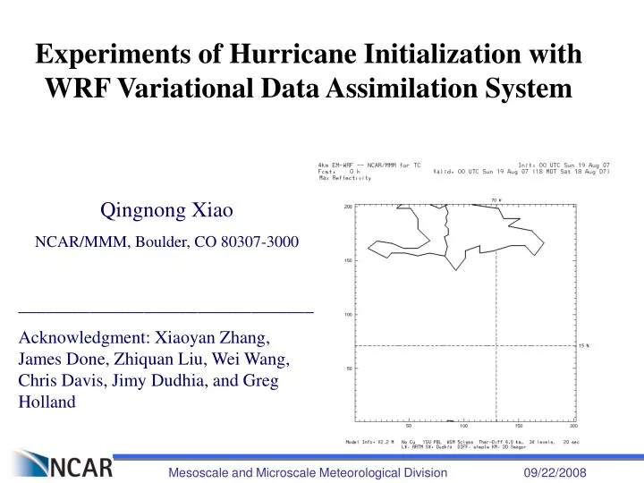
Experiments of Hurricane Initialization with WRF Variational Data Assimilation System. Qingnong Xiao NCAR/MMM, Boulder, CO 80307-3000 _________________________________ Acknowledgment: Xiaoyan Zhang, James Done, Zhiquan Liu, Wei Wang, Chris Davis, Jimy Dudhia, and Greg Holland. Introduction.

E N D
Experiments of Hurricane Initialization with WRF Variational Data Assimilation System Qingnong Xiao NCAR/MMM, Boulder, CO 80307-3000 _________________________________ Acknowledgment: Xiaoyan Zhang, James Done, Zhiquan Liu, Wei Wang, Chris Davis, Jimy Dudhia, and Greg Holland Mesoscale and Microscale Meteorological Division 09/22/2008
Introduction • WRF: Weather Research and Forecasting (WRF) Model • Developed by NCAR, NCEP, and several US universities and DOD labs. • Two cores: • ARW - Advanced Research WRF, led by NCAR and the university community • NMM - Nonhydrostatic Mesoscale model, led by NCEP and in operational application • WRF-Var: WRF Variational (WRF-Var) Data Assimilation System Mesoscale and Microscale Meteorological Division 09/22/2008
Why WRF hurricane initialization? • WRF ARW improved track and intensity over official forecast beyond 36 h. • Short-term forecasts (< 2 days) show a rather poor skills in WRF ARW, due to model spin-up problem. • An improved hurricane initialization, using advanced data assimilation technique, can augment the skills of short-term forecasts. WRF hurricane forecast in 2005 (Orange), Davis et al. 2008 Mesoscale and Microscale Meteorological Division 09/22/2008
Why WRF-Var for hurricane initialization? • WRF-Var is an advanced data assimilation system based on the variational technique. • It includes WRF 3D-Var, 4D-Var, and ensemble/variational hybrid (En3D-Var, En4D-Var). • It can assimilate all observational data, including satellite and radar data. • It is robust, and facilitates research and real-time applications. Mesoscale and Microscale Meteorological Division 09/22/2008
WRF-Var data assimilation system Background constraint(Jb) Observation constraint(Jo) obs • xb: modelbackground(former information) • H(x) : observation operator(simulating observations from model) • [y – H(x)] : innovationvector (new information) • Minimum of the cost function J(x), (analysis) updates the background with new information from observations. Jo former forecast Analysis Jo Background obs corrected forecast Jb Jo xa obs 9h 12h 15h Assimilation window With hypotheses, the analysis estimates the true state of the atmosphere (in terms of max likelihood). Mesoscale and Microscale Meteorological Division 09/22/2008
WRF-Var Flow Chart xb Cycling NCEP Analysis WPS TC Vortex Relocation WRF REAL Regular Obs Satellite Obs Forecast Observation Preprocessor yo WRF-Var (3/4D-Var or En-Var) xa Radar Obs TC Bogus Obs B Verification and Statistics Background Error Calculation Mesoscale and Microscale Meteorological Division 09/22/2008
WRF-Var Hurricane Initialization • Vortex relocation in background fields • If cycling, vortex relocation in background fields is important. • Synthetic vortex (bogussing/relocation) in observation data • Similar to JMA’s scheme, see Xiao et al. (2006) • Assimilation of regular observations • WMO GTS • Dropsonde data from reconnaissance • Bogus data assimilation • The algorithm is described in Xiao et al. (2006) • Satellite data assimilation • Raw data - brightness temperatures • Retrieved data • Radar data assimilation • Ground-based Doppler radar data • Airborne Doppler radar data Mesoscale and Microscale Meteorological Division 09/22/2008
Case studies with BDA: • BDA - Bogus data assimilation • BDA is a technique we proposed for hurricane initialization when I worked at FSU. It combines traditional vortex bogussing with data assimilation. Its initial application was with MM5 4DVAR (Xiao et al. 2000 (Mon. Wea. Rev.); Zou and Xiao 2000 (J. Atmos. Sci.) • With the WRF data assimilation development, I includes the capability in WRF-Var Mesoscale and Microscale Meteorological Division 09/22/2008
Hurricane Katrina track Mesoscale and Microscale Meteorological Division 09/22/2008
Hurricane Katrina intensity Mesoscale and Microscale Meteorological Division 09/22/2008
Comparison with GFS ICs • Green: without BDA, Red: with BDA (statistics from 21 cases in 2004 and 2005 seasons, Xiao et al. 2008) • It is clearly shown that BDA improves hurricane track and intensity. • More improvements are seen in the forecast of intensity than track. Mesoscale and Microscale Meteorological Division 09/22/2008
Case studies with airborne Doppler radar data assimilation • Hurricane Jeanne (2004) • Flight at around 1800 UTC 24 September 2004 • Data include wind and reflectivity Airborne Doppler winds and reflectivity at 2.5 km AMSL Mesoscale and Microscale Meteorological Division 09/22/2008
Hurricane initialization ADR-DA NO-DA GTS-DA Mesoscale and Microscale Meteorological Division 09/22/2008
Hurricane forecast (reflectivity) GTS plus radar wind plus reflectivity 24-hr 36-hr Mesoscale and Microscale Meteorological Division 09/22/2008
Hurricane track Black: Observation Red: NO-DA Blue: GTS-DA Green: GTS + ADR wind DA Cyan: GTS _ ADR wind and reflectivity DA Mesoscale and Microscale Meteorological Division 09/22/2008
Hurricane intensity Black: Observation Red: NO-DA Blue: GTS-DA Green: GTS + ADR wind DA Cyan: GTS _ ADR wind and reflectivity DA Mesoscale and Microscale Meteorological Division 09/22/2008
Real-time hurricane forecasts in 2007 • Initialization: 3D-Var analysis • Observations: • All conventional data: TEMP, SYNOP, METAR, PILOT, AIREP, SHIPS, BUOY, etc. • Satellite-retrievals: QUIKSCAT and GOES WINDS, GPS PW and REFRACTIVITY • Satellite radiances: AMSU-A and AMSU-B from NOAA-15, 16, and 17 • Synthetic observations: CSLP and winds (bogus observations) • First-guess: GFS analysis Mesoscale and Microscale Meteorological Division 09/22/2008
Real-time hurricane forecasts in 2007 • Model: WRF V2.2 • Domain Configuration: 3 domains, 2-way moving nest of domain 2 and 3, 35 vertical layers, dimensions of 424X325 (domain1), 202X202 (domain 2), 241X241 (domain 3), grid-spacings of 12, 4, and 1.333km. • Physics: WSM5 microphysics, YSU PBL, Kain-Fritsch cumulus for Domain 1, • Forecast: 3 days Moving nest Mesoscale and Microscale Meteorological Division 09/22/2008
Track Forecasts for Hurricane Dean (2007) IC: 3D-Var using GFS analysis as first-guess Initialization time: 0000 UTC, each day Forecast time: 3 days Mesoscale and Microscale Meteorological Division 09/22/2008
3-day forecasts for Hurricane Dean (2007) from 0000 UTC daily • The general intensifying and decaying trend of the forecasts is good • The landfall time and location is pretty good • It over-predicts the intensity when Dean is weak, and under-predicts it when Dean becomes strong • 3D-Var analyses are not well balanced with model, so there is initial adjustment Mesoscale and Microscale Meteorological Division 09/22/2008
3-day forecast of Humberto (2007) by WRF initialized with GFDL analysis at 1200 UTC 12 September 2007 Mesoscale and Microscale Meteorological Division 09/22/2008
3-day forecast of Humberto (2007) by WRF initialized with 3D-Var analysis at 1200 UTC 12 September 2007 Mesoscale and Microscale Meteorological Division 09/22/2008
3-day forecast of Humberto (2007) by WRF initialized with 3D-Var analysis at 1200 UTC 12 September 2007 Best track till 2100 UTC 14 September 2007 Mesoscale and Microscale Meteorological Division 09/22/2008
3-day forecasts for Humberto from 1200 UTC September 2007 • The intensification from tropical storm to category I hurricane just before landfall is predicted well • The landfall time and location is pretty good • The trend of weakening after landfall is predicted. However, it over-predicts its strength inland. Mesoscale and Microscale Meteorological Division 09/22/2008
Verification of hurricane forecasts in 2007 season (3DVAR HI ~ GFDL) Black: HI with 3DVAR Red: WPS using GFDL Mesoscale and Microscale Meteorological Division 09/22/2008
Conclusions • The hurricane initialization program using WRF-Var is designed. It includes assimilation of all available observations (in-situ and remote-sensing) and BDA (bogus data assimilation). • Case studies demonstrate positive impact of the hurricane initialization scheme on the hurricane forecasts (track and intensity). • Statistics from 21 cases in 2004 and 2005 hurricane seasons indicates that hurricane track and intensity forecasts are improved compared with the forecasts using the NCEP/GFS-interpolated initial conditions. • Airborne Doppler radar data assimilation has great potential to improve hurricane vortex initialization and forecasts of hurricane structure and intensity. • The WRF-Var hurricane initialization scheme was implemented in real time runs in the 2007 hurricane season. It ran smoothly and robustly. The results are comparable with the runs from GFDL initial conditions. Mesoscale and Microscale Meteorological Division 09/22/2008
Future Plan • Develop a regional coupled ocean-atmosphere model • Atmosphere model: WRF ARW • Ocean model: ROMS or HYCOM • Develop a data assimilation system for the regional coupled ocean-atmosphere model • 3D-Var (initially) • 4D-Var (after 3D-Var works properly) • En3/4D-Var (hybrid with EnKF technique) • Hurricane initialization and modeling • Assimilate atmospheric data (especially satellite data and radar data) • Assimilate ocean data • Research and real-time applications Mesoscale and Microscale Meteorological Division 09/22/2008
Thank you! Mesoscale and Microscale Meteorological Division 09/22/2008