Download
1 / 39
390 likes | 399 Views
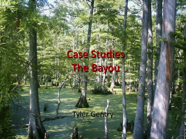
Case Studies The Bayou. Case Studies The Bayou. Tyler Gentry. Bayou.

E N D
Case StudiesThe Bayou Case StudiesThe Bayou Tyler Gentry
Bayou A bayou is a small, slow-moving stream or creek, or a lake or pool (bayou lake) that lies in an abandonedchannel of a stream. Bayous are usually located in relatively flat, low-lying areas, for example, in the Mississippi River delta region of the southern United States. A bayou is frequently a slack water anabranch or minor braid of a braided channel, that is moving with less velocity than the main stem. Many bayous are the home of crawfish, certain species of shrimp, other shellfish, and catfish. • Wikipedia.com
Greens Bayou After several years of study and coordination with the Harris County Flood Control District (HCFCD) and the public, the Corps completed a comprehensive feasibility study for several tributaries of Buffalo Bayou. The Buffalo Bayou Comprehensive Study investigated measures to reduce flood damage losses occurring within the Buffalo Bayou watershed, which encompasses most of the Greater Houston Area. The study resulted in a 1990 congressional authorization for six separate tributary flood damage reduction projects including Green Bayou.
Greens BayouContinued The authorized project included an enlargement of the channel, vegetation clearing, detention basins, tree and shrub plantings, and recreation features. The HCFCD asked the Corps to consider another project that would have less environmental impact, take into consideration ongoing HCFCD projects and focus on areas with higher flood risks. The Corps agreed and initiated a General Reevaluation Study (GRR) in 1995.
Greens BayouContinued Trees and wildlife habitat will be preserved wherever possible. The new stormwater detention basin could include habitat and recreational features. Examples might be: Hiking, biking and walking trailsBirdwatching sites Playfields Water Quality features; and Wildlife habitat features Native trees and grasses could be planted in and around the basin, with wetland plants installed in low areas as part of the landscaping. These features would create wildlife, water quality and recreation benefits. 1 The total cost of the project is $46.3 million.2 The volume of material to be excavated from the detention basin is 2.5 million cubic yards. This is the amount of material it would take to fill the Astrodome.3 With the proposed project, flooding will decrease downstream.4 The total average annual flood damage reduction benefits should be approximately $10.8 million.
Greens BayouContinued Drainage Area : 212 Sq. Miles Watershed Population (in Harris County) : 397,748 Open Stream Miles : 308 Miles Primary Streams : Garners Bayou Greens Bayou Halls Bayou Reinhardt Bayou
Halls Bayou As a tributary of Greens Bayou, Halls Bayou is located in north central Harris County and includes the City of Houston and unincorporated areas of Harris County, with approximately 197,000 people living in the area. Flowing east to join Greens Bayou, it covers nearly 42 square miles and is approximately 20 miles in length. Halls Bayou collects drainage from west of Veterans Memorial Drive eastward until it joins Greens Bayou at Brock Park. Halls Bayou consists primarily of developed urban land with a mix of residential, commercial and industrial uses, as well as some pockets of undeveloped land. There are nearly 5,900 structures in the mapped 1% (100-year) floodplain of Halls Bayou.
Halls BayouContinued Under the authority of a 1996 federal law, the Harris County Flood Control District is conducting the Halls Bayou Federal Feasibility Study in an effort to identify a plan that would address flooding problems along Halls Bayou and qualify for federal funding. If federal participation is secured, this powerful partnership will allow the District to work hand-in-hand with the U.S. Army Corps of Engineers and combine the strengths of both agencies to bring greater flood damage reduction benefits to the communities along Halls Bayou. Three storm water detention basins are being developed to help reduce the risk of flooding. Recreational opportunities are being incorporated into two of these projects, in cooperation with partners such as Harris County, the City of Houston and the Texas Parks and Wildlife Department.
Cedar Bayou The Cedar Bayou watershed is located in east Harris County. The channel forms most of the boundary between Harris County and Liberty and Chambers Counties, with about half of the watershed in Harris and the remainder in the other two counties. Cedar Bayou flows in a southward direction from its headwaters in Liberty County to its mouth at Galveston Bay. The watershed covers approximately 202 square miles, with Cedar Bayou being the sole primary stream. There are about 128 miles of open streams within the watershed, including the primary stream and tributary channels. The estimated population within the watershed (Harris County portion) is just over 32,000.Although a large floodplain exists in the upper and middle reaches of Cedar Bayou, this portion of the watershed is sparsely developed, and therefore, the flooding is more threatening to roads and agriculture than structures. Flooding along the tributaries in the urbanizing portions of the watershed is a concern.
Cedar BayouContinued Most of the primary stream and floodplain is environmentally sensitive due to the saltwater marshlands in the lower reaches and the undeveloped natural channel reaches upstream of Baytown. The Texas Parks and Wildlife Department considers the area around the mouth of Cedar Bayou to be a critical wildlife habitat.
Cedar BayouContinued Drainage Area : 202 Sq. Miles Watershed Population (in Harris County) : 32,592 Open Stream Miles : 128 Miles Primary Streams : Cedar Bayou
Luce Bayou The Luce Bayou watershed is located in the far northeast corner of Harris County and drains into the East Fork San Jacinto River, in the upper reaches of Lake Houston. The watershed extends through Liberty County and into San Jacinto County with its headwaters located in the Sam Houston National Forest. The watershed covers about 227 square miles, of which only 73 square miles are within Harris County. Luce Bayou is the watershed's single primary stream. There are about 35 miles of open streams within the watershed, including the primary stream and tributary channels. Within Harris County, the only significant tributary is Shook Gully, which drains the area to the east of the main channel. The estimated population within the watershed (Harris County portion) is just under 9,500. The floodplain from Luce Bayou is significant in Harris County due to the large upstream drainage area.
Luce BayouContinued Luce Bayou is, for the most part, a natural, vegetated channel. The lower reaches are influenced by the pool elevation from Lake Houston, so that the lower few miles of the bayou are full of water. This constant inundation of the channel and the undeveloped conditions of the watershed support extensive and varied wildlife habitat and make this watershed environmentally sensitive to flood damage reduction projects.
Luce BayouContinued Drainage Area : 73 Sq. Miles Watershed Population (in Harris County) : 9,498 Open Stream Miles : 35 Miles Primary Streams : Luce Bayou
Vince Bayou The Vince Bayou watershed is located in southeast Harris County. Most of the watershed lies within the Pasadena and South Houston city limits, while the remainder is within the City of Houston. The Vince Bayou watershed covers about 16 square miles and includes two primary streams: Vince Bayou and Little Vince Bayou. Vince Bayou flows from Genoa-Red Bluff Road to the Houston Ship Channel and Little Vince Bayou drains the remaining third of the watershed. There are about 19 miles of open streams within the watershed, including the primary streams and tributary channels. The estimated population within the Vince Bayou watershed is just under 89,000.Most flooding issues in the watershed have been from local problems before flows reach channels within the District's jurisdiction. The main channel and some tributaries have existing floodplains that will produce out-of-bank flooding conditions under severe storm events. However, since several channel enlargement projects were completed in the 1980's, no out-of-bank flooding along the Vince Bayou or Little Vince Bayou has been recorded, even though significant rainfall events have occurred in the watershed.
Vince BayouContinued Drainage Area : 16 Sq. Miles Watershed Population (in Harris County) : 88,789 Open Stream Miles : 19 Miles Primary Streams : Little Vince Bayou Vince Bayou
Armand Bayou The Armand Bayou watershed is located in southeast Harris County and encompasses portions of the cities of Houston, Pasadena, Deer Park, La Porte and Taylor Lake Village. Armand Bayou flows in a southward direction from its headwaters near Deer Park to its mouth at Clear Lake. The watershed covers about 60 square miles and includes five primary streams: Armand Bayou, Horsepen Bayou, Big Island Slough, Willowspring Creek and Spring Gully. There are about 86 miles of open streams within the watershed, including the primary streams and tributary channels. The estimated population within the Armand Bayou watershed is just over 120,000.
Armand BayouContinued Regional planning is important on Armand Bayou due to past historical flooding and future development, which is expected for this area. Sizable floodplains exist in areas along the main channel and in Pasadena, Deer Park and La Porte. The watershed is also vulnerable to storm surges from hurricanes or tropical storms. Structural flooding has occurred several times in the past. The watershed hosts the 2,000-acre Armand Bayou Park and Nature Center at its mouth. An ongoing study is investigating the possibilities of creating habitat along the upper two-thirds of the channel and of linking regional detention sites and parks in the watershed in order to establish recreational and habitat corridors.
Armand BayouContinued Things To Do • Visitors to Armand Bayou Nature Center enjoy a variety of fun and educational activities. Those who wish to spend a leisurely walk in nature can hike 1 or all 4 trails that take them through the different ecosystems at the nature center. For those interested in 1890's farm life the Martyn farm house offers a glimpse into the past. Most weekends someone form our volunteer staff is on site for Q&A. And no trip to the Nature Center would be complete with out a stop by the Bison observation deck. Here visitors view the 2 newest members to the Nature Center Family. In February 2008 we received 2 Bison calves. • Saturdays at the Nature Center we offer activities that only a nature persevere can offer. Experience Armand Bayou at water level via a canoe or pontoon boat. The boat trips are very popular and fill up weeks in advance. • For the night Owls, not only do we offer a Moon Light pontoon boat cruise we also give visitors the opportunity to experience the Nature Center's night life. Encounter the Nature Center's nocturnal residents as they come out to forage for food.
Armand BayouContinued Drainage Area : 60 Sq. Miles Watershed Population (in Harris County) : 120,896 Open Stream Miles : 86 Miles Primary Streams : Armand BayouHorsepen Bayou Big Island SloughWillowspring Creek Spring Gully
Hunting Bayou The Hunting Bayou watershed is located in central Harris County, northeast of downtown Houston and is almost completely contained within the city limits of Houston, Galena Park and Jacinto City. The watershed covers about 30 square miles and flows into the Houston Ship Channel via Hunting Bayou, the watershed's single primary stream. There are about 45 miles of open streams within the watershed, including the primary stream and tributary channels. The estimated population within the Hunting Bayou watershed is just over 91,000.
Hunting BayouContinued Herman Brown Park covers a total of 717 acres, with about 375 acres in the Hunting Bayou watershed. The Park has some developed recreational areas (ball fields, playgrounds and picnic areas), but for the most part has been managed with an environmental theme, which promotes wildlife habitat and bottomland forest preservation. Downstream of I-10, the channel flow line is below mean sea level and this reach of the bayou is tidally influenced.
Hunting BayouContinued Drainage Area : 30 Sq. Miles Watershed Population (in Harris County) : 91,119 Open Stream Miles : 45 Miles Primary Streams : Hunting Bayou
Jackson Bayou The Jackson Bayou watershed is located in east Harris County, just east of Lake Houston, and serves the Crosby and Newport areas. The watershed covers about 25 square miles and flows into the San Jacinto River below Lake Houston via Jackson Bayou. There are about 36 miles of open streams within the watershed, including the primary stream and tributary channels. Gum Gully is the largest tributary in the watershed and drains about 17 square miles, which is close to 70% of the watershed. The estimated population within the watershed is just under 10,000.
Jackson BayouContinued Large portions of the watershed are still forested and have not been farmed or developed. Natural wildlife habitats through the undeveloped reaches of the bayou are of high quality and increase the environmental sensitivity of the entire watershed.
Jackson BayouContinued Drainage Area : 25 Sq. Miles Watershed Population (in Harris County) : 9,694 Open Stream Miles : 36 Miles Primary Streams : Jackson Bayou
Blue Bayou Located on 80 acres at I-10 and Highland Road in Baton Rouge, LA right next to Blue Bayou Water Park, Dixie Landin' is an Amusement Park designed for the entire family! Dixie Landin' contains 26 rides, 10 games and much, much more. We have retail shops for you to pick up souvenir t-shirts, hats, cups and many more items to bring home. Dixie also has a large variety of food items. One of the feature attractions is the "Ragin Cajun." A giant steel looping roller coaster that drops from 14 stories up. Or maybe you are interested in the "Splinter," our log flume ride with drops of 26 and 50 feet. Our Giant Wheel stands 90 feet tall and gives you a birds eye view of the entire park.
White Oak Bayou The White Oak Bayou watershed is located in central Harris County. The bayou originates northwest of FM 1960 and flows generally toward the southeast. The bayou drains areas in northwest portions of the county as well as the City of Jersey Village and portions of the City of Houston. White Oak Bayou joins Buffalo Bayou near downtown Houston. The watershed covers about 111 square miles and includes three primary streams: White Oak Bayou, Little White Oak Bayou and Cole Creek. Vogel Creek and Brickhouse Gully are among the major tributaries in the watershed. There are about 151 miles of open streams in the White Oak Bayou watershed, including the primary and tributary channels. The estimated population within the watershed is just over 416,000.
White Oaks BayouContinued Wildlife habitat exists on undeveloped tracts scattered throughout the watershed and has been preserved and/or created in several of the large regional stormwater detention basins constructed by the District. Little undisturbed habitat exists along the urban channels of White Oak Bayou or its major tributaries.
White Oak BayouContinued Drainage Area : 111 Sq. Miles Watershed Population (in Harris County) : 416,067 Open Stream Miles : 151 Miles Primary Streams : White Oak Bayou Little White Oak BayouBrickhouse Gully Cole Creek Vogel Creek
Bayou Bartholomew Bayou Bartholomew is the longest bayou in the world. Until the construction of railroad lines in the area in the late 1800s, it was the most important stream for transportation in the interior Delta. It allowed the development of one of the richest timber and agricultural industries in the Delta area. It starts northwest of the city of Pine Bluff, Arkansas in the Harding community, and eventually dumps into the Ouachita river in Louisiana. It is approximately 375 miles (604 km) long. Over 100 species of fish have been found in Bayou Bartholomew making it the second most diverse stream in North America with regards to fish. The first inhabitants were the Native Americans.
Bayou BartholomewContinued Bayou Bartholomew and its watershed shelters a remarkable assemblage of 117 species of freshwater fish and at least 40 species of mussels, including more than half of all mussel species known in Louisiana and at least three mussel species currently listed by the federal government as endangered or threatened. Much of Bayou Bartholomew’s watershed has been deforested and converted to croplands, and a significant portion of its remaining forestland has been managed over decades for timber production, thus altering to some extent its forest composition and structure. Other conservation concerns include excess sedimentation, environmental stresses from biocide and irrigation practices, and illegal dumping.
Resources • http://en.wikipedia.org/wiki/Bayou • http://www.bayoupreservation.org • http://www.greensbayouproject.com/ • http://www.cedarbayou.com • http://www.flickr.com/photos/jenbachand/2852250754/ • http://www.abnc.org • http://www.hcfcd.org • http://www.tsarp.org/ • http://www.bluebayou.com/ • http://en.wikipedia.org/wiki/Blue_Bayou • http://www.buffalobayou.org/ • http://lucebayou.com • http://en.wikipedia.org/wiki/White_Oak_Bayou • http://www.hcfcd.org/images/overview_openchannel.jpg • http://en.wikipedia.org/wiki/Bayou_Bartholomew • http://www.arkansasstripers.com/bartholomew.htm • http://www.nature.org/wherewework/greatrivers/namerica/