Download
1 / 25
250 likes | 256 Views
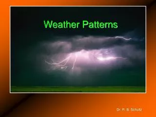
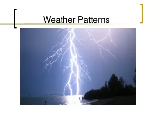
Weather Patterns. Air Masses. A huge body of air that has similar temperature, humidity, and air pressure at any given height. A single air mass may spread over millions of square kilometers and be up to 10 kilometers deep. Classifying Air Masses. Maritime Tropical.

E N D
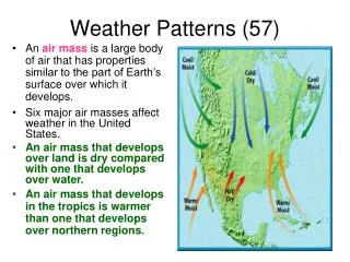
Air Masses A huge body of air that has similar temperature, humidity, and air pressure at any given height. A single air mass may spread over millions of square kilometers and be up to 10 kilometers deep.
Maritime Tropical • Warm, humid air masses form over tropical oceans. • In the summer they usually bring hot, humid weather • In the winter they can bring heavy rain or snow.
Maritime Polar • Cool, humid air masses form over the icy cold North Pacific and North Atlantic oceans. • They affect the West Coast more than the East Coast. • Even in summer, these masses of cool, humid air often bring fog, rain, and cool temperatures to the West Coast.
Continental Tropical • Hot, dry air masses form mostly in summer over dry areas of the Southwest and northern Mexico. • They cover a smaller area than other air masses. • They occasionally move northeast, bringing hot, dry weather to the southern Great Plains.
Continental Polar • Large continental polar air masses form over central and northern Canada and Alaska. • In winter they bring bitterly cold weather with very low humidity to much of North America. • In summer the air mass is milder. • Storms may occur when they move south and collide with maritime tropical air masses moving north.
Jet Stream • The jet stream is a current of fast moving air found in the upper levels of the atmosphere. This rapid current is typically thousands of kilometers long, a few hundred kilometers wide, and only a few kilometers thick. Jet streams are usually found somewhere between 10-15 km (6-9 miles) above the earth's surface. The position of this upper-level jet stream denotes the location of the strongest SURFACE temperature contrast (as in the previous diagram).
During the winter months, Arctic and tropical air masses create a stronger surface temperature contrast resulting in a strong jet stream. However, during the summer months, when the surface temperature variation is less dramatic, the winds of the jet are weaker.
Prevailing Westerlies • The prevailing westerlies, the major wind belts over the continental United States, generally push air masses from west to east. • For example, maritime polar air masses from the Pacific Ocean are blown onto the West Coast, bringing in low clouds and showers.
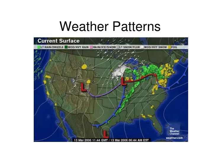
Fronts • As huge masses of air move across the land and the oceans, they collide with each other. • However, they do not easily mix. • The boundary where the air masses meet becomes a FRONT. • Storms and changeable weather often develop along fronts.
Types of Fronts • Colliding air masses can form four types of fronts: • Cold fronts • Warm fronts • Stationary fronts • Occluded fronts • The kind of front that develops depends on the characteristics of the air masses and how they are moving.
Cold Fronts A cold front is defined as the transition zone where a cold air mass is replacing a warmer air mass. Cold fronts generally move from northwest to southeast. The air behind a cold front is noticeably colder and drier than the air ahead of it. When a cold front passes through, temperatures can drop more than 15 degrees within the first hour.
Symbolically, a cold front is represented by a solid line with triangles along the front pointing towards the warmer air and in the direction of movement. On colored weather maps, a cold front is drawn with a solid blue line.
Warm Fronts • A warm front is defined as the transition zone where a warm air mass is replacing a cold air mass. Warm fronts generally move from southwest to northeast and the air behind a warm front is warmer and more moist than the air ahead of it. When a warm front passes through, the air becomes noticeably warmer and more humid than it was before.
Symbolically, a warm front is represented by a solid line with semicircles pointing towards the colder air and in the direction of movement. On colored weather maps, a warm front is drawn with a solid red line.
Stationary Fronts • When a warm or cold front stops moving, it becomes a stationary front. Once this boundary resumes its forward motion, it once again becomes a warm front or cold front.
A stationary front is represented by alternating blue and red lines with blue triangles pointing towards the warmer air and red semicircles pointing towards the colder air.
Occluded Fronts A developing cyclone typically has a preceding warm front (the leading edge of a warm moist air mass) and a faster moving cold front (the leading edge of a colder drier air mass wrapping around the storm). North of the warm front is a mass of cooler air that was in place before the storm even entered the region.
As the storm intensifies, the cold front rotates around the storm and catches the warm front. This forms an occluded front, which is the boundary that separates the new cold air mass (to the west) from the older cool air mass already in place north of the warm front. Symbolically, an occluded front is represented by a solid line with alternating triangles and circles pointing the direction the front is moving. On colored weather maps, an occluded front is drawn with a solid purple line.
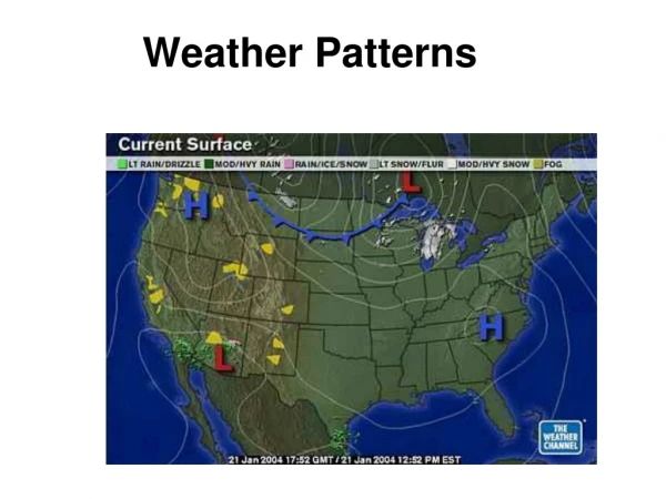
Cyclones • A cyclone is an area of low pressure around which the winds flow counterclockwise in the Northern Hemisphere and clockwise in the Southern Hemisphere. • A developing cyclone is typically accompanied by a warm front pushing northward and a cold front pulling southward, marking the leading edges of air masses being wrapped around a center of low pressure, or the center of the cyclone. They are associated with clouds, wind, and precipitation.
Anticyclones • The opposite of a cyclone is an anticyclone. It is a high pressure system with winds that blow out from the center of the high in a clockwise direction. High pressure systems usually bring dry, clear weather. In anticyclones, the air converges high in the atmosphere and then sinks toward the ground. In the lower atmosphere, the air spreads out, or diverges. The sinking air contains little moisture, and therefore brings dry weather.
A high pressure center is represented on a weather map by a blue H. Winds flow clockwise around the high in the northern hemisphere. The opposite is true in the southern hemisphere, where winds flow in a counterclockwise around an area of high pressure. Sinking air in the vicinity of a high pressure center tends to suppress the upward motions required for the clouds and precipitation to develop, which is why fair weather is commonly associated with an area of high pressure.
Homework • Review notes • Find or draw pictures of how the four fronts form. • Remember you need to be watching the weather on TV.