Download
1 / 15
150 likes | 213 Views
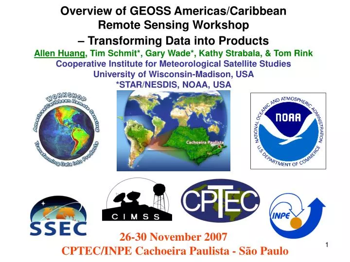
Overview of GEOSS Americas/Caribbean Remote Sensing Workshop – Transforming Data into Products Allen Huang , Tim Schmit*, Gary Wade*, Kathy Strabala, & Tom Rink Cooperative Institute for Meteorological Satellite Studies University of Wisconsin-Madison, USA *STAR/NESDIS, NOAA, USA.

E N D
Overview of GEOSS Americas/Caribbean Remote Sensing Workshop– Transforming Data into ProductsAllen Huang, Tim Schmit*, Gary Wade*, Kathy Strabala, & Tom RinkCooperative Institute for Meteorological Satellite StudiesUniversity of Wisconsin-Madison, USA*STAR/NESDIS, NOAA, USA 26-30 November 2007 CPTEC/INPE Cachoeira Paulista - São Paulo
Global Earth Observation System of Systems GEOSS For official NOAA GEOSS information go to: http://www.noaa.gov/eos.html • The purpose of GEOSS is to provide coordinated and sustained observations of the Earth through thousands of instruments in the world, and transform the information collected into a whole range of applications that will benefit the areas of public health, energy, agriculture and knowledge of weather conditions, among others. • Key to the GEOSS concept is the words “transform the information collected into a whole range of applications that will benefit the mankind ……”. • The move of NOAA’s GOES-10 to 60 degrees West was undertaken in the spirit of GEOSS. • According to the NOAA “The shift of the NOAA GOES-10 satellite from its equatorial perch over the mid-Pacific to a new spot in orbit over Brazil is meant to limit the effects of natural disasters like storms, floods, drought, volcanic ash clouds and fires.”
Regional GEOSS Americas/Caribbean Satellite Training Key Points • An integrated 3-tier approach that will assure this transformation of these space based observations into products and information that allow a range of applications will occur. • While the focus of the training activity will be on the GOES-10 satellites imager and sounder, it must be realized that to assure maximum benefit of that satellite’s data it must be used in synergy with other observational data sets, particularly important being the use of other space based observing systems (i.e., NOAA and NASA satellites) to maximize the spectral, spatial and temporal observing capabilities to the particular problem being addressed. • Three tier training approach looks at immediate needs, near term training and long term activity. Each tier leverages on prior and ongoing activity, and draws upon unique expertise that exists at NOAA’s cooperative institutes CIRA and CIMSS, the COMET Program, as well as the NOAA sponsored Virtual Laboratory Centers of Excellence (COE).
Regional GEOSS Americas/Caribbean Satellite Training 3-Tier Training (1/2) • Tier 1 is envisioned as turning satellite sounder data into scientifically based products. While the focus is on GOES-10 sounder data, keeping in mind GEOSS and space based synergy, deriving products from co-located imagers and higher spectral resolution sounders such as AIRS and IASI will also be addressed. This will pave the way for use of sounder data from the METOP IASI and NPP/NPOESS CrIS. • Tier 2 is envisioned as near term event driven training that focuses on the use of GOES-10 imager and sounder data for a variety of GEOSS related applications. The training event is envisioned to take advantage of face-to-face training at the NOAA COEs, with each having a specific focus area, and with some common lectures that are shared between COEs as was done during the recent WMO High Profile Training Event. Further, selected of the lectures will be made available to a wider audience using VISITView. It is anticipated that several of the key lectures will be recorded by COMET for their development into a future web cast. • Tier 3 see next slide
Regional GEOSS Americas/Caribbean Satellite Training 3-Tier Training (2/2) • Tier 3 actually has already begun. It looks to long term continuity and growth of applications and training. The Caribbean/America’s Regional focus group that meets in a virtual sense twice a month is nicely proving the concept of continued training in the use of satellite data for meteorological applications. It is envisioned that this activity will continue and grow in the GEOSS context with the Tier2 training activity. In addition, COMET has translated a number of modules into Spanish, and those are available for continued education. It is expected that COMET and their production of new modules in Spanish, their recording of the Tier2 training and production into Spanish web cast, and their continued interaction with NOAA as future training capabilities are developed will provide the longer term training capability for the GEOSS activity, along with the continued contribution of the COEs.
Regional GEOSS Americas/Caribbean Satellite Training Tier 1 of 3-Tier Training (1/3) • Tier 1 deals with those aspects of transforming the GEOSS data and information into a whole range of practical products ready for use in multi-disciplinary applications. It is envisioned as being an interface between CIMSS and GEOSS product developers and producers such as INPE, CONAE, and other Americas/Caribbean data receiving and processing centers. • Specifically the tier 1 training will cover the areas of 1) instrument design principals, 2) measurement characteristics, 3) processing algorithms, 4) data processing software, and 5) the related theory employed in the quantitative derivation of the satellite products. • The outcome of this training is to assist the processing centers in fully understanding the end-to-end process of generating quality products that meet user defined needs and requirements. Furthermore, this training will also establish a local, center-wise self-reliance in optimizing the quality of regional unique products that support the evolving needs of broad spectrum of users. An obvious benefit is the significant reduction of the knowledge gap that exists between the product producers and the users. GEOSS Americas/Caribbean centers like INPE and CONAE, can then provide additional support and training to all users, researchers, and scientists in optimizing the information available from GEOSS.
Regional GEOSS Americas/Caribbean Satellite Training Tier 1 of 3-Tier Training (2/3) • While the initial focus is on processing GOES-10 data into quantitative products, CIMSS could conduct a series of training sessions for the Americas/Caribbean region on the processing of GEOSS data independently and synergistically. For example data and products available for the polar orbiting satellites such as MODIS, AIRS, AMSU, IASI, AVHRR, and future NPOESS and GOES-R sensor suites of CrIS, ATMS, VIIRS, ABI and the legacy sounder. • As part of NOAA’s long term capability building effort, the 1st tier training builds a strategic training capability that will educate and train Americas/Caribbean satellite data/products providers in the optimal operation of current and next generation hyperspectral sounders, infrared and microwave multispectral imagers. The self reliance capability in supporting their users, training their own scientists, educating their own students, and enhancing evolving and broad uses of rich information provided by GEOSS is an important goal of the training effort.
Regional GEOSS Americas/Caribbean Satellite Training Tier 1 of 3-Tier Training (3/3) • Operational satellite systems cover a large part of the electromagnetic spectrum at a variety of temporal and spatial resolutions. Generally, sensors degrade the signal of interest and it is important to understand the nature of this degradation to properly develop image analysis algorithms. To support self-reliance, tier 1 activities include discussion of the general characteristics of satellite instruments to establish this context for processing images of earth. An overview of geolocation and calibration are also covered under tier 1 activities. The science of radiometry will be applied as a means to an end, that is to describe the physical processes that determine the observed features in a given spectral regions typically used in satellite remote sensing.
Workshop Agenda • Day 1 Monday • 1.1Workshop Opening • 1.2 Overview of Workshop • 1.3 Review of Remote Sensing Fundamentals I • 1.4 Multispectral Imager and Sounder Measurement Information Content • Lunch • 1.5 MODIS Data/Imagery (Lab Session) • Reception 18:00-19:30 • Day 2 Tuesday • 2.1Review of Remote Sensing Fundamentals II • 2.2 Overview of MODIS Products (Atmosphere) • 2.3 Overview of MODIS Products (Land & Marine) • 2.4 Direct Broadcast CIMSS Regional Assimilation System (DB-CRAS) • Lunch • 2.5MODIS Products (Lab Session) • 2.6 Q/A Session (17:30 to ???)
Workshop Agenda - Continue • Day 3 Wednesday • 3.1 Review of Remote Sensing Fundamentals III • 3.2 Overview of NOAA Geo Program • 3.3 SSEC Remote Sensing Expertise • 3.4 Review of GOES-10 Instruments • Lunch • 3.5 GOES-10 Images/ Products (Lab Session) • 3.6 Q/A Session(17:30 to ???) • Day 4 Thursday • 4.1 Review of Remote Sensing Fundamentals IV • 4.2 Review of GOES-10 Sounder I • 4.3 Review of GOES-10 Sounder II • Lunch • 4.4 GOES-10 Soundings (Lab Session) • 4.5 Q/A Session(17:30 to ???) • Banquet 20:20-23:00
Workshop Agenda - Continue • 5. Day 5 Friday • 5.1 Geo/Leo Integration (lab session) • 5.2 CPTEC Lecture I • by Dr. Leonardo Peres, Dr. Alberto Setzer, Dr. Milton Kampel, & • Dr. Luiz Machado • Lunch • 5.3 CPTEC Lecture II • by Dr. Rodrigo Souza, & Dr. Juan Ceballos • 5.4 Future Systems/Capabilities/Opportunities/Plans • 5.5 Workshop Review and Conclusion (Hosts & Lecturers) • Workshop Review and Synopsis (All) • Workshop Discussions (All) • Workshop Survey • Certificate • Workshop Concluding Remarks (All)
What are the best features, the parts that you like the most, of the workshop? • What are the most difficult areas of the workshop, the parts with which you have any problem? • What changes would you like to see made to this workshop to make it more useful to you? • Overall Ranking (circle one): • How useful is this Workshop in assisting your operation/research work? • Very Useful / Useful / Somewhat Useful / Not Useful Others (please specify): • How likely are you to attend this kind of workshop in the future? • Definitely will / May be / Unlikely • Others (please specify): • Additional comments (also use the back if additional space is necessary). Workshop Survey
6. What academic degree do you have or are working towards (circle one or write down)? • Have: BS / MS / Ph. D. Others (please specify): • Working towards: BS / MS / Ph. D. / Others (please specify): • 7. What kind of work are you doing? • Operations / Research / others (please specify): • Meteorology / Hydrology / others (please specify): • 8. Have you or do you currently use GOES-10 data? • If yes: Imager / Sounder; Radiances / Products / others (please specify): • If no, are you considering accessing GOES-10 data now? Yes / No • 9. For your work/job what other types of satellite data do you also use? • 10. Do you find HYDRA useful in the lab? Yes / No • If yes, will you consider using this kind of visualization tool for your work? Workshop Survey - Continue
Workshop Support and Acknowledgement • Sponsors: • NOAA/NWS International Activities Office, USA • NOAA/NESDIS International and Interagency Affairs, USA • Local Host: • INPE/CPTEC, Brazil
GEOSS Americas/Caribbean Remote Sensing Workshop – Transforming Data into Products • All reading, lecture, laboratory materials and visualization S/W are located at the following web sites: • http://webaula.cptec.inpe.br/visitview/curso_geoss/ • http://www.ssec.wisc.edu/rss/SaoPaulo2007/ • Reading Materials: • a) Chap 2; 3 & 5 of Paul Menzel’s Satellite Meteorology • http://www.ssec.wisc.edu/rss/SatelliteNotes/Notes.html • b) COMET • Satellite Meteorology: GOES Channel Selection Satellite Meteo.: Introduction to Using the GOES Sounder Remote Sen. of Land, Oceans, and Atmosphere with MODIS c) VISITview lessons The GOES 3.9 µm Channel GOES High Density Winds Water Vapor Channel Satellite Imagery Wildland Fire Detection using Satellite Imagery Fog Detection and Analysis with Satellite Data GOES Sounder Data and Productshttp://www.meted.ucar.edu/export/GEOSS_WMO_07/