Download
1 / 24
240 likes | 247 Views
Using Monitoring Data to Make a Difference: Cornwall Dune Management. 6 th October 2009 Anne-Marie Moon, Dr Nigel Pontee, Dr Jonathan Rogers & Robert Webbon (Halcrow) Martin Clemo (Cornwall Council). Using Monitoring Data to Make a Difference: Cornwall Dune Management. Background

E N D
Using Monitoring Data to Make a Difference: Cornwall Dune Management 6th October 2009 Anne-Marie Moon, Dr Nigel Pontee, Dr Jonathan Rogers & Robert Webbon (Halcrow) Martin Clemo (Cornwall Council)
Using Monitoring Data to Make a Difference: Cornwall Dune Management • Background • Monitoring Data • Sand Dune Inventory • Detailed Studies • Sand Dune Management Guide • Pilot Dune Management Plans • Future Applications of Monitoring Data • Conclusion
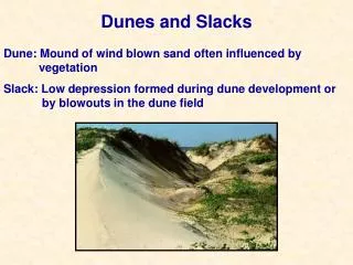
Background • Cornwall comprises 15% of UK coastal dune complexes • The dunes are an important natural resource for their: • Coast defence function • Tourism value • Habitat value • Pressures on dunes in Cornwall principally arise from: • Natural processes e.g. sea level rise, wave action • Tourism e.g. high visitor numbers, trampling, development • Combination of pressures means that dune management is required
Background Main elements of Strategy • Sand Dune Inventory • Sand Dune Management Guide • 2 Pilot Dune Management Plans
Monitoring Data South West Regional Coastal Monitoring Programme www.channelcoast.org • LiDAR Data • Topographic Profile Survey Data • Topographic Baseline Survey Data • Hydrographic Survey Data • Ortho-rectified Photography • Non Ortho-rectified Photography • Use of existing data minimises duplication of survey work and can provide a longer data set
Sand Dune Inventory • Identification of dune sites
Sand Dune Inventory • Identification of dune sites • Dune Area
Sand Dune Inventory • Identification of dune sites • Dune Area • Backshore Characteristics • Key Morphological Features
Dune Inventory • Identification of Dune Sites • Dune Area • Backshore Characteristics • Key Morphological Features • Site Specific Issues
Harvey’s Towans Hayle Estuary
Detailed Studies • To provide more detailed investigation into coastal processes and impacts affecting the study sites, and to aid the development of the Sand Dune Management guidance • Sediment Budget Analysis • Sand Dune Management Manual
Sediment Budget “Accounting of the rate of sediment supply from all sources (credits) and the rate of sediment loss to all sinks (debits) from an area of coastline to obtain the net sediment supply/ loss” • Monitoring data enabled assessment of contemporary changes in beach and dunes • Monitoring data applied alongside other available information including historical mapping and literature reviews • Dune and beach management issues frequently related to the sediment budget
Aerial Photograph Analysis • Environment Agency 2000 • SWRCMP 2006/2007 • Assessed changes in dune front and stream position
Profile Data Analysis • Cross Sectional Area calculation using Halcrow’s SANDS database • Assessment of Profile Form
Sand Dune Management Guide • Combines information from the Dune Inventory and Detailed Studies • Overview of national and internationally implemented sand dune management techniques with references for detailed information • Discussion of potential management techniques for the 9 detailed study sites
Pilot Dune Management Plans Two Pilot Dune Management Plans (DPMs) • Fistral Beach • Harvey’s Towans Pilot DMP’s contain • Dune Action Plan • Action Indicators and Responses • Emergency Indicators and Responses • Recommendations for future monitoring
Future Applications of Monitoring Data • Current analysis based on data since 2006 and provided information on recent short term changes • Longer data set will provide more information to enable identification of long term trends • Continued monitoring to enable adaptive management • Continued monitoring to identify when action and emergency conditions are reached • Repeat LiDAR surveys to monitor features further into the dune system • Repeat bathymetric data to provide information on sediment transfer further offshore
Conclusion Within the project monitoring data was able to make a difference through: • Identification of 25 dune sites • Identification of dune characteristics • Identification of key pressures and impacts at each site • Contribution to understanding the sediment budget • Contribution to Sand Dune Management Guide • Contribution to Pilot Dune Management Plans
Using Monitoring Data to Make a Difference: Cornwall Dune Management Thank you