Download
1 / 43
430 likes | 516 Views
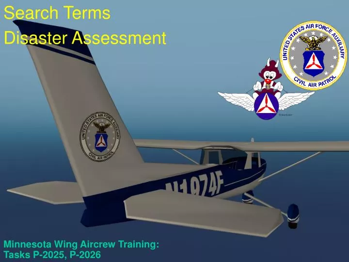
Minnesota Wing Aircrew Training: Tasks P-2025, P-2026. Search Terms Disaster Assessment. Search Terms. Search Terms.

E N D
Minnesota Wing Aircrew Training: Tasks P-2025, P-2026 Search Terms Disaster Assessment
Search Terms • Meteorological visibility is the maximum distance at which large objects (e.g., a mountain) can be seen Ground track is an imaginary line on the ground that is made by an aircraft’s flight path over the ground • Maximum Area of Possibility is normally a circular area centered at the search objective’s last know position, with certain corrections • Probability Area is a smaller area, within the maximum area of possibility, where there is an increased likelihood of locating the search objective • Probability of Detection (POD) is the likelihood, expressed in percent, that a search airplane might locate the objective
Search Terms • Scanning range is the lateral distance from a scanner’s aircraft to an imaginary line on the ground, parallel to the ground track, that a scanner is expected to have a good chance at spotting the search objective • Search Altitude is the altitude the aircraft will fly above the ground (AGL) • Search track is an imaginary swath across the surface formed by the scanning range and the length of the aircraft’s ground track • Search visibility is the distance at which an object on the ground can be seen and recognized from a particular height • Track Spacing (S) is the distance between adjacent visual or electronic search legs
Definitions • Search Involves • Estimating the position of the wreck or survivors • Determining the area to be searched • Selecting the search techniques to be used • Last Known Point • Critical Information • A newly learned LKP can completely reshape a search • Possibility Area (Theoretical) • Circle around the Last Known Position (LKP) • The radius is equal to the endurance of the aircraft • Correct for wind • Probability Area (Statistical) • Where is the aircraft likely to be
Determining the Possibility Area No wind endurance Flight level winds: 330/20 Aircraft Speed: 100 Kts Endurance: 2 Hours Therefore, range of aircraft = 200 miles = radius of circle Winds cause circle to be offset by 40 miles 40NM LKP 200 NM Wind vector Corrected forwind Maximum possibility area
Probability Area • Based on past searches • CSAD: Canadian Search Area Definition • 77% Probability of Area (POA) within 10 NM of intended track • 83% POA within 15NM
Probability Area (cont.) • Concentration of cases near LKP and destination • Slightly more in last half, especially last quarter
Disaster Assessment • Natural and man-made • Examples of CAP services: • Air and ground SAR services • Air and ground visual and/or video imaging • Flood boundary determination • Air and ground transportation • Courier flights • Radio communications support
How Disasters Can Effect CAP Operations • Effects of extreme weather • Physical landscape may be so altered as to make maps obsolete or make navigation difficult • Damage or destruction of area infrastructure • Effects of biological, chemical or radiological terrorism (or accidental release)
Assessment • Flying damage assessment sorties is not much different from our SAR search patterns • The big difference is what you look for • Should be asking questions such as: • What is the geographical extent and severity of the damage? • Is the damage spreading? If so, how far and how fast? • How has access/egress been affected? • What are the primary and secondary hazards? • Is the disaster threatening critical structures or areas? • Have utilities been affected or are they threatened? • Can you see alternatives to problems?
Assessment • Some specific things to be looking for are: • Breaks in pavement, railways, bridges, dams, levees, pipelines, runways and structures • Roads/streets blocked by water, debris or landslide • Downed power lines • Ruptured water lines • Motorists in distress or major accidents • Alternate routes for emergency vehicles or evacuation • Distress signals from survivors
Assessment • At each site, besides sketching or highlighting the extent of the damage and identifying access and egress routes, you should record: • Latitude and longitude • Description • Type and extent of damage • Photo number, or time reference for videotape • Status and trends
Tornado Iowa tornado DR picture taken by CAP over Easter 2006
Wide image of train wreck Chemical spill (hazmat)
Missing Person Search • A person is very difficult to spot from the air if they are not actively trying to be spotted • Lost children and people with diminished capacity can be especially difficult to spot from the air; often they will hide from searchers • Lost people often fight topography; children under five years frequently travel uphill • Important to know what color clothes they were wearing (not just the outer clothes) and their habits
Person on the Ground PLAIN SHIRT, 1000 AGL
Person on the Ground PLAIN SHIRT, 500 AGL
Person on the Ground CAMO SHIRT, 500 AGL
Person on the Ground YELLOW SHIRT, 500 AGL
Person on the Ground BLUE SHIRT, 500 AGL
Person on the Ground ORANGE SHIRT, 500 AGL
Person on the Ground SIGNAL MIRROR, 500 AGL