Download
1 / 1
10 likes | 147 Views
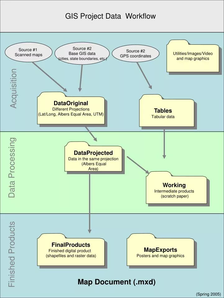
Utilities/Images/Video and map graphics. Working Intermediate products (scratch paper). Tables Tabular data. GIS Project Data Workflow. Source #1 Scanned maps. Source #2 Base GIS data (cities, state boundaries, etc.). Source #2 GPS coordinates. Acquisition. DataOriginal

E N D
Utilities/Images/Video and map graphics Working Intermediate products (scratch paper) Tables Tabular data GIS Project Data Workflow Source #1 Scanned maps Source #2 Base GIS data (cities, state boundaries, etc.) Source #2 GPS coordinates Acquisition DataOriginal Different Projections (Lat/Long, Albers Equal Area, UTM) DataProjected Data in the same projection (Albers Equal Area) Data Processing FinalProducts Finished digital product (shapefiles and raster data) MapExports Posters and map graphics Finished Products Map Document (.mxd) (Spring 2005)