Download
1 / 30
330 likes | 517 Views
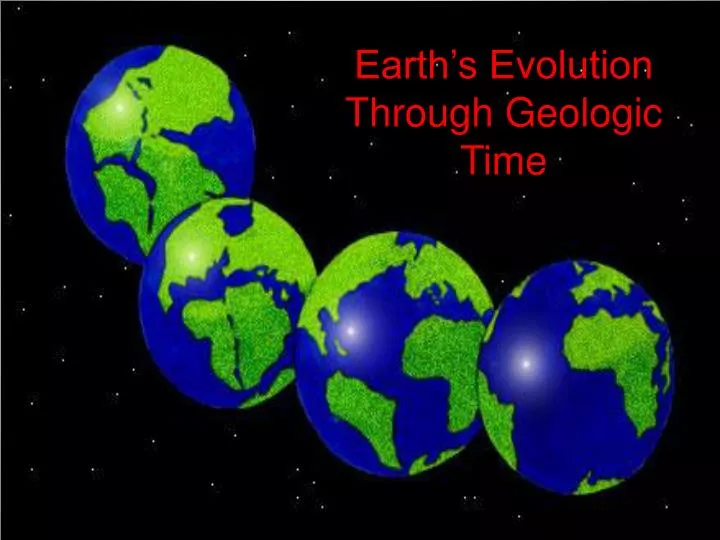
Earth’s Evolution Through Geologic Time. Why is Earth Unique? Life is ubiquitous ! – It’s everywhere! Just the right size – gravitational forces hold a relatively thin atmosphere Earth possesses a metallic core – supports a magnetic field protecting life from lethal cosmic rays

E N D
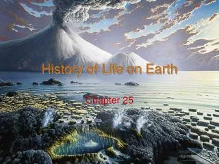
Earth’s Evolution Through Geologic Time
Why is Earth Unique? • Life is ubiquitous! – It’s everywhere! • Just the right size – gravitational forces hold a relatively thin atmosphere • Earth possesses a metallic core – supports a magnetic field protecting life • from lethal cosmic rays • Just the right distance from the sun – 93 million miles allowing water • to exist in all three phases (solid, liquid, gas) • Just the right time – enough time for microorganisms to photosynthesize an • oxygen-rich atmosphere 2.2 billion years ago • Just the right time – asteroid impact about 65 million years ago creates • mass extinction allowing the proliferation of mammals • Plate Tectonic Processes – recycling lithospheric material • External forces vs. Internal forces So, how did earth become what it is today?
65 my 186 my 88% of Geologic Time 251 my 291 my 542 my 4600 my
I The Geologic Time Scale. • Write down the Geologic Time Scale. • Include in your time scale the following: • Eons • Eras • periods • Epochs for the Cenozoic and • Tertiary periods • 2. Write a “mnemonic” phrase for the periods 10
Start of the Precambrian 4.6 by • explosion from a single point • universe expanding • contribution of heavy • elements • cooling H, He • fusion begins • more contraction / accretion • contraction prtosun planetesimals chemical differentiation Earth Primitive atmosphere starts to form during the Hadean Eon
The Hadean Eon (4.6 b.y.): “hellish” conditions As the Earth begins to cool… • In Earth’s early formation: • atmosphere: H, He, CH4, NH3, CO2, H2Ovapor • weak gravity H, He is lost to space • T-Tauri phase (high solar winds) removed all the other gasses • Earth’s First Enduring Atmosphere: • produced by outgassing – gasses escape from the Earth’s interior • outgassing produced by hundreds of active volcanoes • Earth was in a “fluid state,” releasing high amts of gas • Earth’s atmosphere from outgassing • water vapor, CO2, SO2, minor amounts of other gasses So, where is the oxygen?
Oxygen in the Earth’s Atmosphere • Increasing oxygen-generating organisms • oxygen increased steadily to stable concentrations • “the oxygen explosion” forms ozone (O3) • formed in the stratosphere • protects life (DNA) from UV radiation Stable O2 levels by 1.5 b.y. • Oxygen reacts with iron, creating banded iron • formations (3.5 – 2 b.y. ago) • iron + oxygen --> RUST • alternating layers of chert and iron-rich • rocks Banded Iron Formations • Photosynthesizing bacteria release oxygen into the • water---- 3.5 billion years ago • CO2 + H2O + Energy sun --> Oxygen Cynobacteria (blue-green algae) • A cooling earth Condensing water vapor (clouds) • and rain, producing the oceans (filling in low areas) 4.0 b.y.
Banded Iron Formations • Deposited during the Precambrian Eon • 3.5 to 2 billion years ago
Evolution of the Earth’s Oceans • CO2 (major greenhouse gas) readily soluble • in seawater (the oceans) CO2 + H2O + Ca+2 CaCO3(Limestone) Organisms extract CaCO3 shells and die producing LS-sediment Atmospheric CO2 Dissolved ions in the ocean • Earth’s atmosphere rich in H2S , CO2, SO2 • Rain + H2S, CO2, and SO2 ACID RAIN • Highly acidic rain accelerated weathering • Na, K, Ca, Si ions carried into the ocean • Some dissolved ions ppt chemical sediment • Other ions increased ocean salinity About 90% of the current volume of seawater was contained in the ocean basins (4.0 b.y.)
White Cliffs of Dover, England Thick chalk sequence (CaCO3) deposited during the Precambrian Eon – 542 million years ago
Making Earth’s Continents • Partial melting of basaltic • rocks lower density • continental crust • D= 2.7 g/cm3 2.7 g/cm3 3.0 g/cm3 • Partial melting of mantle • basaltic rocks (ocean crust) • D = 3.0 g/cm3 5.5 g/cm3 Lithosphere Continued Chemical Differentiation • Formation of the lithosphere (thin crust) • continental crust • oceanic crust Oldest Rocks • Low density, low silica minerals • move from the mantle toward • surface – lighter material rises Acasta gneiss NW Canada 4.0 b.y. • Formation of the Earth’s • metallic core (Fe, Ni) and • rocky mantle
Making Earth’s Continents • Collision (convergence) and accretion of various island arc systems • deformed and metamorphosed sediment • shortening and thickening of continental crust • silica-rich magmas (less dense) ascend and intrude rocks above • continued accretion cratons • modern-day exposed cratons are known as stable shields The crust is on the move through plate tectonic activity. Subduction of lithospheric material numerous isolated island arc systems.
The Making of North America “Accretion of Crustal Provinces” oldest youngest youngest oldest • Piecemeal assembly into a continent • Continued plate tectonic activity accretion of island arc systems known as • crustal provinces • About 1.9 billion years crustal provinces converged Trans-Hudson Mt. belt • Other crustal provinces added over geologic time
I the early earth . 3. Describe the atmospheric condition during the Hadean Eon. 4. Describe the significance of the banded iron formations. 5. Explain how abundant concentrations of limestone (CaCO3) were deposited during the Precambrian Eon. 6. How would you describe a craton?
Supercontinents of the Precambrian • Supercontinent Cycle: • cyclic rifting and dispersal of one supercontinent followed by • a long period of gradual reconstruction a new supercontinent GONDWANA Between 800-600 m.y. fragments of Rodinia become Gondwana (Southern Hemisphere) “Future Pangaea” Continents that will form Pangaea during the Phanerozoic Eon • RODINIA: • Supercontinent • dominating the • Precambrian Eon • Breaks apart by the • end of the PC
Geologic History of the Phanerozoic Eon The Formation of Earth’s Modern Continents Phanerozoic encompasses approximately 542 million years of geologic time. • The Phanerozoic Eon: • Marks the appearance of first life forms • Increased availability of fossils improved age accuracy • Abundant organisms associated with various niches • invaluable information to ancient environments Phanerozoic Eon is divided into 3 main eras. Cenozoic Era 65+ m.y. The Phanerozic Eon represents about 12% of the geologic time scale Mesozoic Era 186 m.y. Paleozoic Era 291 m.y.
Evolution of the supercontinent Pangaea during the Paleozoic Laurasia + Gondwana = Pangaea Laurasia EQ • Laurasia • warm, wet tropical conditions • abundant swampy conditions • future coal deposits (Mississippian)
B A C Pangaea • The accretion of Pangaea resulted in: • collision of northern Europe with Greenland Caledonian Mountains-A • joining of northern Asia (Siberia) and Europe Ural Mountains- B • Joining of North Africa and Eastern U.S. Appalachian Mountains- C • During the formation of the Appalachian Mountains, Pangaea was at • its maximum size.
Mesozoic History – 186 million years (Triassic, Jurassic, Cretaceous) • Cretaceous Period • Continued break-up of Pangaea forming the Atlantic Ocean • Westward-moving North American plate converging with the Pacific • basin • Subduction of the Farallon plate (Pacific plate) producing • coast ranges, Sierra Nevada Mts, Idaho batholith • Laramide orogeny Formation of the Rocky Mountains • Jurassic Period • Regressive / Transgressive seas deposit thick sequences • of sedimentary rocks • Colorado Plateau (Grand Canyon, Bryce Canyon) stratigraphy • The Navajo Sandstone – 300m thick (1000 feet) • Middle Jurassic – enormous desert (American-Southwest) • evidenced by ancient sand dune remnants • Steven Spielberg makes the movie Jurassic Park??? • Triassic Period • Breakup of Pangaea modern day continents • Much of the current continents above sea level • evidenced by massive terrestrial sandstone, mudstone • deposits
Massive cross-bedded sandstones deposited during Middle Jurassic Period
I The Paleozoic Era. 7. Distinguish between the following tectonic landmasses (when they occurred geologically): Rodinia, Gondwana, Laurasia, Pangaea 8. How did the Appalachian Mountains form? 9. Describe at least one significant geologic event that has taken place during the Triassic, Jurassic, and Cretaceous periods.
Continent Configuration Cenozoic Era
Cenozoic History – 65 million years (Tertiary, Quaternary Periods) • Cenozoic Era – “era of recent life” • Only a small amount of geologic time, but more is known about • the Cenozoic than other eras (WHY?) • rocks units widespread and less disturbed • higher levels of fossil preservation • Eastern North America (N.A.) during the Cenozoic Era • Most of N.A. above sea level • Eastern N.A. “passive” tectonic boundary • tectonically stable – considered a tectonic trailing edge • erosional processes > tectonic processes • abundant marine deposition (transgression of seas) along the Gulf of Mexico numerous petroleum traps • early Cenozoic --- Most of the Appalachian Mountains • eroded the eastern seaboard
United States Geologic Map Eastern United States Cenozoic geology Western United States “passive tectonic margin” trailing edge Erosion of the Appalachians Transgression of seas during the Cenozoic
Western N.A. during the Cenozoic Era • Laramide Orogeny the Rocky Mountains coming to an end. • erosion of the Rocky Mountains sediments deposited • (clastic-wedge), making the Great Plains • Miocene Epoch (20 m.y. ago): • Nevada into Mexico experienced crustal extension • Basin and Province Range • Faulted blocks (horst and grabens) extending from • Nevada into Utah and portions of Mexico • Rocky Mountains re-uplifted • creating the Grand Canyon, Colorado • creating the Grand Canyon, Snake River, Idaho • Flood basalts in Oregon-Washington (CRB’s) • Flood basalts range in thickness up to 1 mile • Continued convergence producing the Cascade Volcanoes • subduction of the Farallon plate stratacomposite volcanoes • Sierra Nevada batholith, Idaho batholith faulted and uplifted • Mesozoic batholiths exposed to the surface • The onset of the San Andreas Fault • A portion of California (North American Plate) begins • to “slide” northwest against the Pacific plate.
United States Geologic Map Western United States Cenozoic Geology Flood Basalts CRB Cascade Volcanoes Larmide Orogeny ends Erosion of the Rocky Mountains The Great Plains Crustal Extension Sierra Nevada batholith Onset of the San Andreas Fault
I the Cenozoic Era. 10. Describe at least 3 geologic events taking place in Eastern U.S. and 3 geologic events in Western U.S. 11. Why is the Eastern section of the U.S. less tectonically active than the Western U.S.? 12. What is significant about the Laramide Orogeny?
The Geologic Time Scale and the association of life will continue in the next section.